


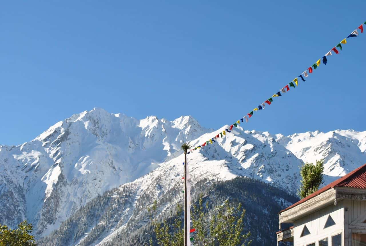
Are you looking to walk the full circle around the sacred Kinnaur Kailash massif and not just stand below the Shivling for a photo? The Kinnaur Kailash Parikrama trek is a different animal from the popular Shivling Yatra that most people talk about. It is a roughly 60 km circumambulation of the entire mountain, crossing the high and unforgiving Charang La at about 5,242 m (17,194 Ft), and it is widely considered one of the toughest treks in Himachal Pradesh. I am writing this guide the way I would explain it to a friend who called me before booking, so you know exactly what you are signing up for.
Here is the honest part first. This is a pilgrimage and an adventure trek at the same time, and most of the coverage online picks one side and ignores the other. Religious sites talk about blessings and legends but skip the acclimatization math. Trek operators list the route but gloss over the spiritual weight of the circuit. I have tried to bridge both here, with practical logistics, permit nuances, Reckong Peo ground realities, and a firm, protective take on the altitude. Keep in mind, the parikrama season (roughly July to September) is active right now as I write this in July 2026, so if you are planning for this year, read the safety section twice.
Quick Answer: Kinnaur Kailash Parikrama Trek at a Glance
The Kinnaur Kailash Parikrama is a demanding 60 km high-altitude circuit around the Kinner Kailash massif, usually walked over 4 to 5 days from Thangi village to Chitkul via Charang La pass (5,242 m / 17,194 Ft). Best done July to September. It is a difficult trek that needs a guide, good fitness, and proper acclimatization. Not a beginner trek, my friend.
| Detail | Information |
|---|---|
| Route | Thangi to Chitkul (via Charang, Lalanti, Charang La) |
| Total distance | About 60 km |
| Trekking days | 4 to 5 days (plus 1-2 acclimatization days) |
| Maximum altitude | Charang La, about 5,242 m (17,194 Ft) |
| Kinner Kailash peak | 6,050 m (about 19,850 Ft) |
| Difficulty | Difficult to challenging (fit trekkers only) |
| Best time | July to September |
| Start point access | Reckong Peo (district HQ of Kinnaur) |
| Permit | Adventure activity registration mandatory; ILP for foreigners |
| Last verified | July 2026 |
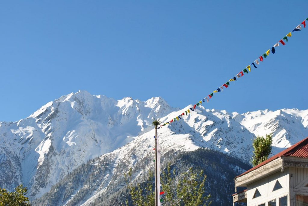
What Is the Kinnaur Kailash Parikrama and Why Is It Sacred?
Quick answer: The Kinnaur Kailash Parikrama is a ritual circumambulation of the Kinner Kailash mountain, believed in Hindu tradition to be the winter abode of Lord Shiva and Goddess Parvati. Walking the full circle around the massif is considered deeply purifying. As a trek, it is a 60 km circuit crossing Charang La, one of the hardest in Himachal.
Kinner Kailash is one of the Panch Kailash, the five sacred Kailash peaks of the Himalayas. As per Wikipedia and Hindu scriptures, it ranks fourth in importance after Mount Kailash in Tibet, Adi Kailash, and Shrikhand Mahadev Kailash, and ahead of Manimahesh Kailash. The mountain is sacred to both Hindu and Buddhist Kinnauris, which you feel in every village on the route where prayer flags and small temples sit side by side. The peak itself stands at about 6,050 m (19,850 Ft), as recorded by PeakVisor.
The most famous feature is the Shivling, a natural vertical rock formation roughly 79 feet tall sitting at around 4,800 m on the mountain. Locals say it changes colour through the day as the sunlight shifts, and pilgrims believe it represents Lord Shiva himself. Near the peak lies Parvati Kund, a sacred pond linked to the legend of Parvati worshipping here. According to the myth, Shiva and Parvati themselves performed the parikrama around this mountain, which is exactly the circuit you will be walking.
The Shivling Yatra vs the Parikrama: Do Not Confuse the Two
This is the single most important thing to understand before you book anything, and almost nobody explains it clearly. There are two completely different journeys, and people mix them up constantly.
- The Kinner Kailash Shivling Yatra: A steep out-and-back pilgrimage from Tangling village near Reckong Peo, climbing up to the Shivling at about 4,800 m and returning the same way. It is brutal on the legs but you are back on familiar ground. This is the yatra that runs on official dates (in 2026, roughly July 1 to July 30) and the one most pilgrims mean when they say “Kinner Kailash”.
- The Kinnaur Kailash Parikrama: The full circumambulation covered in this guide. You do not come back the way you went. You cross the mountain from Thangi side to Chitkul side over Charang La, walking the entire circle. It is longer, higher risk, and requires proper expedition-style planning.
So, if your goal is darshan of the Shivling and you have limited days and moderate fitness, the Shivling Yatra is your route. If you want the complete sacred circuit and you are a seasoned high-altitude trekker, the Parikrama is what this guide is about. Do not let an operator upsell you from one to the other without understanding the difference.
When Is the Best Time to Do the Kinnaur Kailash Parikrama?
Quick answer: July to September is the window. The snow on Charang La has usually melted enough by July, and the trail stays walkable till mid-September. The traditional parikrama is done in late July or the first week of August. Before July, the pass often holds hard snow that makes the crossing dangerous without technical gear.
Let us break the season down honestly. In June, the lower sections open up but Charang La can still be snowbound, and the descent from the pass toward Lalanti is where people get into trouble on old snow. From July onward the crossing becomes more reliable, which is why the official Kinner Kailash Yatra dates fall in this month. Late July and early August coincide with the monsoon in the plains, but Kinnaur sits in a partial rain shadow, so the upper trek is drier than you would expect. Still, keep in mind that the road approach through the Sutlej gorge below Reckong Peo is landslide-prone in monsoon, so build a buffer day into your plan.
September is my quiet-season pick. The monsoon eases, the skies clear, the crowds from the July yatra rush have thinned, and the light on the Kinner Kailash range is stunning. The trade-off is colder nights at Lalanti and above, so your sleeping bag rating matters more. By late September into October the high camps get bitterly cold and the first snows can return to the pass, so I would not push the parikrama past mid-September unless you really know what you are doing. You can cross-check general seasonality in my best time to visit Kinnaur Valley guide.
How Difficult Is the Kinnaur Kailash Parikrama Trek?
Quick answer: It is a difficult to challenging trek, not for beginners. You gain serious altitude, cross a 5,242 m pass, walk on glacial moraine and unmarked trail with no mobile network, and there are no villages or bailout points across the high section. You need prior high-altitude experience, strong fitness, and a guide.
Let us look at the altitude profile, because this is where the difficulty really lives. The trek climbs from Thangi at about 2,730 m to Charang La at 5,242 m, a gain of roughly 2,500 m across the circuit, and the summit day itself involves a big push to the pass followed by a long, knee-punishing descent to Chitkul at about 3,450 m. Here is the stage-by-stage altitude table so you can see the jumps.


| Stage | Altitude (m) | Altitude (Ft) |
|---|---|---|
| Thangi | 2,730 | 8,957 |
| Lambar | 2,950 | 9,678 |
| Charang village | 3,510 | 11,516 |
| Lalanti | 4,200 | 13,780 |
| Charang La (pass) | 5,242 | 17,194 |
| Chitkul (end) | 3,450 | 11,320 |
Now, keep in mind two things that make this harder than the altitude numbers alone suggest. First, the trail across the upper section is genuinely unmarked. There are stretches where the only path markers are stones stacked by trekkers before you, and with no cellular connectivity, a compass, a downloaded offline map, and ideally a local guide are not optional. People do get lost here. Second, the terrain in the Lalanti to Charang La section is glacial moraine and scree, which is slow, ankle-twisting ground even for experienced legs. Some operators quote Charang La slightly higher, up to about 5,270 to 5,300 m, so treat 5,242 m as the conservative figure and prepare for a genuine 5,200 m-plus pass either way. If you have done a pass like Bhaba Pass, you will have a feel for this kind of ground. See my Pin Bhaba Pass trek guide for a comparable Kinnaur-to-Spiti crossing.
What Permits Do You Need for the Kinnaur Kailash Parikrama?
Quick answer: Every trekker must register for the trek under the Himachal Pradesh adventure activity rules, done through the Kinnaur district administration at Reckong Peo. Indian citizens carry a government photo ID that is checked at the ITBP checkpost. Foreign nationals additionally need an Inner Line Permit because Kinnaur borders Tibet.
Here is the background, because the permit rules on this route exist for a sad reason. After a June 2019 incident near Parvati Kund where pilgrims lost their lives, the Kinnaur district administration tightened registration under the Himachal Pradesh Miscellaneous Adventure Activities Rules 2017. You can cross-check adventure and tourism norms on the official Himachal Pradesh Tourism portal. As per the district administration, registration is now mandatory for anyone attempting the Kinner Kailash routes. This is not bureaucracy for its own sake. It means someone official knows you are on the mountain and roughly when you should be back.
- Adventure activity registration: Mandatory for all trekkers. Arrange it through the ADM or district administration office in Reckong Peo, or let your trek operator handle it. Carry copies of your ID.
- Indian citizens: No Inner Line Permit is required for Indians in Kinnaur as of 2026, but carry your Aadhaar or another government photo ID. It gets checked at the ITBP checkpost on the approach.
- Foreign nationals: You must obtain an Inner Line Permit to trek here, since the area lies close to the Indo-Tibet border. Apply through the SDM or district office, and it is far easier if a registered operator sponsors it.
For the full picture on how the permit system works across this belt, read my dedicated post on Inner Line Permits for Kinnaur, Lahaul and Spiti. Rules do get revised, so I always suggest you confirm the current status with the office in Reckong Peo before you start, rather than trusting any blog including mine as the final word.
Day-by-Day Route of the Kinnaur Kailash Parikrama
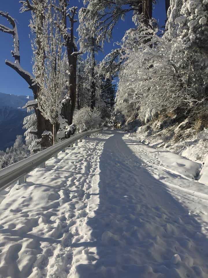
Quick answer: The classic route runs Thangi to Lambar to Charang to Lalanti, over Charang La, and down to Chitkul, covering about 60 km. Fit groups walk it in 3 to 4 days, but I strongly recommend adding an acclimatization day at Charang, making it a 5-day trek plus your approach days from Reckong Peo.
Below is the staging I would follow, built around safety rather than speed. Distances are approximate and depend on where your vehicle can drop you, so treat them as a guide and verify with your operator on the ground.
- Acclimatization (Reckong Peo / Kalpa, about 2,960 m): Spend at least one, ideally two nights around Reckong Peo or Kalpa before the trek. This is your buffer against altitude sickness later. Do your shopping, registration, and rest here.
- Day 1 (Thangi 2,730 m to Lambar 2,950 m): Drive from Reckong Peo to Thangi village, the road head, then a short walk to Lambar. A gentle start that lets your body settle. Some groups camp near Lambar.
- Day 2 (Lambar to Charang village 3,510 m): A steady climb of roughly 10 to 14 km along the stream to Charang, an old Kinnauri village. You gain useful altitude but sleep low enough to recover.
- Day 3 (Charang, acclimatization and rest): Do not skip this. Rest at Charang, hydrate, and visit the old Rangrik Tungma monastery, one of the region’s oldest. This day is what keeps AMS off your back on the pass.
- Day 4 (Charang to Lalanti 4,200 m): A tougher climb of about 10 to 12 km into a high meadow basin below the pass. Nights here are cold. This is your launch camp for the crossing.
- Day 5 (Lalanti over Charang La 5,242 m to Chitkul 3,450 m): The big day. Start before dawn to cross the pass on firm morning snow, take in the view of the Kinner Kailash massif from the top, then begin the long descent to Chitkul. This is a very long day of 14 to 18 km with a punishing knee-heavy drop. Pace it and do not rush the descent.
- Day 6 (Chitkul onward): Rest at Chitkul, the last inhabited village on the Baspa, then drive out through Sangla toward Reckong Peo or Shimla.
Reaching Chitkul at the end of a Himalayan parikrama is a genuinely emotional moment, and it happens to be one of my favourite villages anyway. If you have a day to spare, spend it there. I have written a full Chitkul travel guide and a Sangla Valley guide that cover where to stay and eat once you walk out.
Campsites, Shelter and What to Expect at Night
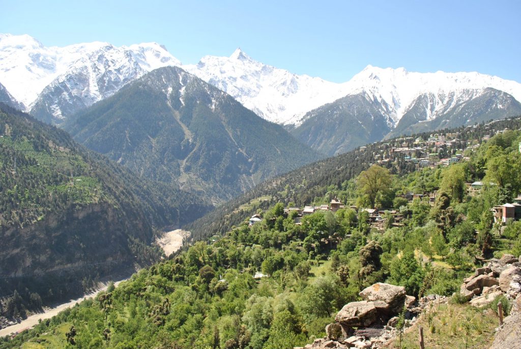
Quick answer: This is a tented trek. Once you leave Charang village, there are no guesthouses or permanent shelters until Chitkul. You camp at spots like Lambar, Charang, and Lalanti in your own or your operator’s tents. Carry a sleeping bag rated for sub-zero nights, especially at Lalanti.
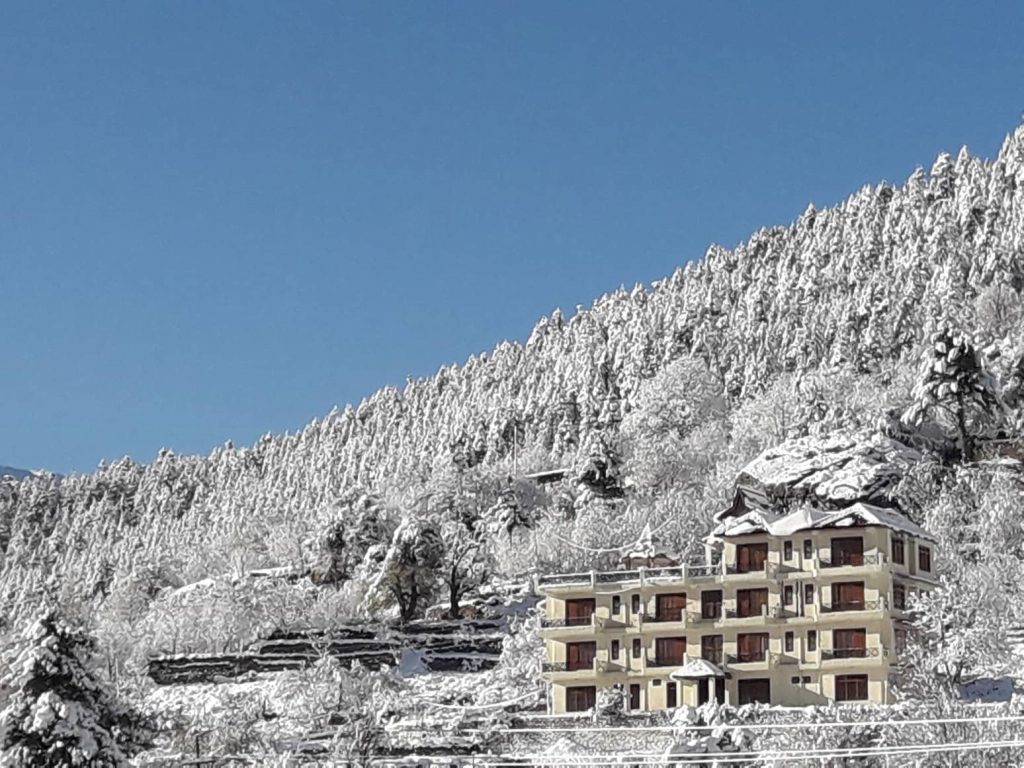
Charang village is the last place with actual buildings and the possibility of a basic homestay or room, so it doubles as a comfortable acclimatization base. Above that, everything is canvas. Lalanti at 4,200 m is a beautiful but exposed meadow camp, and the temperature drops hard after sunset even in August. Water is available from streams at the camps, but purify it. There is no electricity beyond the villages, so carry a power bank and headlamp. Because there is zero mobile network across the high section, tell someone your itinerary before you start and stick to it. If you want a deeper primer on pitching tents in this region, see my notes on camping in Kinnaur.
Hiring a Guide and Ponies in Reckong Peo (2026 Rates)
Quick answer: A guide is essential on this trek, not optional, because the trail is unmarked and there is no network. Arrange guides, porters and pony support in Reckong Peo, or book an all-inclusive package that starts and ends there. Verified 2026 porter rates run around Rs 1,500 per day; full packages run roughly Rs 10,000 to Rs 18,000 per person.
Let me be very direct here, my friend. I would not attempt the Charang La crossing without a local guide who has done it, and neither should you. The stretch above Lalanti has no reliable trail, the weather turns fast, and rescue is genuinely hard because there is no phone signal. A guide is your navigation and your safety margin rolled into one.
Reckong Peo is where you organise all of this. As the district headquarters of Kinnaur, it is the last town with an ATM, a chemist, mobile recharge and network signal, and reliable fuel. Stock up here because nothing essential is available beyond this point. From my research, the going 2026 rates look roughly like this, though I want to be honest that guide and pony daily rates vary by group size and season, so treat the numbers below as approximate and confirm on the ground.
| Service | Approximate 2026 rate | Notes |
|---|---|---|
| Porter | Rs 1,500 per day | Verified from operators; carries your load |
| Guide | Rs 1,500 to Rs 2,500 per day (approx.) | Verify locally; essential, split across the group |
| Pony / mule | Rs 1,200 to Rs 2,000 per day (approx.) | Verify locally; useful for rations and gear |
| All-inclusive package | Rs 10,000 to Rs 18,000 per person | Verified range; includes guide, food, tents, permits |
If you would rather have transport and driver support sorted in advance, I keep a running list of taxi drivers for Kinnaur and Spiti that regular readers use to reach the road head. Many of these drivers also know the trekking guides personally and can connect you.
Gear and What to Carry
This is a serious high-altitude trek, so your kit matters. Here is what I would not leave Reckong Peo without.
- Sleeping bag rated for sub-zero temperatures, plus a sleeping mat. Lalanti nights are cold.
- Proper trekking boots with ankle support for the moraine, already broken in. Do not buy new boots for this trek.
- Layers: thermals, fleece, a windproof and waterproof jacket, warm gloves, a woollen cap, and a sun hat. Mountain weather swings from hot sun to freezing wind in an hour.
- Trekking poles. Your knees will thank you on the long Charang La descent.
- Navigation: a downloaded offline map, a compass, and a power bank, because there is no network to fall back on.
- Sun protection: high-SPF sunscreen, lip balm, and UV sunglasses. Snow glare at the pass is intense.
- First-aid and AMS kit: Diamox if your doctor approves it, painkillers, ORS, blister care, and any personal medication. There is no chemist beyond Reckong Peo.
- Water purification tablets or a filter, and a reusable bottle. Stream water is available but treat it.
2026 Budget Breakdown for the Kinnaur Kailash Parikrama
Quick answer: A do-it-yourself parikrama with shared guide and porter support works out to roughly Rs 12,000 to Rs 20,000 per person from Reckong Peo, excluding your travel to Kinnaur. An all-inclusive operator package runs about Rs 10,000 to Rs 18,000 per person for the trek portion. Add your transport from Delhi or Shimla on top.
Now, keep in mind your final cost depends heavily on group size, because guide, pony and transport costs are shared. Four to six people is the sweet spot. Here is a tentative do-it-yourself breakdown for the trek portion, assuming a group of about 4 to 6 and using the approximate rates above. Please tweak the math to your own group and verify current rates in Reckong Peo, since I do not want you budgeting off a number that has drifted.
| Expense | Approximate per person (group of 4-6) |
|---|---|
| Guide (5 days, split across group) | Rs 2,000 to Rs 3,000 |
| Porter / pony support (shared) | Rs 2,000 to Rs 3,500 |
| Food and rations (5-6 days) | Rs 2,500 to Rs 4,000 |
| Tent and gear rental (if needed) | Rs 1,500 to Rs 3,000 |
| Reckong Peo to Thangi and Chitkul to Peo transport (shared) | Rs 1,500 to Rs 2,500 |
| Permits, registration and buffer | Rs 1,000 to Rs 2,000 |
| Acclimatization stay at Peo / Kalpa (2 nights) | Rs 1,500 to Rs 2,000 |
| Total (trek portion, per person) | Rs 12,000 to Rs 20,000 |
On top of this, add your travel to reach Kinnaur. A budget-minded traveller can reach Reckong Peo from Delhi or Shimla mostly by HRTC bus. For the cheapest approach, my guide on how to make a budget trip to Kinnaur by public transport covers the bus routes and fares in detail. Overall, an operator package can actually work out simpler and not much costlier once you factor in the hassle of arranging tents, food and a guide yourself.

AMS and High-Altitude Safety on the Parikrama
Quick answer: Acute Mountain Sickness is the biggest real danger on this trek because you cross above 5,200 m. Acclimatize for at least two days around Reckong Peo or Kalpa, take a rest day at Charang, climb slowly, hydrate constantly, and descend immediately if symptoms worsen. Never push over Charang La with a bad headache.
Let me be the annoying big brother for a minute, because this section matters more than the pretty views. On my own high-altitude trips the AMS symptoms in a group have ranged from mild, like a headache and trouble sleeping, to serious, and I have learned to respect the mountain. On the Kinnaur Kailash Parikrama you gain height fast and cross a very high pass with no easy exit, so the margin for error is thin.
- Acclimatize properly. Two nights around Reckong Peo or Kalpa before you start, and the rest day at Charang, are not luxuries. They are what keep you safe on the pass.
- Watch the symptoms. Persistent headache, nausea, dizziness, breathlessness at rest, or confusion are red flags. Mild is common. Worsening is an emergency.
- Descend on worsening symptoms. The only real cure for serious AMS is going down. Do not summit Charang La if you or anyone in your group is genuinely unwell. Turning back is not failure, it is good judgement.
- Hydrate and pace. Drink far more water than feels necessary and walk slowly. Speed is the enemy at altitude.
- Carry an AMS kit and know it. Diamox can help as a preventive if your doctor approves, but it is not a licence to climb carelessly.
Because there is no mobile network and no road across the high section, self-reliance is everything here. This is exactly why I keep repeating that a guide is non-negotiable and that you should tell someone your plan before you leave Reckong Peo. Please take a sensible call for yourself and the people waiting for your safe return.
How to Reach the Trailhead from Reckong Peo
Quick answer: Reach Reckong Peo first from Shimla or Delhi by HRTC bus or taxi along NH-5, then take a local vehicle to Thangi village, the road head for the parikrama. From Chitkul at the end, drive out via Sangla back to Reckong Peo or onward to Shimla.
Reckong Peo is the hub for everything on this trek. To get there, the usual approach is Delhi to Shimla, then Shimla to Reckong Peo along the Hindustan-Tibet road (NH-5) through Narkanda, Rampur and the Sutlej gorge. HRTC runs regular buses on this route, and there are also direct long-haul buses from Delhi. It is a long, winding journey, so I would not try to do the whole thing in one go from Delhi without a night’s break. Confirm current road conditions before you travel, since the gorge section is landslide-prone in monsoon, using my Kinnaur and Spiti road status post.
From Reckong Peo, a local taxi takes you to Thangi village, the trek’s road head, in a couple of hours. On the return, Chitkul connects by road to Sangla and then back to the NH-5 near Karcham, from where you rejoin the highway toward Reckong Peo or Shimla. If you want to understand the wider region before you go, my Kinnaur Valley travel guide and Kalpa guide give you the lay of the land, and Kalpa is the best place to see the Kinner Kailash range up close while you acclimatize.
Related Reading from Discover With Dheeraj
- Kinnaur Valley Travel Guide: Kalpa, Sangla and Chitkul
- Kalpa Detailed Travel Guide (best view of Kinner Kailash)
- Chitkul Travel Guide (the trek endpoint)
- Inner Line Permits for Kinnaur, Lahaul and Spiti
- Pin Bhaba Pass Trek: Kafnu to Mudh
- Kinnaur Spiti Circuit Itinerary 2026
Frequently Asked Questions
Is the Kinnaur Kailash Parikrama the same as the Kinner Kailash Shivling Yatra?
No, and this trips up a lot of people. The Shivling Yatra is a steep out-and-back pilgrimage from Tangling village to the Shivling rock at about 4,800 m, returning the same way. The Parikrama is the full 60 km circumambulation of the whole massif from Thangi to Chitkul via Charang La. The Parikrama is much longer and harder.
Can a beginner do the Kinnaur Kailash Parikrama?
Honestly, no. This is a difficult trek that crosses a 5,242 m pass on unmarked, glacial terrain with no network and no bailout points. You should have prior high-altitude trekking experience, good fitness, and always a guide. If this would be your first big Himalayan trek, build up to it with something easier first.
How high is Charang La pass?
Charang La is most commonly cited at about 5,242 m (17,194 Ft), the highest point of the circuit. Some operators quote it slightly higher, around 5,270 to 5,300 m. Either way, it is a genuine 5,200 m-plus pass, so prepare for that level of altitude.
Do Indian citizens need a permit for the parikrama?
Indians do not need an Inner Line Permit for Kinnaur as of 2026, but you must complete the mandatory adventure activity registration with the Kinnaur district administration in Reckong Peo, and carry a government photo ID that gets checked at the ITBP checkpost. Foreign nationals additionally need an Inner Line Permit.
When is the best time to do the parikrama in 2026?
July to September. The traditional parikrama is walked in late July or early August, and the official Kinner Kailash Yatra dates in 2026 fall in July. September offers clearer skies and fewer crowds but colder nights. Before July, Charang La usually holds risky snow.
How many days does the trek take?
The walking itself takes about 4 to 5 days over roughly 60 km, and fit groups sometimes do it in 3 to 4. I recommend planning for 5 trekking days including a rest day at Charang, plus 1 to 2 acclimatization days at Reckong Peo or Kalpa, so budget around 7 days on the ground from Reckong Peo.
Is a guide really necessary, or can I do it solo?
A guide is essential, not optional. The trail above Lalanti is unmarked, there is no mobile network, and the weather changes fast. Trekkers have got lost here. Arrange a local guide and porter or pony support in Reckong Peo, or join an all-inclusive package. Please do not attempt the Charang La crossing alone.
What does the parikrama cost in 2026?
An all-inclusive operator package for the trek portion runs roughly Rs 10,000 to Rs 18,000 per person. A do-it-yourself trek with shared guide and porter support works out to around Rs 12,000 to Rs 20,000 per person from Reckong Peo. Add your transport from Delhi or Shimla on top. Verify current rates locally, as they drift year to year.
Where does the parikrama start and end?
It starts at Thangi village, reached by road from Reckong Peo, and ends at Chitkul, the last inhabited village in the Baspa (Sangla) valley. Because it is a circuit, you do not return the way you came, so plan your transport for two different points.
Is there mobile network on the trek?
No. Reckong Peo is the last place with a reliable signal, ATM and chemist. There is no cellular connectivity once you leave the villages and cross into the high section, which is another reason a guide and a shared itinerary with someone back home are so important.
Final Thoughts
The Kinnaur Kailash Parikrama is not a trek you knock off a bucket list. It is a hard, high, sacred walk around a mountain that both Hindus and Buddhists hold holy, and it rewards you only if you respect the altitude, carry the right kit, and go with a guide who knows the way over Charang La. Do it in the July to September window, acclimatize honestly, and do not be too proud to turn back if AMS shows up. That single decision is worth more than any summit photo.

If you are weighing this against the shorter Shivling Yatra, or you are not yet sure your fitness is there, start a conversation in the DwD Community and talk to people who have actually walked it. That is exactly what the community is for, and finding a couple of experienced trek partners will make this circuit far safer and far more affordable. I hope this guide helps you plan a safe and meaningful parikrama in 2026 🙂 …
If you have any questions, feel free to ask in the comments section below 🙂
