Trek duration: 7-8 days | Max altitude: 15,419 ft (Phangchi Galu) | Difficulty: Moderate-Difficult | Distance: ~90 km | Best time: May to June, September to October | Permit: GHNP Sainj Range Office, INR 100/day (Indian), INR 500/day (Foreign) | Base camp: Siund, Sainj Valley
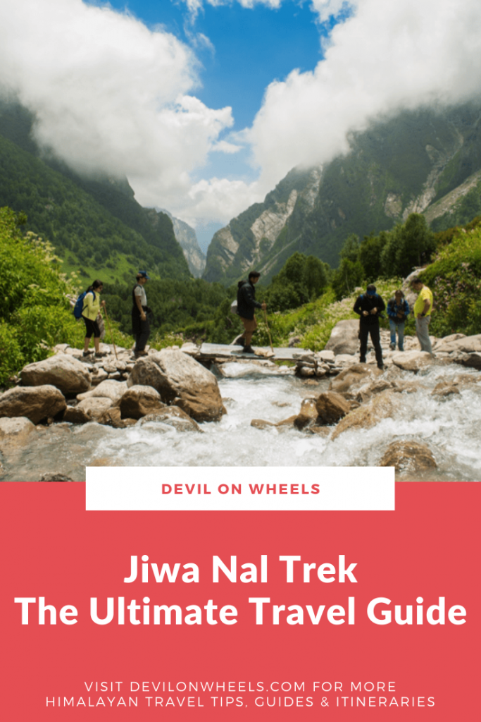
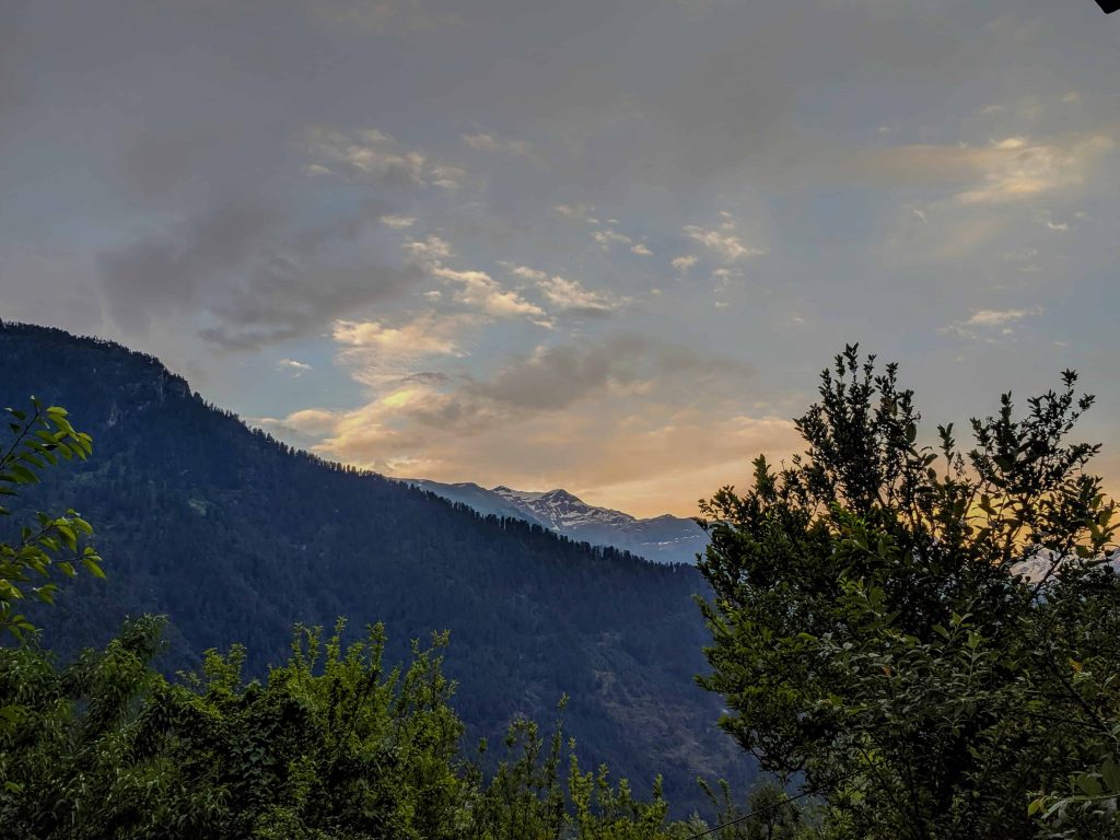
The Jiwa Nal trek in the Great Himalayan National Park is one of those rare Himalayan experiences that strips away everything familiar and drops you into complete wilderness. This trek connects the Sainj Valley with the Parvati Valley through two high-altitude passes, dense forests with zero trail markings, glacial moraines, and meadows so remote that the only footprints you will find are from shepherds and wild animals.
I have been following this trek for years now, and every trip report I read reinforces one thing. Jiwa Nal is not a trek you do on a whim. It demands prior high-altitude trekking experience, a sound knowledge of reading terrain, and the mental toughness to trek 10 hours a day in complete isolation. If that excites you rather than scares you, keep reading. This guide covers everything you need to plan your Jiwa Nal trek in 2026, from permits and preparation to a detailed day-by-day itinerary.
Let's quickly dive into the details:
What Is the Jiwa Nal Trek and Why Should You Do It?
The Jiwa Nal trek is a cross-valley expedition through the core zone of the Great Himalayan National Park (GHNP), a UNESCO World Heritage Site since 2014. Starting from Siund in the Sainj Valley, it takes you over two mountain passes and ends at Barshaini in the Parvati Valley. The entire route covers approximately 90 km over 7-8 days.
What makes this trek special is the sheer isolation. Unlike popular Himalayan treks where you encounter fellow trekkers every few hours, Jiwa Nal takes you through stretches where you will not see another human being for days. The only signs of life are occasional shepherd camps and cairns (locally called burjis) that mark the route.
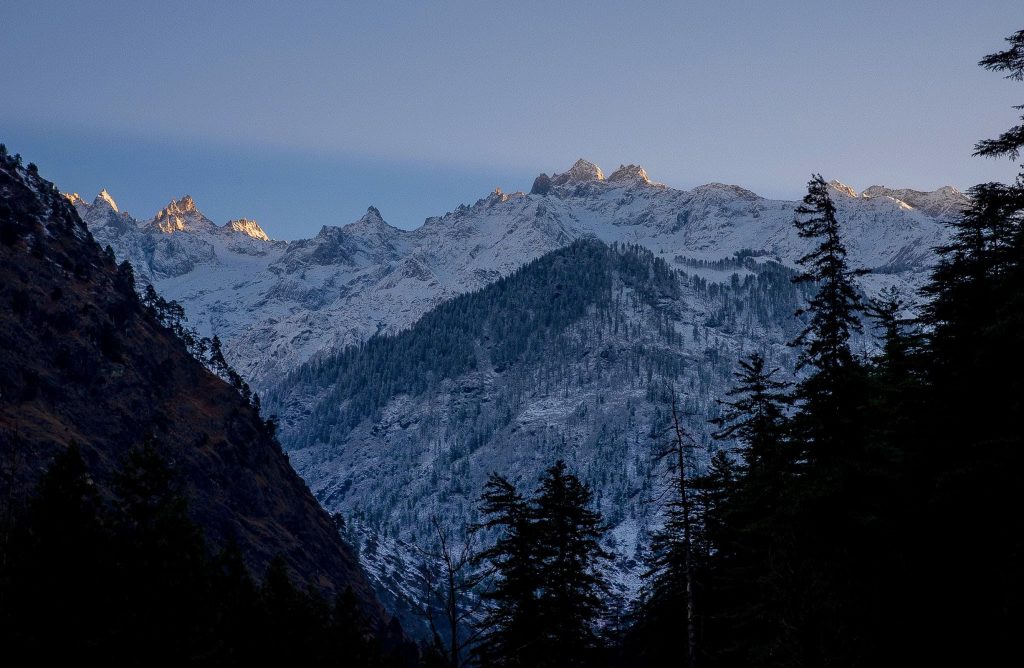
The Jiwa Nal Valley lies along the Jiwa Nal river, which originates from the Sarthoo Pond, a glacial lake fed by snowmelt. The river eventually flows into the Beas at Siund, about 35 km from Aut on the Chandigarh-Manali highway. The trek crosses two significant passes: Kandi Galu (approximately 10,728 ft) and Phangchi Galu at 15,419 ft, the highest point of the entire route.
How Difficult Is the Jiwa Nal Trek?
Jiwa Nal is rated moderate-difficult by most trekking organizations, and I would lean towards calling it plain difficult for anyone who has not done high-altitude multi-day treks before. The difficulty comes from several factors combined.
First, the daily elevation changes are brutal. There are days where you ascend 2,000 meters and descend 1,500 meters in the same day. That is over 3,500 meters of total elevation change in a single day, and it takes a serious toll on your knees and lungs. Second, the trails are poorly marked or non-existent in many sections. You need to be able to read terrain, follow cairns, and navigate through dense forests without GPS signals. Third, the isolation means there is no rescue team around the corner. If something goes wrong, you are on your own for hours or even a full day before help can arrive.
Hence, this trek requires prior experience in high-altitude trekking. If you have done treks like Hampta Pass, Pin Bhaba, or similar multi-day Himalayan treks, you have a reasonable baseline. If Jiwa Nal is your first serious trek, I would strongly advise against it.
What About the Great Himalayan National Park?
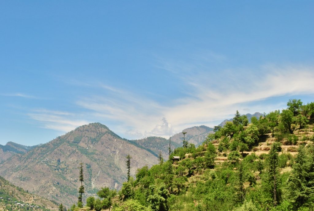
The Great Himalayan National Park (GHNP) spans 1,171 sq km in the Kullu district, flowing through altitudes ranging from 1,500 to 6,000 meters. It acts as an ecological bridge connecting alpine, glacial, temperate, and subtropical ecosystems. The park is home to over 375 fauna species protected under the Wildlife Protection Act and achieved UNESCO World Heritage status in 2014.
GHNP is connected to Pin Valley National Park and Rupi Bhabha Wildlife Sanctuary, with buffer zones formed by the Sainj and Tirthan wildlife sanctuaries. Because of its conservation status, the number of trekkers allowed into the core zone at any time is limited. This is what keeps the Jiwa Nal trek so pristine, but it also means you need permits well in advance.
How Do You Get the GHNP Trekking Permit?
You need a valid permit from the GHNP authorities before entering the core zone. Permits can be obtained from the Sainj Range Office at Ropa (most convenient for the Jiwa Nal trek), the Tirthan Range Office at Shairopa, or the GHNP head office at Shamshi near Kullu.
As of 2019 (the last verified rates from the original article), the fee was INR 100 per day for Indian nationals and INR 500 per day for foreign nationals. Camera charges apply separately. Keep in mind that these rates may have been revised since then. I would recommend calling the GHNP office at +91 1902 265320 or emailing dirghnp@gmail.com to confirm current fees before you travel.
One important rule: multi-day trekkers in GHNP must hire certified local guides and porters. This is mandatory, not optional. The park authorities maintain a roster of trained guides who know the routes, wildlife behavior, and emergency protocols. The guide and porter arrangement can be made through the range office when you collect your permit. Budget approximately INR 800-1,200 per day for a guide and INR 600-800 per day for a porter (verify locally for current rates).
How Should You Prepare Physically for This Trek?
You will be trekking roughly 10 hours a day on most days of this trek. This is a grueling schedule, especially when you factor in the reduced oxygen at altitudes above 12,000 ft. Having a Diamox (Acetazolamide, 250mg every 12 hours) can help with altitude acclimatization, though it is a temporary measure, not a substitute for fitness.


In my opinion, you should start preparing at least 2 months before the trek. A combination of daily cardio (running, cycling, or stair climbing) and leg strengthening exercises will make a significant difference. Aim for 10-15 km of intense running every week at minimum. Practice with a loaded backpack on hilly terrain if possible, as the actual trek involves carrying weight over uneven ground for extended hours.
Mental preparation matters equally. There will be long stretches with no trail, no people, and no phone signal. If you are not comfortable being in complete wilderness for days on end, this trek will be extremely challenging psychologically.
What Is the Best Time to Do the Jiwa Nal Trek?
The best months for the Jiwa Nal trek are May to June and September to October. During May-June, the meadows are lush green and wildflowers are in bloom. The passes are usually clear of heavy snow by mid-May, though patches remain at higher altitudes. September-October brings autumn colors and crystal-clear visibility, making it excellent for photography.
![What things to carry on cold weather Spiti or Ladakh winter bike ride? [8 Must-Have Items]](https://discoverwithdheeraj.com/yt_vid_thumbs/ladakh/84.png)
Avoid the monsoon months of July and August entirely. GHNP receives heavy rainfall during monsoons, making trails slippery, river crossings dangerous, and leeches a constant companion. The dense forest sections become near-impassable. Winter (December to February) is out of the question as the passes are buried under snow and the park is effectively closed for trekking.
What Gear and Essentials Should You Carry?
Since this is a fully self-supported trek with no tea houses or shops along the route, your packing list needs to be thorough. Here is what I recommend carrying on the Jiwa Nal trek.
- Tent and sleeping bag rated for -10C (nights at Lalbatti and higher camps get extremely cold and windy)
- Cooking equipment and fuel, as firewood is not available at all campsites (Lalbatti has none)
- 8-10 days of food supplies including high-energy snacks, instant meals, and electrolyte sachets
- Water purification tablets or filter, as stream water needs treatment
- First aid kit with Diamox (250mg tablets), painkillers, anti-diarrheal, bandages, and antiseptic
- Sturdy trekking boots with ankle support (river crossings and rocky terrain demand good footwear)
- Trekking poles (your knees will thank you on the 1,500m descents)
- Rain gear and waterproof covers for your backpack
- Headlamp with extra batteries (no electricity at any campsite)
- Detailed topographic map of the GHNP region (phone GPS may not work)
- Sunscreen, lip balm, and sunglasses for high-altitude UV exposure
How Do You Reach the Trek Starting Point at Siund?
The Jiwa Nal trek begins at Siund in the Sainj Valley, which lies about 550 km from Delhi. The approach is straightforward.
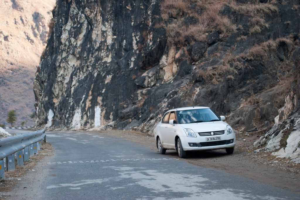
From Delhi: Take an overnight bus to Manali. HRTC and private buses run daily from ISBT Kashmere Gate. Get off at Aut, right after the Mandi tunnel on NH21. Aut is the diversion point for the Sainj and Tirthan valleys. If you take an overnight bus, you will reach Aut by early morning, giving you enough time to complete your Day 1 tasks.
From Aut to Sainj: Sainj is about 1.5 hours from Aut. You can catch a local bus heading towards Ropa or Neuli (small hamlets in the valley), or hire a private cab for approximately INR 1,500-2,000 (as of 2019, verify locally). Shared cabs are rare since not many tourists head this way.
Accommodation in Sainj: GHNP has guest houses in the region that can be booked online through the official GHNP website. Spend at least one full day in Sainj to acclimatize, collect your permit from the GHNP Park Office (about 2 km from the guest house), and arrange your guide and porters. Keep in mind that the officials typically do not start work before 11-11:30 AM.
What Does the Day-by-Day Jiwa Nal Trek Itinerary Look Like?
Here is a detailed breakdown of what to expect each day. Please note, this is a guide based on standard conditions. On the actual trek, weather and trail conditions define everything. Hence, always be vigilant and listen to your guide.
Day 1: Sainj to Shanshar to Bhagi Kashyari (6,800 ft to 8,530 ft)
Some trekkers start from Neuli, which adds an easy 14-15 km hike. However, you can drive further to Shanshar, the last motorable point, about 30 minutes from Neuli by cab. This shortens your first day considerably.
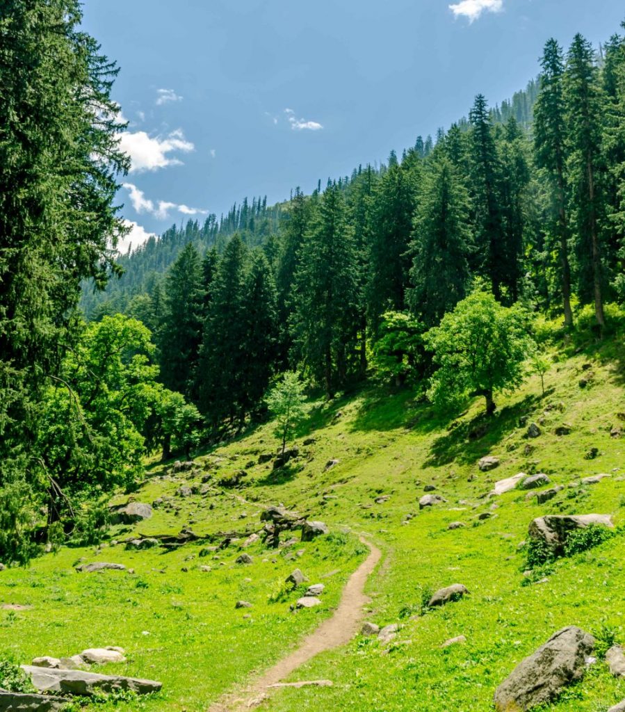
The first day’s trek is gentle, climbing from 6,800 ft to 8,530 ft through villages and small settlements. The total trek time should not exceed 4 hours, making it a good warm-up day. Bhagi Kashyari is a small settlement with no formal campsites. You can pitch your tent in the school playground. Alternatively, push ahead 3-4 km if you feel strong and want a head start on Day 2. Visit the beautiful Manu Temple nearby if time permits.
Day 2: Bhagi Kashyari to Kandi Galu to Subli Thatch (8,530 ft to 10,826 ft via 10,728 ft pass)
Today is your first real test. You will cover approximately 17-20 km, so start as early as possible. The morning heat can be punishing during the prime daytime hours.
From Bhagi Kashyari, you descend for an hour into a narrow gorge, then climb back up through thick forests. This pattern of descending into gorges and climbing out repeats three times before you reach Kandi Galu at approximately 10,728 ft. The entire trail to Kandi Galu is densely forested with minimal trail markings. A keen sense of direction is mandatory here, as wrong turns can lead to confusion and panic in the wilderness.
From Kandi Galu, descend for about 1.5 hours to reach Subli Thatch at 10,826 ft. By now you are past the tree line. Subli Thatch has two dilapidated rooms, but most trekkers pitch tents nearby. Water and firewood are readily available here, making it a comfortable campsite. Fair warning though: you will likely be too exhausted to enjoy the night sky, no matter how spectacular it is.
Day 3: Subli Thatch to Dwada Thatch (10,826 ft to 10,170 ft)
Today is comparatively shorter at about 6-8 km, giving your body a chance to recover from yesterday’s grind. The day starts with a tricky descent through high bushes and dry stream beds. Finding the actual ground beneath you can be a challenge, let alone the trail.
You will be guided by the sound of the Jiwa Nal river, whose rumble becomes audible as you descend. A critical point: there are only a handful of spots where you can safely cross the river. Take the first reasonable crossing opportunity when you spot one. The old bridges along the river have been washed away long ago.
The entire 6-8 km stretch takes 5-6 hours due to the technical terrain. If you start early, you might reach Dwada Thatch by lunchtime. Dwada Thatch sits at 10,170 ft (some sources say 10,334 ft) and offers easy access to firewood and water. This is a good campsite to recharge.
Buffer Day at Dwada Thatch (Optional but Recommended)
This is the point where I recommend building in a rest day if your body is feeling the strain. While sticking to the schedule is important, forcing yourself through exhaustion at altitude is a recipe for trouble. The peaceful valley along the cascading Jiwa Nal river is worth absorbing slowly.
If you feel strong, you can use this day for a round trip to Sarthoo Pond (a few hours each way) and return to Dwada Thatch for the night. This splits the otherwise brutal Day 5 into two manageable parts.

Day 4/5: Dwada Thatch to Sarthoo Pond to Khandedhar Top to Lalbatti (10,170 ft to 14,435 ft to 13,123 ft)
This is the longest and most demanding day of the entire trek. You will cover 21 km and approximately 11 hours of trekking, reaching the maximum altitude of 14,435 ft at Khandedhar Top. Brace yourself.
The morning starts beautifully with a pleasant hike through lush green meadows to Sarthoo Pond at 11,482 ft. This small glacial lake has perfect emerald-green hues and serves as the source of the Jiwa Nal river. From this vantage point, you get a panoramic view of the entire Jiwa Nal Valley. It is one of the most rewarding moments of the trek.
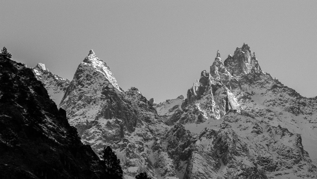
From Sarthoo Pond, the real grind begins. The hike to Khandedhar Top is steep and strenuous, taking about 3 hours. As you climb, the landscape transforms dramatically. The lush green meadows give way to glacial deposits, rock debris, and barren terrain on the other side of the pass.
The descent from Khandedhar Top to Lalbatti takes about 45 minutes. Lalbatti sits at 13,123 ft and is an exposed campsite with limited water access. Firewood is not available here, so you must carry your own cooking fuel. It can be freezing and extremely windy. This is where your -10C sleeping bag earns its weight.
Travel Tip: After completing the Jiwa Nal trek, you can travel to Jibhi and Banjar Valley or come back via the Shoja and Jalori Pass route for a well-rounded Himachal trip.
Day 5/6: Lalbatti to Phangchi Galu to Chippi (13,123 ft to 15,419 ft to 11,154 ft)
Today you cross Phangchi Galu at 15,419 ft, the highest point of the Jiwa Nal trek. This pass leads into the Parvati Valley, and it is the trickiest section of the entire route. You will cover 18 km in about 8 hours.
The initial ascent from Lalbatti to Phangchi Galu involves extremely narrow trails with steep slopes on both sides. Rockfall is a real risk in this section, so exercise extreme caution and stay alert at all times. The lack of oxygen at this altitude makes even careful walking exhausting.
After 2-3 km of worrisome trekking, the route shows some mercy. But do not relax your guard. The glacial moraines beyond the pass can be confusing and misleading when it comes to direction. For a basic rule of thumb, stick to the left of the glacier’s tongue. Your guide will be invaluable through this section.
Chippi is a welcome sight after this grueling day. It offers stunning views of the Parvati Valley landscape and, more importantly, access to firewood and water. You have earned your rest.
Day 6/7: Chippi to Pulga to Barshaini (11,154 ft to 9,514 ft to 8,858 ft)
The final trekking day covers 16 km and takes about 7 hours. Right from the start, the rocky terrain and mountain stream crossings require careful technique. The downhill sections are relatively easier, with only a handful of steep sections thrown in.
As you descend through alpine meadows and tiny shepherd settlements, there is a palpable feeling of re-entering civilization. Finally, you reach Pulga at 9,514 ft, a charming Parvati Valley village with beautiful traditional wooden architecture. If you have time, spend an hour walking through the village before continuing.
From Pulga, descend through a bridge to Barshaini. From Barshaini, you can take a bus to Manikaran, Kasol, or Kullu for your onward journey. The Jiwa Nal trek is officially complete.
How Much Does the Jiwa Nal Trek Cost?
Here is a rough budget breakdown for the Jiwa Nal trek. All prices are approximate and should be verified locally for current rates.
| Expense | Approximate Cost (INR) |
|---|---|
| Delhi to Aut (overnight bus) | Rs 700-1,500 |
| Aut to Sainj (private cab) | Rs 1,500-2,000 |
| GHNP permit (8 days, Indian) | Rs 800 (as of 2019, verify locally) |
| Guide (8 days @ Rs 800-1,200/day) | Rs 6,400-9,600 |
| Porter (8 days @ Rs 600-800/day) | Rs 4,800-6,400 |
| Food and supplies (8 days) | Rs 3,000-5,000 |
| Barshaini to Kasol/Kullu (bus) | Rs 100-300 |
| Total per person (approx.) | Rs 17,000-25,000 |
In case you are splitting guide and porter costs with a group of 3-4 trekkers, the per-person cost drops significantly. A group of 4 can manage the trek for roughly Rs 10,000-15,000 per person including transport, permits, guide, porter, and food.
What Are Some Important Safety Tips for the Jiwa Nal Trek?
- Never trek without a certified GHNP guide. This is not just a rule, it is common sense in terrain with no trail markings and zero mobile network.
- Carry enough food for 2 extra days beyond your planned duration. Weather can force you to stay put at a campsite for a day or more.
- Start Diamox (250mg twice daily) one day before reaching high altitude. Consult your doctor before taking it. Acute mountain sickness is a real risk above 12,000 ft.
- River crossings are the most dangerous part. Cross only at spots recommended by your guide. Never attempt crossings during heavy rain or in the afternoon when glacial melt increases water flow.
- Inform someone about your itinerary. Leave your planned route with the GHNP office and a family member. There is zero mobile network for most of the trek.
- Carry a whistle and mirror for emergency signaling. In dense forest, these are more effective than shouting.
Can You Combine the Jiwa Nal Trek with Other Destinations?
Since the trek ends at Barshaini in the Parvati Valley, you have several excellent options for extending your trip.
- Kasol and Manikaran: Just 30 minutes from Barshaini by bus. Spend a weekend in Kasol to recover from the trek. Hot springs at Manikaran are perfect for sore muscles.
- Kheerganga Trek: If your legs still have life in them, the Kheerganga trek starts from Barshaini itself. It is a relatively easy 12 km trek with hot springs at the top.
- Tirthan Valley: Head back to Aut and take the Tirthan Valley route for a completely different GHNP experience with easier trails.
- Jibhi and Jalori Pass: Jibhi in the Banjar Valley is a peaceful retreat and can be reached from Aut in a couple of hours.
Jiwa Nal Trek at a Glance
| Difficulty | Moderate-Difficult (prior experience required) |
| Duration | 7-8 days (including buffer day) |
| Maximum Altitude | 15,419 ft (Phangchi Galu Pass) |
| Total Distance | ~90 km |
| Start Point | Siund/Shanshar, Sainj Valley |
| End Point | Barshaini, Parvati Valley |
| Best Time | May-June, September-October |
| Permit | GHNP Sainj Range Office (Ropa) |
| Guide Required | Yes (mandatory for multi-day GHNP treks) |
| Mobile Network | None for most of the trek |
| Nearest Hospital | Kullu District Hospital (60+ km from trailhead) |
Frequently Asked Questions
Is the Jiwa Nal trek suitable for beginners?
No. The Jiwa Nal trek is rated moderate-difficult and requires prior high-altitude trekking experience. The route has minimal trail markings, extreme elevation changes of 3,500+ meters in a single day, and complete isolation with no rescue infrastructure. If you are a beginner, consider easier GHNP treks in the Tirthan or Sainj buffer zones first.
Do I need a guide for the Jiwa Nal trek?
Yes, hiring a certified GHNP guide is mandatory for all multi-day treks in the park’s core zone. Beyond the legal requirement, a guide is essential for navigation since large sections have no trail markings. Guides can be arranged at the Sainj Range Office in Ropa when you collect your permit.
What is the maximum altitude on the Jiwa Nal trek?
The highest point is Phangchi Galu Pass at 15,419 ft (4,700 m). The second pass, Kandi Galu, sits at approximately 10,728 ft. Altitude sickness is a real concern above 12,000 ft, so carry Diamox and acclimatize properly.
Is there mobile network on the Jiwa Nal trek?
There is no mobile network for the vast majority of the trek. You may get intermittent signal at Sainj before starting and at Barshaini after finishing. Plan for complete disconnection for 6-7 days. Inform family members of your itinerary and expected return date before you start.
Can I do the Jiwa Nal trek solo without a guide?
No. GHNP regulations require a certified guide for multi-day core zone treks. Even if regulations did not exist, solo trekking on this route is extremely risky due to unmarked trails, river crossings, and complete lack of communication. Always trek with a certified guide and at least one porter.

Where can I get food and water on the trek?
There are no shops, tea houses, or food stalls anywhere on the Jiwa Nal trek route. You must carry all your food for the entire duration plus 2 extra days of supplies. Water is available from streams at most campsites (Bhagi Kashyari, Subli Thatch, Dwada Thatch, Chippi), but Lalbatti has limited water access. Always purify stream water before drinking.
How much does the Jiwa Nal trek cost per person?
A solo trekker should budget approximately Rs 17,000-25,000 including transport, GHNP permit, guide, porter, and food. In a group of 3-4, the per-person cost drops to Rs 10,000-15,000 since guide and porter costs are shared. Verify current permit and guide rates with the GHNP office before travel.
Have you done the Jiwa Nal trek? Any details I missed in this guide? If you are planning this trek or any other offbeat Himalayan adventure, feel free to drop a comment below or reach out to the DwD community. We are always happy to help fellow trekkers plan their next journey into the wild. Remember to travel responsibly and leave nothing behind but footprints 🙂
Last Updated: April 2026