
The last day on the Manali-Leh Highway is when everything comes together. You have been on the road for three days, crossed multiple high-altitude passes, survived the thin air, and now Leh is just a few hours away. The excitement is almost unbearable. Your body is tired, your lungs have been working overtime, but there is this energy that comes from knowing the finish line is near.
I remember sitting in the car after leaving Pang, watching the landscape shift once again, and thinking, “How does this highway keep outdoing itself?” The last leg of the Manali to Leh journey, roughly 150 km from Pang to Leh, takes about 5-7 hours depending on stops. It covers More Plains, the climb to Tanglang La (17,480 ft), the descent through Rumtse and Gya, the checkpoint at Upshi, and finally the stretch along the Indus River into Leh town.
Last Updated: March 2026
Let's quickly dive into the details:
What Does the Pang to Leh Route Look Like?
The Pang to Leh stretch is the grand finale of the Manali-Leh Highway. If you have been following my series, you already know the journey so far. Here is a quick recap in chronological order:
- Manali to ZingZing Bar, moving from lush green mountains to barren isolation
- Baralacha La with all its high-altitude magic
- Sarchu and how AMS hit us hard
- The dizzying Gata Loops and the legendary ghosts that came with it
- Reaching Pang through the back-to-back punches of Nakee La and Lachalung La
- The reward after tough passes, More Plains
This post covers everything from More Plains onward to arriving in Leh. If you are planning this trip, my complete Manali-Leh Highway travel guide has all the details about preparing for the road, fuel stops, permits, and day-by-day breakdowns. For the overall trip plan, check the Manali-Leh Highway planning guide.
Practical Info Box
| Section | Pang to Leh (last day, Manali-Leh Highway) |
| Distance | ~150 km |
| Driving Time | 5-7 hours (including photo stops) |
| Key Passes | Tanglang La (17,480 ft / 5,328 m) |
| Key Stops | More Plains, Debring, Tanglang La, Rumtse, Gya, Upshi, Karu, Leh |
| Fuel | Next pump after Tandi is at Karu (30 km before Leh), ~345 km gap |
| Mobile Network | Dead between Jispa and Upshi. Resumes at Upshi (BSNL, Airtel, Jio) |
| Police Checkpoint | Upshi (carry ID, vehicle papers) |
| Permits | EDF fee Rs 400/person + Rs 20/person/day + Rs 10 Red Cross/day (2026 rates) |
| Best Time | Late June to September |
How Does the Landscape Change After More Plains?
More Plains is one of those places that stays with you. A 40-km high-altitude plateau at around 4,700 meters, completely flat, with nothing but open sky and brown earth stretching in every direction. After the intensity of the passes before it, More Plains feels like the highway is giving you a breather before the final push.
As you leave More Plains behind, you reach Debring. This is a small settlement where you might spot the first signs of civilization after hours of isolation. Keep in mind, Debring is also the junction where the road branches off toward Tso Kar Lake. If you are traveling from Leh to Manali (the reverse direction), you can plan a detour to Tso Kar. However, if you are coming from the Manali side, skip this detour. Your body is not acclimatized enough yet, and you will need your Inner Line Permit arranged beforehand.
What Is Tanglang La Like, the Last Major Pass Before Leh?
Tanglang La at 17,480 ft (5,328 m) is the last major pass on the Manali-Leh Highway before you descend into the Indus Valley. The climb from Debring is steady and gradual. Since you are already at exceptional altitude (4,700 m at More Plains), the additional climb does not feel as dramatic as, say, Baralacha La did on day one.
That said, the cold hits you hard at the top. When we stopped at Tanglang La, the wind was cutting through every layer I had on. The oxygen was noticeably thin, but having already crossed Nakee La and Lachalung La earlier in the day (had it really been just a few hours since we left Sarchu? How can one day pack in so much before 1 PM?), none of us felt particularly sick. Just tired, excited, and a little breathless.
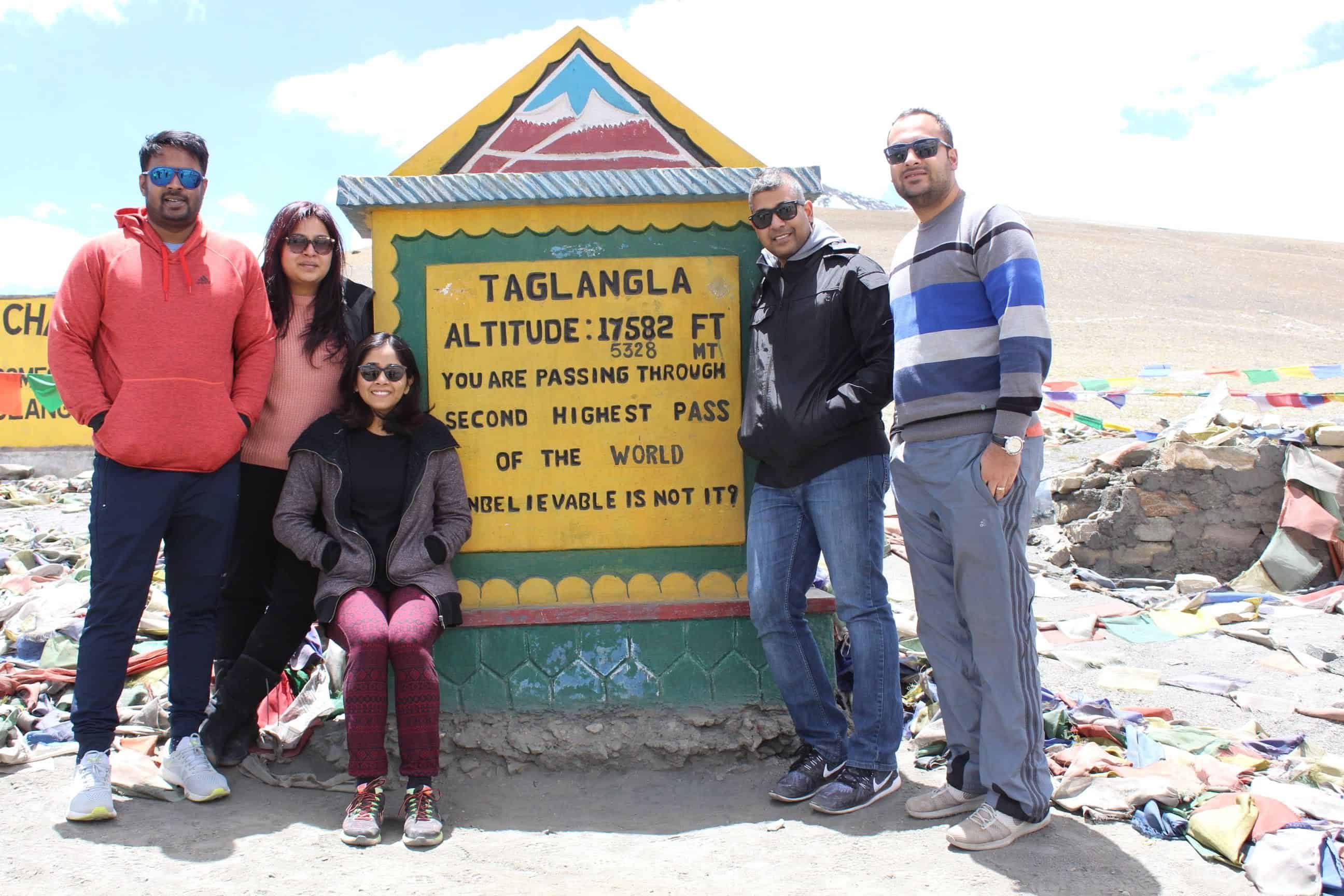
The board at Tanglang La claims it is the second-highest motorable pass in the world. A quick note here: many passes on this highway and across Ladakh claim to be the “highest” or “second highest” something. The boards rarely get updated as new roads are built. For example, Khardung La is often called the highest motorable pass, but that is not accurate. The corrected height of Khardung La is 17,582 ft, not the often-claimed 18,380 ft. Take these signboard claims with a pinch of salt and enjoy the pass for what it is, a stunning high-altitude crossing.
How Should You Handle AMS on This Section?
By the time you reach Tanglang La, you have been at high altitude for nearly two days. Most people who were going to get acute mountain sickness (AMS) would have experienced it at Sarchu or Pang already. But do not let your guard down. The cumulative effect of multiple days above 14,000 ft can catch up with you.
Keep yourself hydrated, eat light meals, and avoid sleeping during the drive through this section. One of our group members suffered a nosebleed later in the day near the Indus River, well past Tanglang La. AMS does not always hit you at the highest point. It can show up hours later when you least expect it. Listen to your body, my friend. If you feel a severe headache, nausea, or confusion, stop and descend immediately. These are isolated locations with no medical facilities until Upshi or Leh.


What Happens After You Descend from Tanglang La?
This is where the magic really happens. As you descend from Tanglang La toward Rumtse, there is a signpost that will get your heart racing. I will not spoil exactly what it says, but this is your first glimpse of the Ladakh Valley. The moment you see it, something shifts. The exhaustion fades, the camera comes out, and everyone in the car is suddenly wide awake.
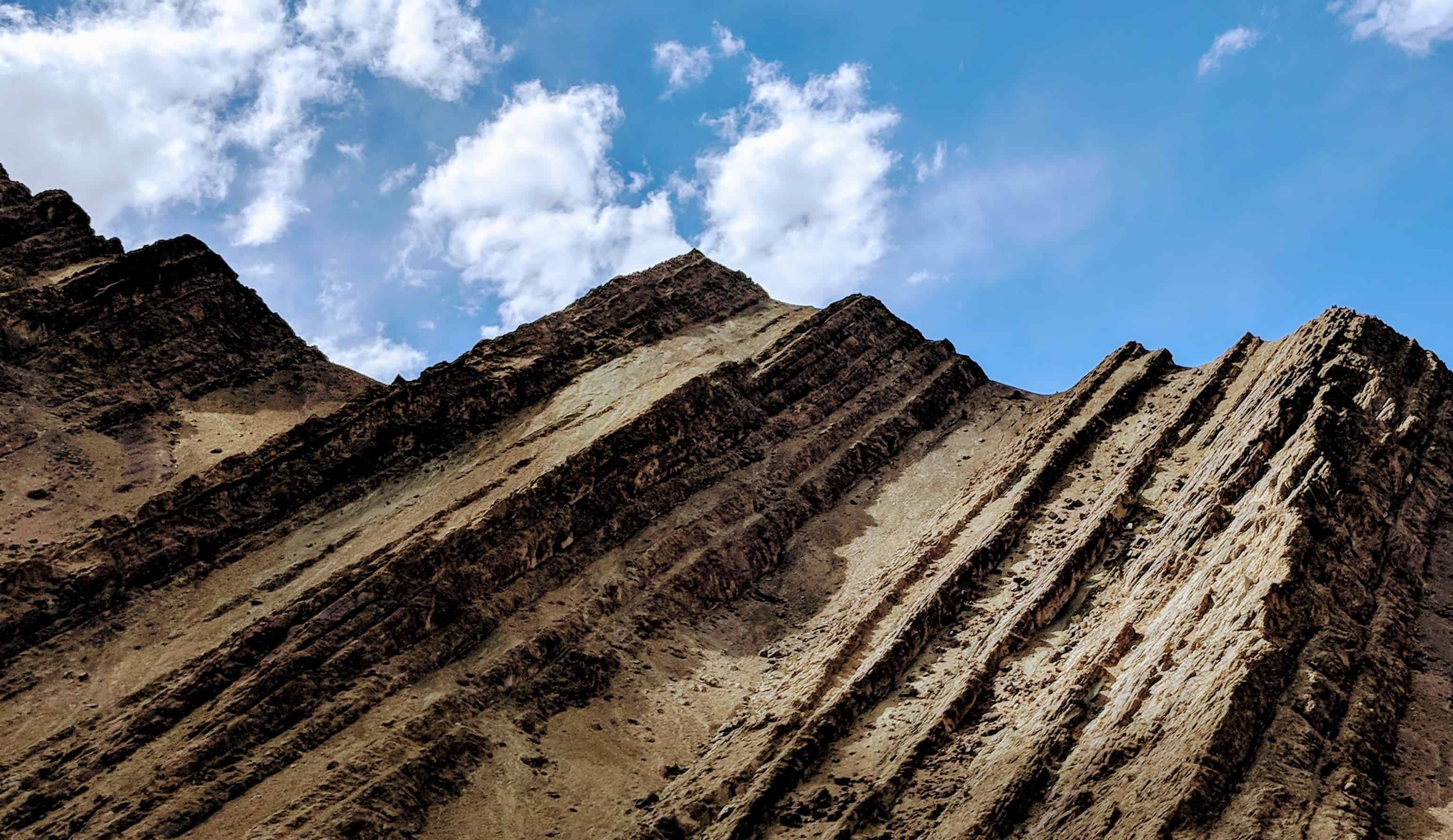
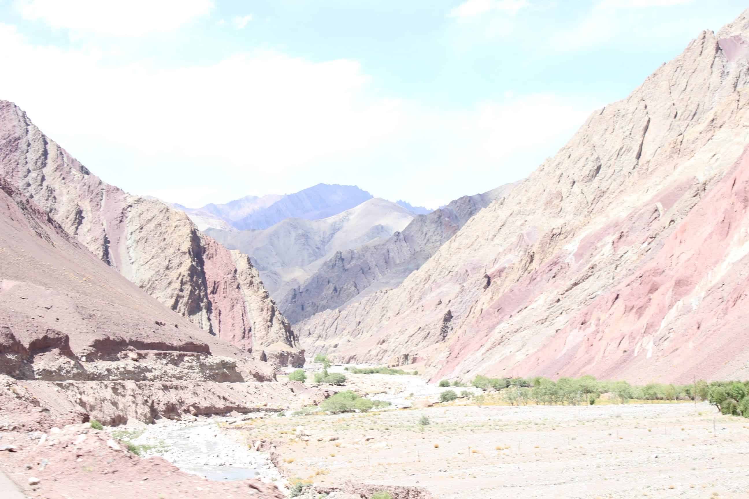
In all my previous articles about this highway, I have mentioned how at every turn, the view changes from one kind of 100% beautiful to a completely different and starkly contrasting 100% beautiful. From the lush green of Manali, to the black-and-white drama of Baralacha La, to the barren brown of Sarchu, to the open plateau of More Plains, and now this. Burgundy splendor. The hills turn a deep reddish-maroon, with textures carved by centuries of wind and water. It is unlike anything you have seen on the entire journey so far.

Driving Along the Indus River
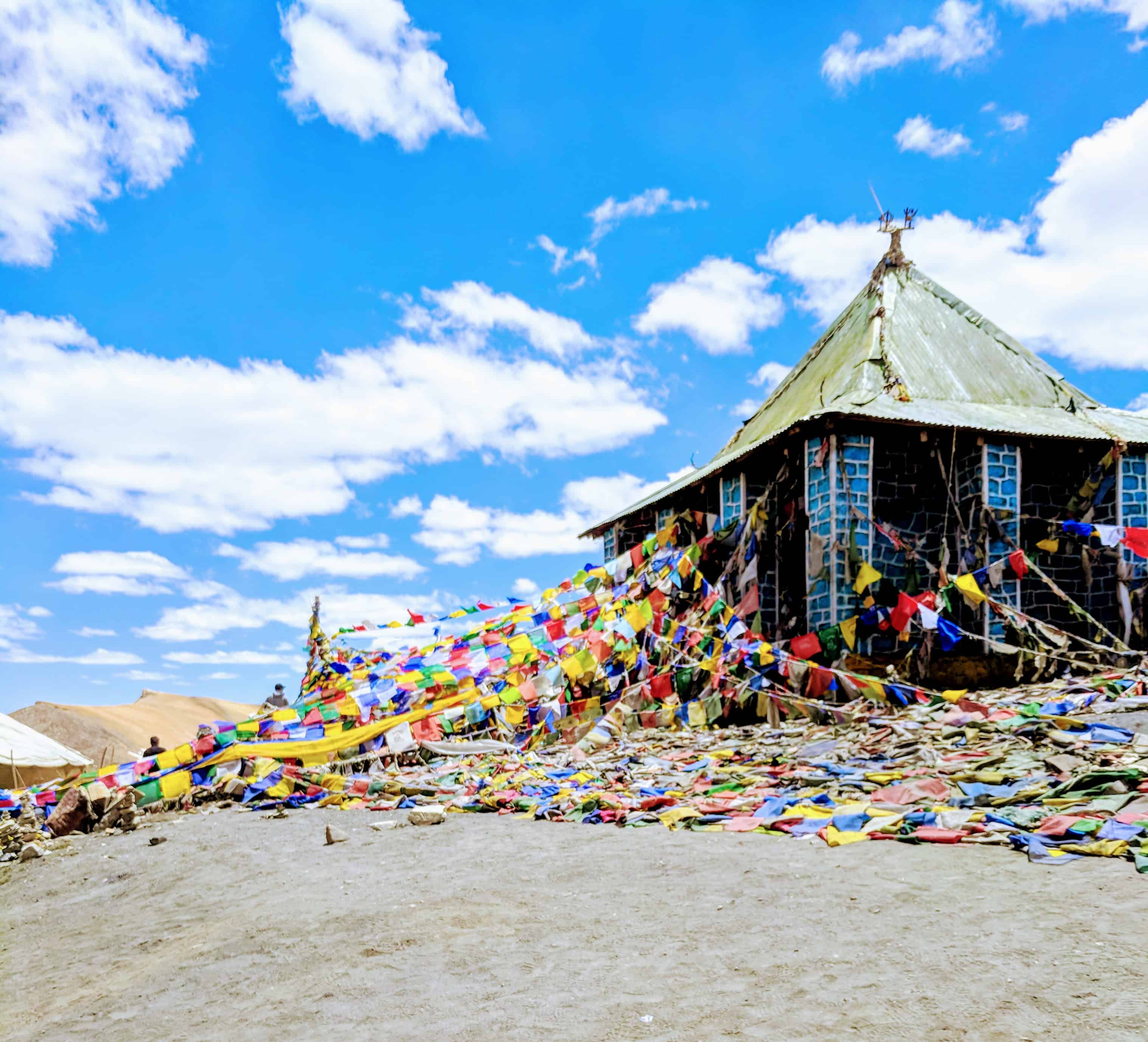
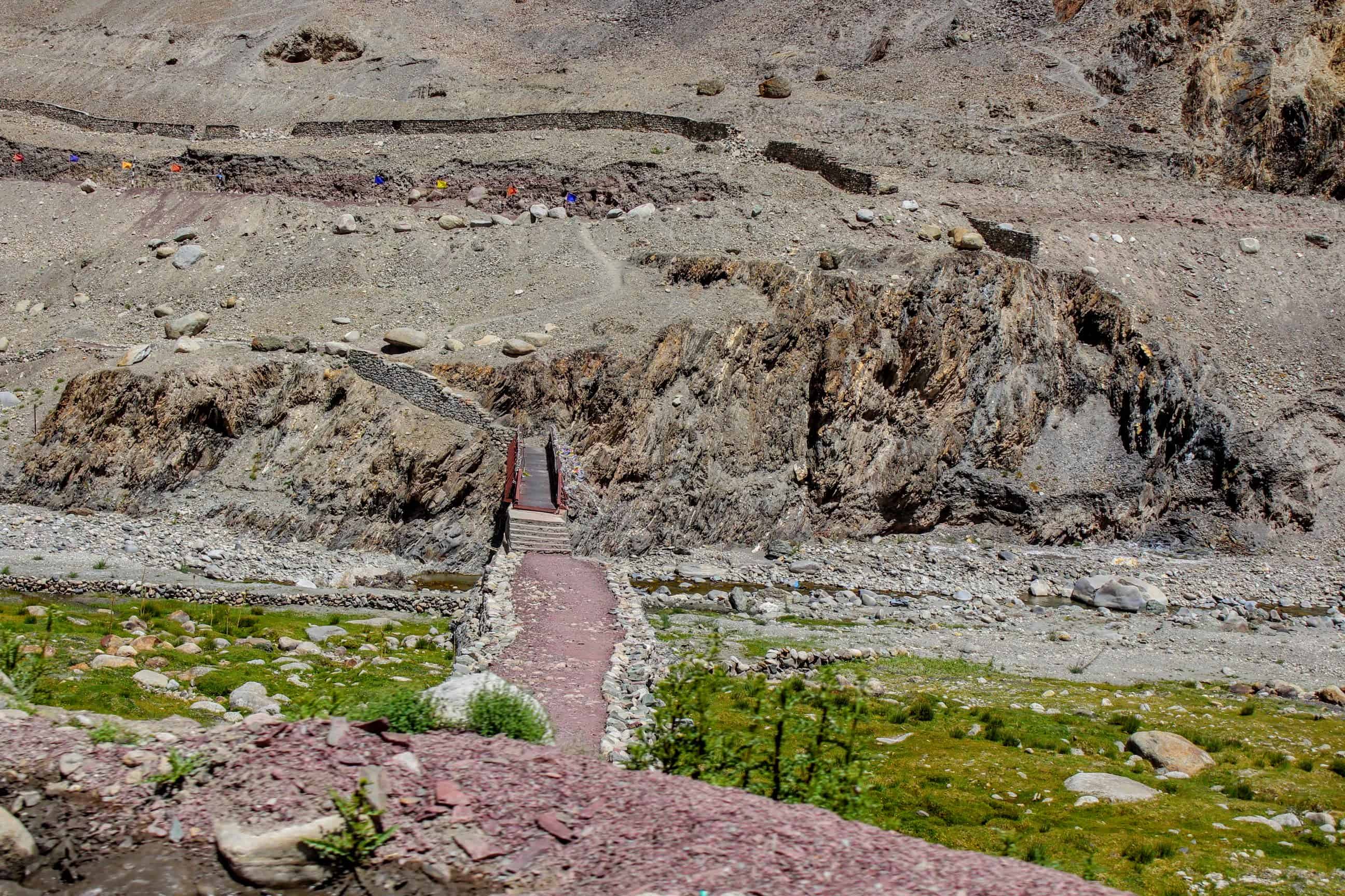
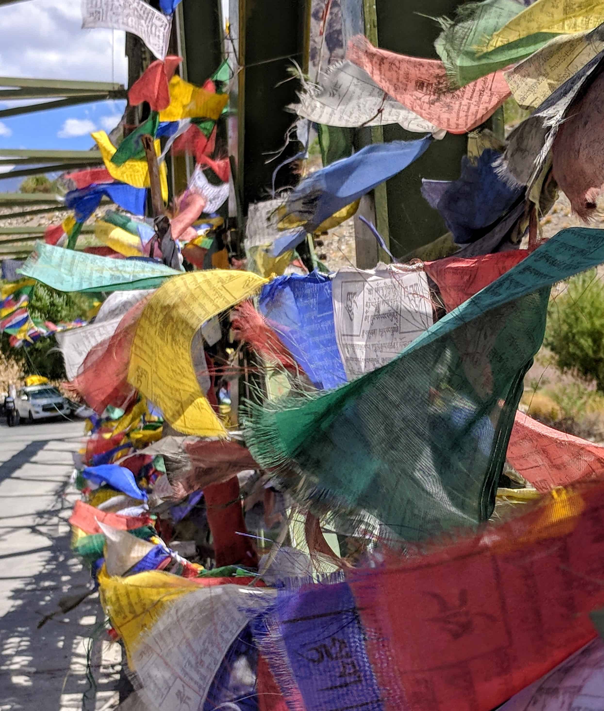
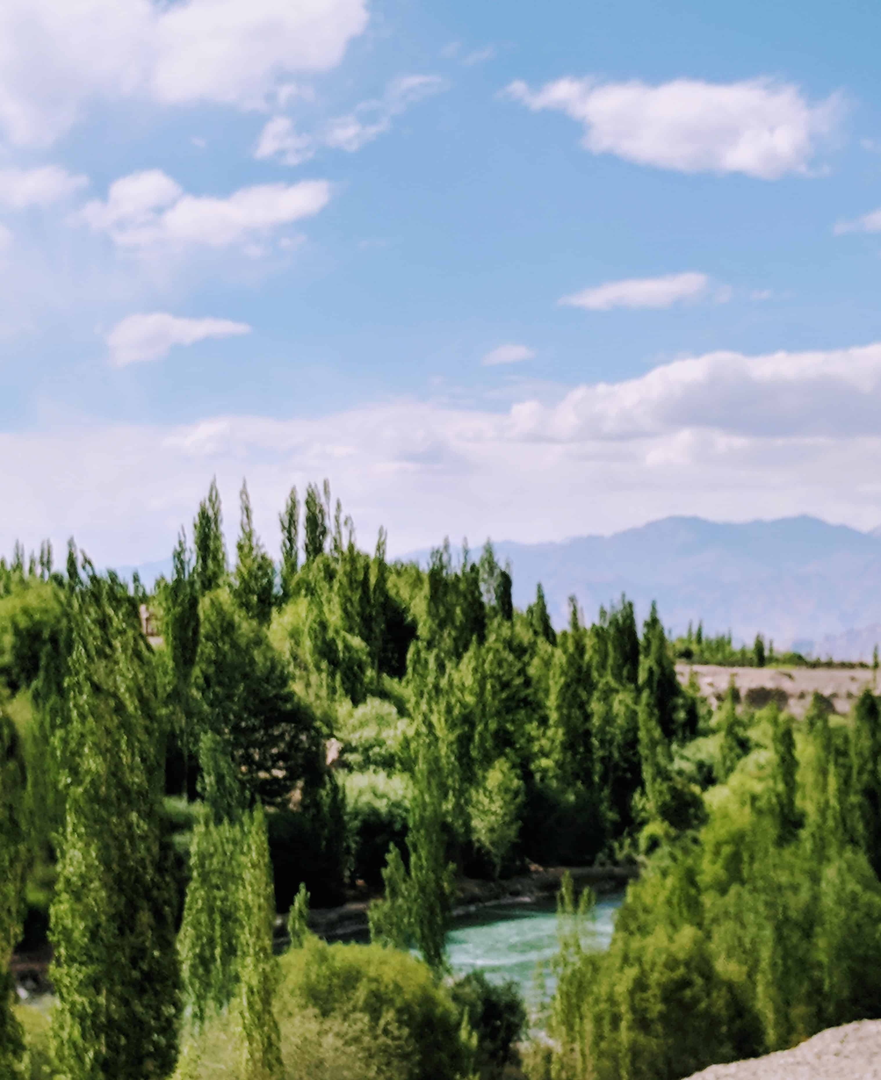
What makes this section truly special is that you are now driving along the riverbed of the Indus River. White stupas of all shapes and sizes dot the landscape. Prayer flags flutter from every bridge and hilltop. The burgundy hills frame the turquoise river in a way that no photograph can fully capture.
Have I used the word “beautiful” too many times in this series? Probably! But I genuinely ran out of adjectives on this trip. The elements of surprise never end on the Manali-Leh Highway, and this final stretch keeps you on your toes until the very last kilometer.
We stopped at one of the bridges covered in prayer flags, the kind you see in Bollywood movies set in Ladakh. We had been looking for this bridge for hours. We parked the car, walked down to the Indus, tossed stones to see who could get the most splashes, and just sat by the water. I have never seen water this clear in my life. Crystal clear, ice-cold, flowing straight from the glaciers. One of our friends suffered a nosebleed here (AMS can linger for a while, you guys!), but the rest of us just soaked in the moment.
What Are the Key Stops Between Tanglang La and Leh?
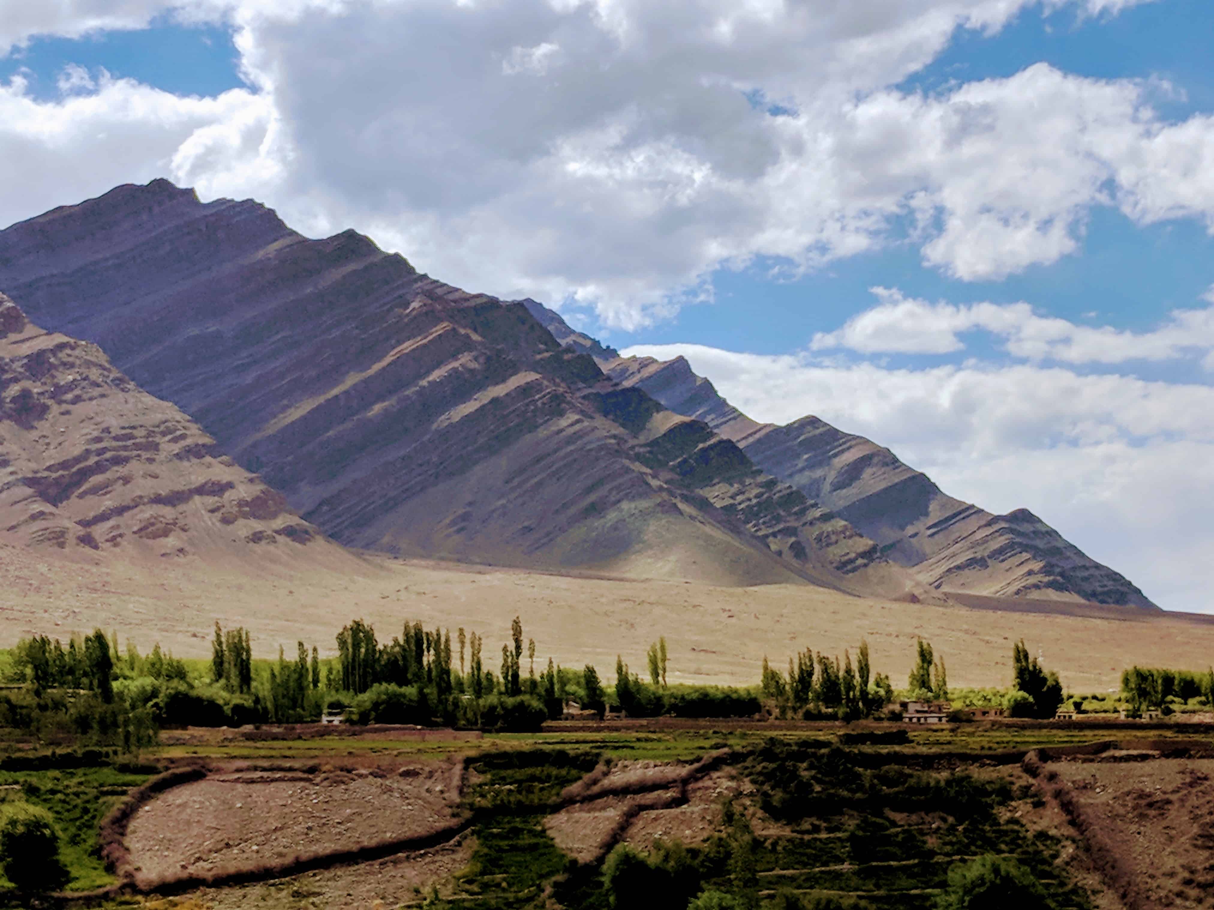
After the visual spectacle of the Indus Valley, the drive settles into a comfortable rhythm. The altitude drops steadily, and for the first time in days, you will notice your breathing easing up. We actually laughed about this in the car. Three days of consciously breathing, and suddenly we did not have to think about it anymore. Being in Leh later changed our entire perspective. We became genuinely grateful for something as basic as oxygen.
Rumtse and Gya
The first settlements you encounter after Tanglang La are Rumtse and Gya. These are small villages with basic guesthouses. If you started very late from Pang or are feeling unwell, these villages offer a place to rest. However, most travelers push through to Leh since it is only 2-3 hours away from here.
Upshi, the Last Checkpoint
Upshi is the last police checkpoint on the Manali-Leh Highway. Standard questions: where are you coming from, where are you going, how many people in the vehicle, vehicle registration number. Keep your ID and vehicle papers handy. The process takes just a few minutes.
Upshi sits along the Indus River at around 3,400 m (11,150 ft). This is also where mobile network coverage resumes after the long blackout since Jispa. BSNL postpaid works here, and Airtel/Jio signals return too. If you have been out of touch for two days, this is where your phone will start buzzing with messages.
Karu, Fuel and Civilization
About 10-15 km past Upshi is Karu, and this is where civilization hits you. An actual township, a full-fledged army cantonment, cars, shops, and most importantly, a petrol pump. If you have been watching your fuel gauge nervously since Tandi (the last fuel pump on the Manali side, roughly 345 km back), you can finally breathe easy. Fill up at Karu before the final 30 km drive into Leh.
For more on managing fuel on the Manali-Leh Highway and in Ladakh, I have a detailed guide that covers every pump location and tips for carrying extra fuel.
What Does It Feel Like to Finally Arrive in Leh?
And then, just like that, you are there.
Leh. The destination you have been dreaming about, planning for, maybe even fearing a little. The Leh Palace comes into view, the main market road stretches ahead of you, and the realization hits: you actually did it. You drove from Manali to Leh on one of the most challenging and beautiful highways in the world.
Cheers to the mother of all journeys. The passes that tested your limits, the plains that gave you peace, and the landscapes that changed your understanding of what “beautiful” means. Words will not do justice to the feeling of arriving in Leh after this journey, and I will not try too hard to describe it. I do not want to color your experience or create a bias. Go with a clean slate, experience it with an open mind, and build your own memories.
I know this is one trip that people plan for years. Some plan it for a decade. It is a commitment many want to make but hesitate because of the what-ifs. Yes, you should read up on AMS, the route details, the pain points. But overall, it is a journey you must experience firsthand. Just book your tickets and go.
What Tips Should You Remember for the Last Day?
Here are some practical things I wish someone had told me more clearly before the final leg:
- Start early from Pang. Leave by 6-7 AM. The road to Tanglang La can get crowded by mid-morning with trucks and convoys.
- Carry enough water. Be best friends with water on this trip. Fill up your bottles whenever you get a chance. Dehydration at altitude is dangerous and sneaky.
- Do not overeat. Heavy meals at altitude slow you down and make AMS worse. Stick to light food, dry fruits, and biscuits.
- Garlic helps. Local wisdom says garlic improves oxygen flow. Whether it is scientifically proven or placebo, it worked for us. Many dhabas on the highway add extra garlic to dal for exactly this reason.
- Avoid night driving. Never, ever drive this section after dark. The road has no lighting, no guardrails in many places, and stray animals can appear without warning.
- Fuel management is critical. The gap between Tandi and Karu is roughly 345 km. Most vehicles with a full tank plus 5-10 litres extra can manage, but do not take chances. Carry spare fuel in proper containers.
- Listen to your body. Lack of oxygen causes foggy and delayed decision-making. If you feel off, stop driving and let someone else take over.
- Your tribe defines your vibe. Seriously. The people you travel with on this highway will become friends for life.
What Should You Do After Reaching Leh?
The biggest mistake first-timers make is planning activities for the day they arrive in Leh. Do not do this. Your body needs at least one full day of rest for acclimatization. Leh sits at 11,520 ft (3,500 m). While that is lower than the passes you just crossed, the cumulative fatigue needs time to settle.
Here is what I recommend for your first 24 hours in Leh:
- Check into your hotel, rest, drink water, sleep early
- Take a short walk around Leh Main Bazaar in the evening if you feel up to it
- Do not rush to Pangong or Nubra Valley on day one. Give yourself a rest day
- Arrange your Inner Line Permits online or from the DC office in Leh
- Check out the local sightseeing options in Leh for a gentle first day
For planning the rest of your Ladakh trip, check out the most common Ladakh itinerary or the 9-day Ladakh itinerary if you are short on time.
Is There a Community That Forms on This Highway?
This is something I want to talk about before signing off, because it is one of the most underrated parts of the Manali-Leh experience.
The community you develop during and after this trip is one you will cherish for a lifetime. Whether it is helping a stranded biker with a busted tire, giving feedback on the route ahead, or just exchanging a thumbs-up with a fellow traveler you pass on an empty stretch, you are forever connected. Your soul has a piece of the place where I left a piece of mine. Our stories might be different, but they share the same magnificent backdrop.
This journey changes your life. Your viewpoint shifts, you become a calmer version of yourself, more connected to the things that truly matter. And having been on a similar journey of growth, I understand you.
So, my friend, welcome to the small club of wandering souls. If you have any questions about the Manali to Leh journey or need help planning your trip, feel free to drop a comment below or reach out to the DwD community. We have all been there, and we are happy to help. See you out there 🙂
Related Reading
- How to Plan a Trip on the Manali-Leh Highway
- Why Jispa Is Better Than Sarchu as a Stopover
- Leh Ladakh Trip Budget Calculator
- Best Time to Visit Ladakh and Zanskar
- Nubra Valley Complete Travel Guide
Frequently Asked Questions
How far is Pang from Leh and how long does it take?
Pang to Leh is approximately 150 km and takes 5-7 hours by road. The route passes through More Plains, Tanglang La pass (17,480 ft), Rumtse, Upshi, and Karu before reaching Leh. The actual time depends on road conditions, military convoys, and how many photo stops you make along the way.
Is Tanglang La the highest pass on the Manali-Leh Highway?
Tanglang La at 17,480 ft (5,328 m) is the highest pass on the Manali-Leh Highway. It is also the last major pass before you descend into the Indus Valley and reach Leh. The signboard claims it is the second-highest motorable pass in the world, but that claim is outdated as several higher passes have since been opened to traffic.
Where is the first petrol pump after Tandi on the Manali-Leh Highway?
The next petrol pump after Tandi (near Keylong) is at Karu, which is about 30 km before Leh. This means there is a gap of roughly 345 km without any fuel station. Always fill your tank completely at Tandi and carry 5-10 litres of extra fuel in proper containers.
Is there mobile network between Pang and Leh?
Mobile network is mostly dead between Jispa and Upshi. BSNL postpaid has the widest coverage and may get intermittent signals at some points, but do not rely on it. Network coverage resumes at Upshi, where BSNL, Airtel, and Jio all work. From Upshi to Leh, you will have regular connectivity.
Can I visit Tso Kar Lake on the way from Manali to Leh?
The turnoff for Tso Kar Lake is at Debring, on the More Plains section. However, visiting Tso Kar on your way from Manali to Leh is not advisable. Your body will not be properly acclimatized, and you need an Inner Line Permit arranged beforehand. It is much better to visit Tso Kar as a day trip from Leh or as part of the Tso Moriri circuit.
What should I do on the first day after reaching Leh?
Rest. Your first full day in Leh should be dedicated to acclimatization. Do not plan any excursions to Pangong, Nubra, or Khardung La on day one. Drink plenty of water, eat light meals, and take a gentle walk around Leh Main Bazaar in the evening. Your body needs at least 24 hours to adjust to the altitude of 11,520 ft.
What is the EDF fee for entering Ladakh in 2026?
The Environmental Development Fee (EDF) for Ladakh in 2026 is Rs 400 per person as a one-time fee, plus Rs 20 per person per day, and an additional Rs 10 per person per day for the Red Cross fund. This applies to all tourists entering Ladakh by road or air.
2 Comments
Comments section gets closed in 90 days. To ask your travel questions, you can follow my YouTube Channel for a faster reply or for a much slower reply follow me on Instagram. :)
All the best for your next adventure and we will be waiting for a safe return with a bundle of memories…
God Bless you
Thank you!