
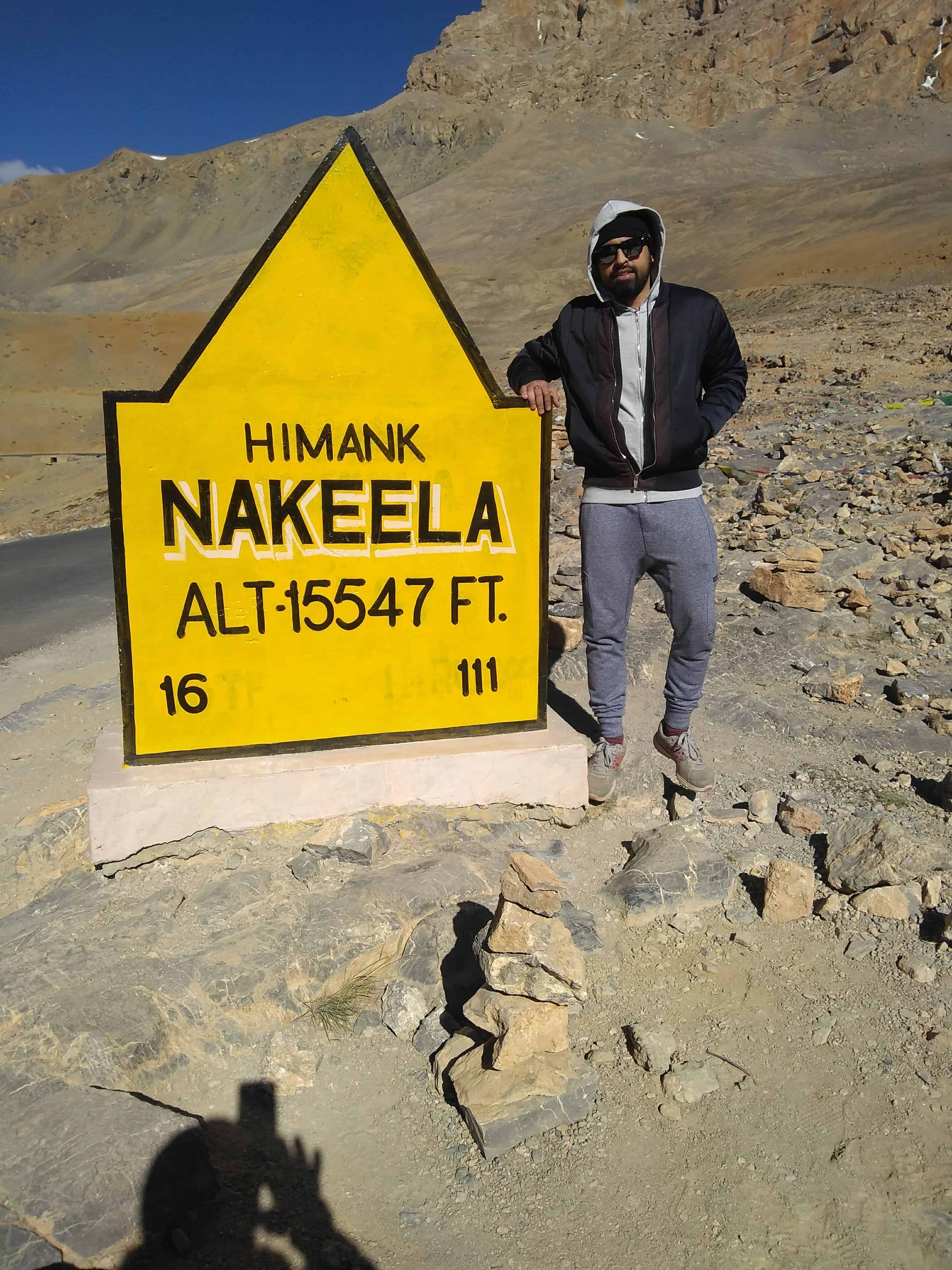
Nakee La (15,547 ft) and Lachalung La (16,616 ft) are the two back-to-back passes on the Manali-Leh Highway that test you more than any other stretch on this route. Coming right after the infamous Gata Loops, these passes hit you with altitude, bad roads, and zero facilities, all within a span of about 30 km. I crossed them in June 2018 and, honestly, it was the toughest section of our entire Ladakh road trip.
Quick Info: Nakee La sits at 4,739 m (15,547 ft) and Lachalung La at 5,065 m (16,616 ft). Both passes lie between Sarchu and Pang on the Manali-Leh Highway (NH3). The road is open from late May to early October. There is no fuel, food, accommodation, or mobile network at either pass. Carry water, snacks, and basic medicines before leaving Sarchu.
Let's quickly dive into the details:
Where Are Nakee La and Lachalung La on the Manali-Leh Highway?
These two passes sit in the section between Sarchu (14,070 ft) and Pang (15,280 ft) on the Manali-Leh Highway. If you are driving from Manali towards Leh, the sequence of passes goes like this: Atal Tunnel (bypasses Rohtang), Baralacha La, then Gata Loops leading to Nakee La, followed immediately by Lachalung La, then the descent to Pang, and finally Tanglang La before Leh.
Nakee La is the third highest pass on the Manali-Leh Highway. Lachalung La is the second highest. The highest is Tanglang La at 17,480 ft. What makes this section particularly brutal is that you barely descend after crossing Nakee La before the climb to Lachalung La begins. Your body does not get time to recover. Hence, most cases of altitude sickness on this highway happen in this stretch.
How Do You Reach Nakee La from Sarchu?
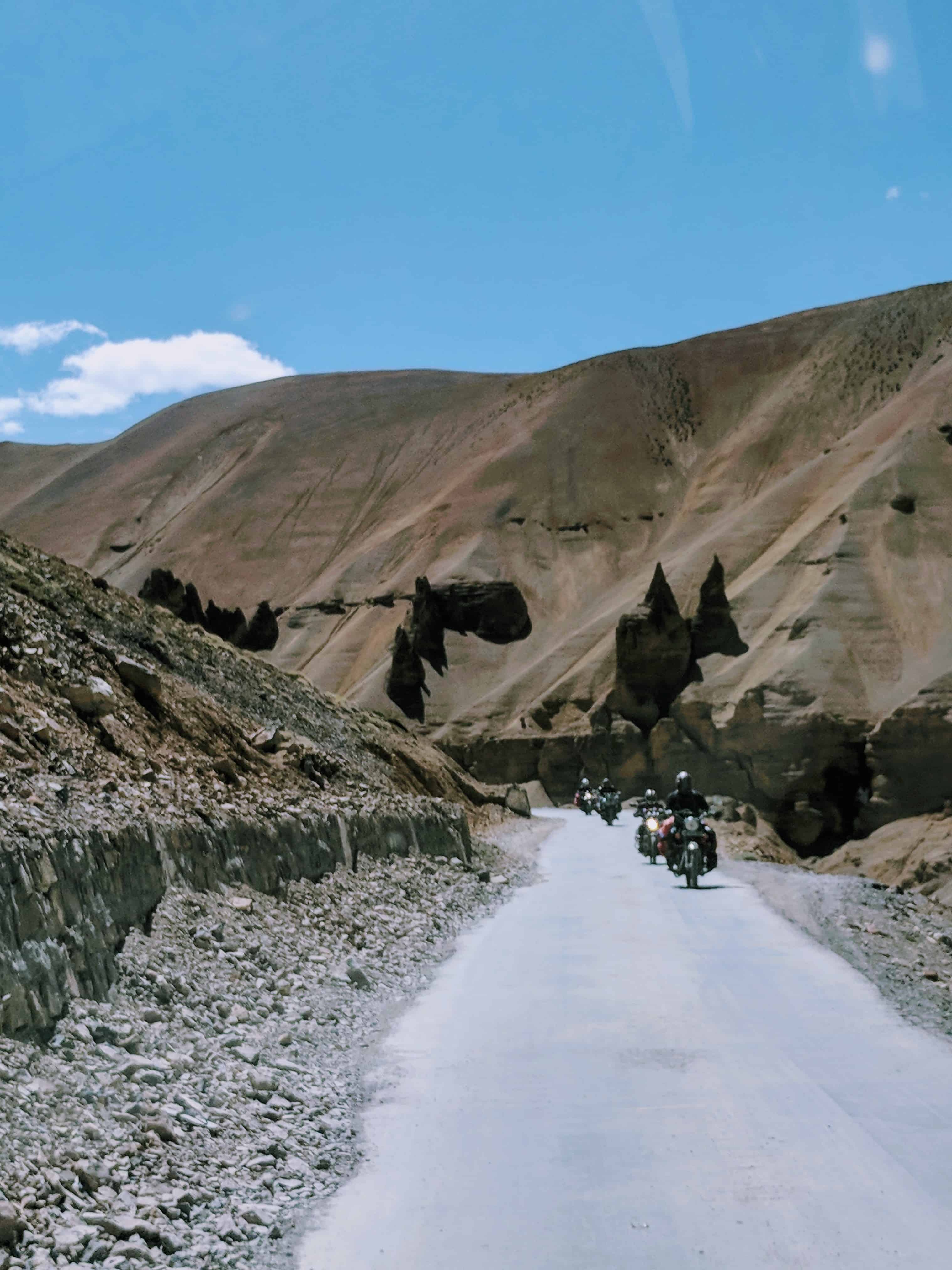
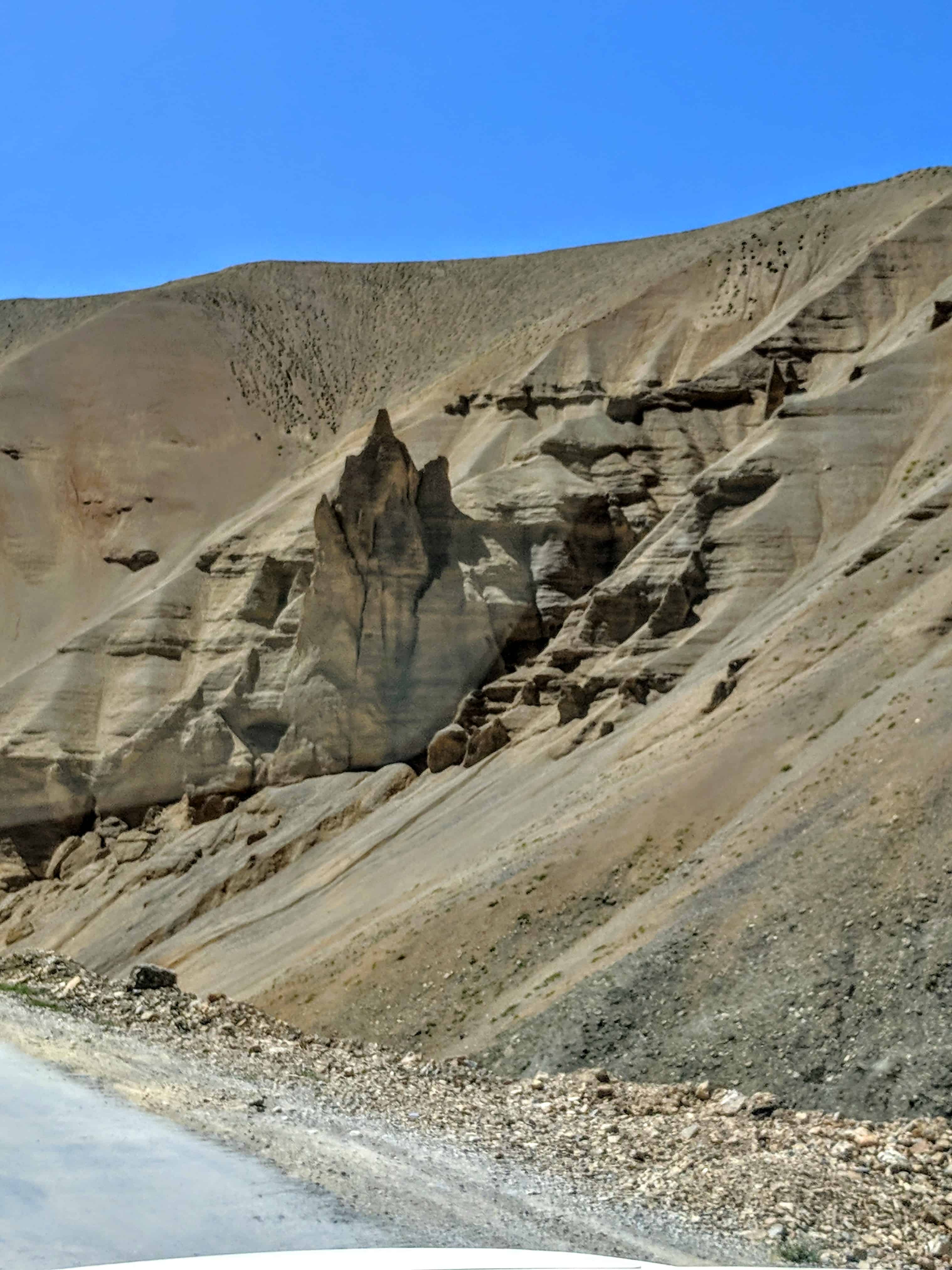
From Sarchu, the road climbs gradually for about 24 km before hitting the famous Gata Loops, a series of 21 hairpin bends that climb roughly 7 km from 4,190 m to 4,630 m. The Gata Loops are a spectacle in themselves, but they are physically exhausting. By the time you finish them, your body is already working overtime to cope with the altitude.
After the Gata Loops, the road continues climbing gently towards Nakee La. The total distance from Sarchu to Nakee La is about 37 km. Keep in mind, this entire stretch has no dhabas, no fuel, and no habitation. The last proper stop was Sarchu (or Jispa, if you followed my advice and stayed there instead).
What Is It Like Crossing Nakee La at 15,547 Ft?
Honestly? I barely remember the views. And I say that with zero embarrassment. By the time we reached Nakee La, I had a splitting headache and mild nausea from the Gata Loops. The multiple sharp bends were more to blame than the altitude itself, but at 15,547 ft, even your body’s coping mechanism starts slowing down.
I was trying very hard to pretend I was fine. Self-inflicted peer pressure is a powerful motivator when you are traveling with friends. “I’m good, I’m good,” I kept repeating while my stomach disagreed violently. Not having eaten anything for the day, and not having had enough water, I attempted to throw up but nothing came out. It was that empty, dry retching feeling that tells you your body is struggling.
But here is the thing about traveling with goofball friends. They do not take your illness too seriously, which oddly motivates you to not take it seriously either. As I said, peer pressure can be a gift sometimes 🙂
What Happens When AMS Hits You at Nakee La?
Getting back into the car after the pass, we discovered that a bottle of hand cream had exploded. The air pressure at this altitude is so low that sealed containers can burst open. Now, a sensible person would have thrown away the bottle and cleaned up. But that is not how our brains were functioning at 15,500+ ft.
The owner of the hand cream proceeded to bang the bottle on every surface he could find, hoping gravity would push the cream back in. Of course, that was never going to work because the pressure difference had expanded the cream outward. But rational thinking is one of the first casualties of altitude.


While this was happening, someone called my name and I realized my ears had popped. The voice sounded like it came from very far away. Coupling this awareness with the constant banging of the bottle, something snapped. Suddenly I could not process anything. I felt my body shutting down and I did not understand what was happening.

We stopped the car. I got out into the cold breeze, not feeling a thing, not hearing the roar of the winds, unable to breathe properly. Finding the pressure point right behind my ear, I massaged it for a minute and finally understood that my nasal airways were completely blocked. Clearing my nose was an instant relief. Oxygen flow to the brain restored. I could think again.
Safety Note: Lack of oxygen at high altitude leads to foggy and delayed decision-making. If you feel disoriented, stop immediately and focus on breathing. Do not push through. Carry Diamox (after consulting a doctor) and keep a portable oxygen can handy. Read our detailed AMS prevention guide before this trip.
What Is Whisky Nala Between the Two Passes?
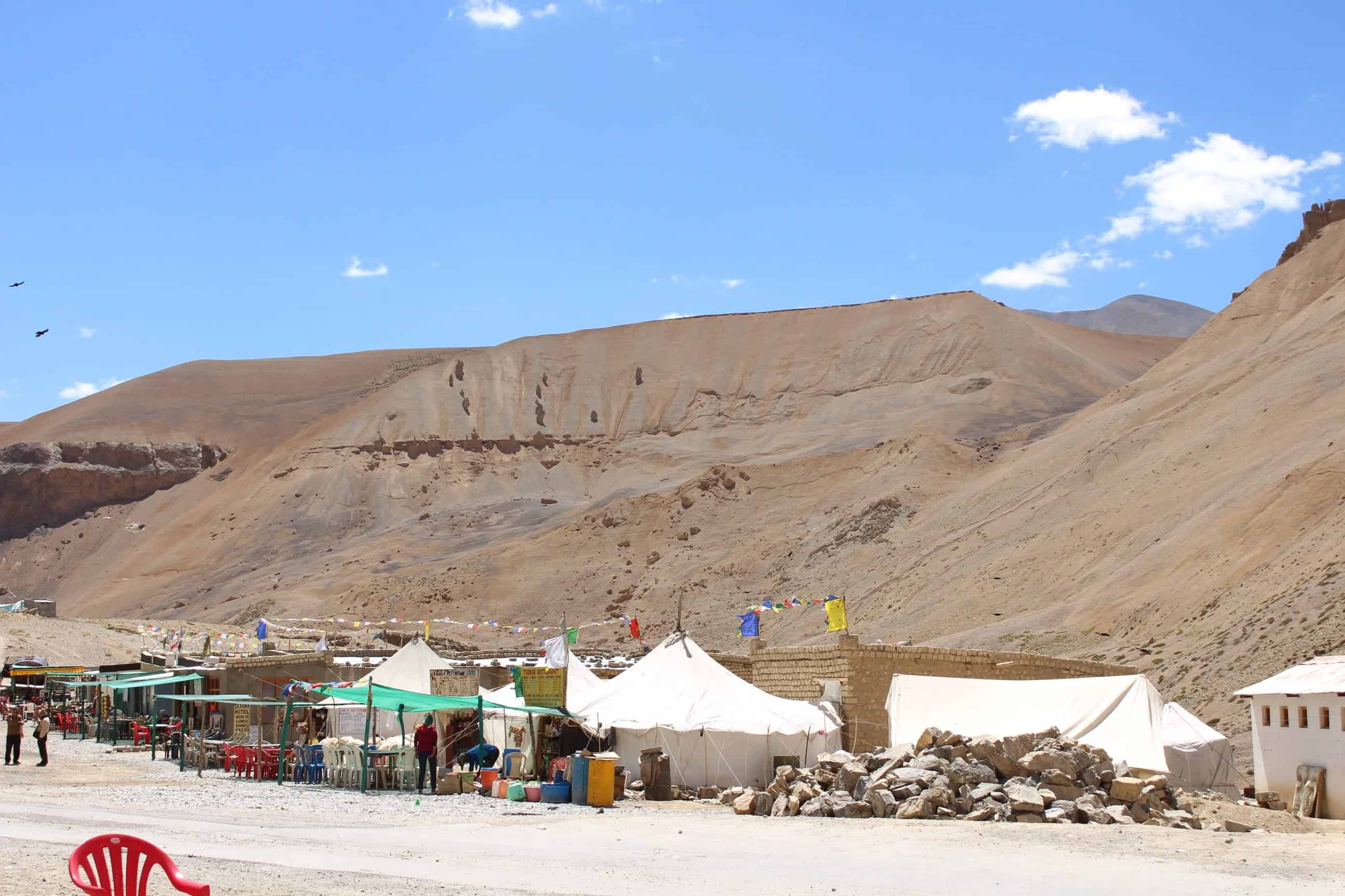
At the bottom of the descent from Nakee La, there is a small cluster of dhabas at a place called Whisky Nala. The name comes from a seasonal stream (nala) that flows here, though when we crossed in June, there was no water flow at all. This is your only chance to eat or drink anything between Sarchu and Pang, so do not skip it.
I stayed in the car, still not feeling great, but a lot of water helped immensely. This 20-minute break of not moving, proper hydration, and a cup of chai felt like a blessing. I felt warmer almost immediately. Everyone else ate dal-chawal at the dhaba. I was in no condition to eat and passed.
If you are planning your Manali-Leh Highway journey, keep in mind that Whisky Nala dhabas are seasonal. They operate only when the highway is open (June to September). Expect basic food, nothing fancy, and no UPI or card payments. Cash only.
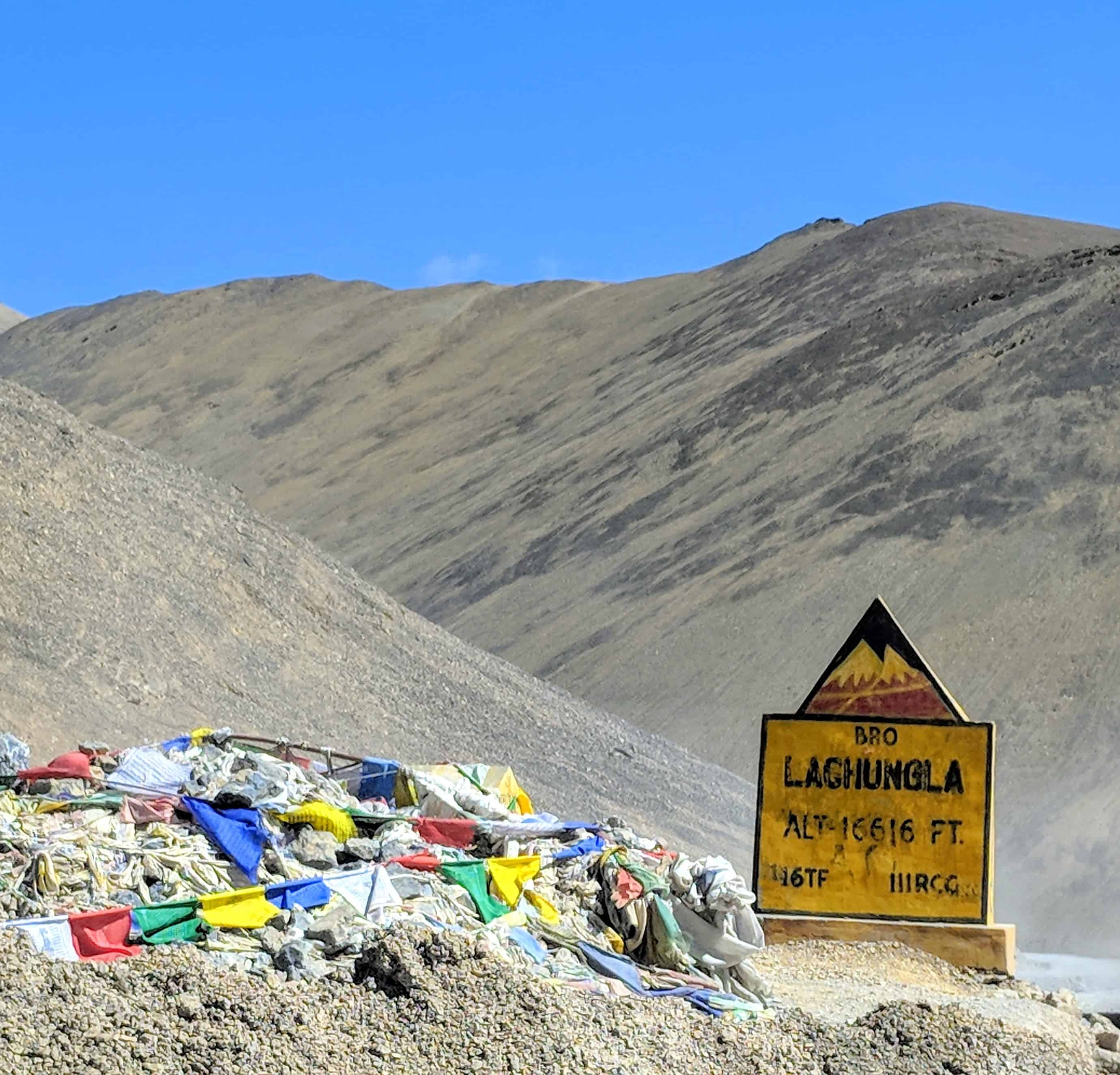
How Tough Is the Climb to Lachalung La at 16,616 Ft?
Immediately after Whisky Nala, the ascent to Lachalung La begins. This is the part I was dreading. Lachalung La (also spelled Lachulung La or Lungalacha La) sits at 16,616 ft (5,065 m), making it the second highest pass on the entire Manali-Leh Highway. After the AMS episode at Nakee La, I was genuinely scared of what lay ahead.
But thankfully, this time I did well. My stint of altitude sickness was behind me, and I genuinely enjoyed the calm and the vast emptiness of the landscape. However, the AMS monster decided to hit another member of our group instead. Since he had just eaten breakfast at Whisky Nala, the vomiting was far worse than mine. There is a lesson here, my friend. Do not eat a heavy meal right before climbing to 16,000+ ft.
Since we had already been through this as a group (thanks to my earlier episode), my friend’s sickness became a somewhat calmer experience for everyone. We were not panicking. We decided to descend without stopping, and the nausea slowly faded as we lost altitude towards Pang.
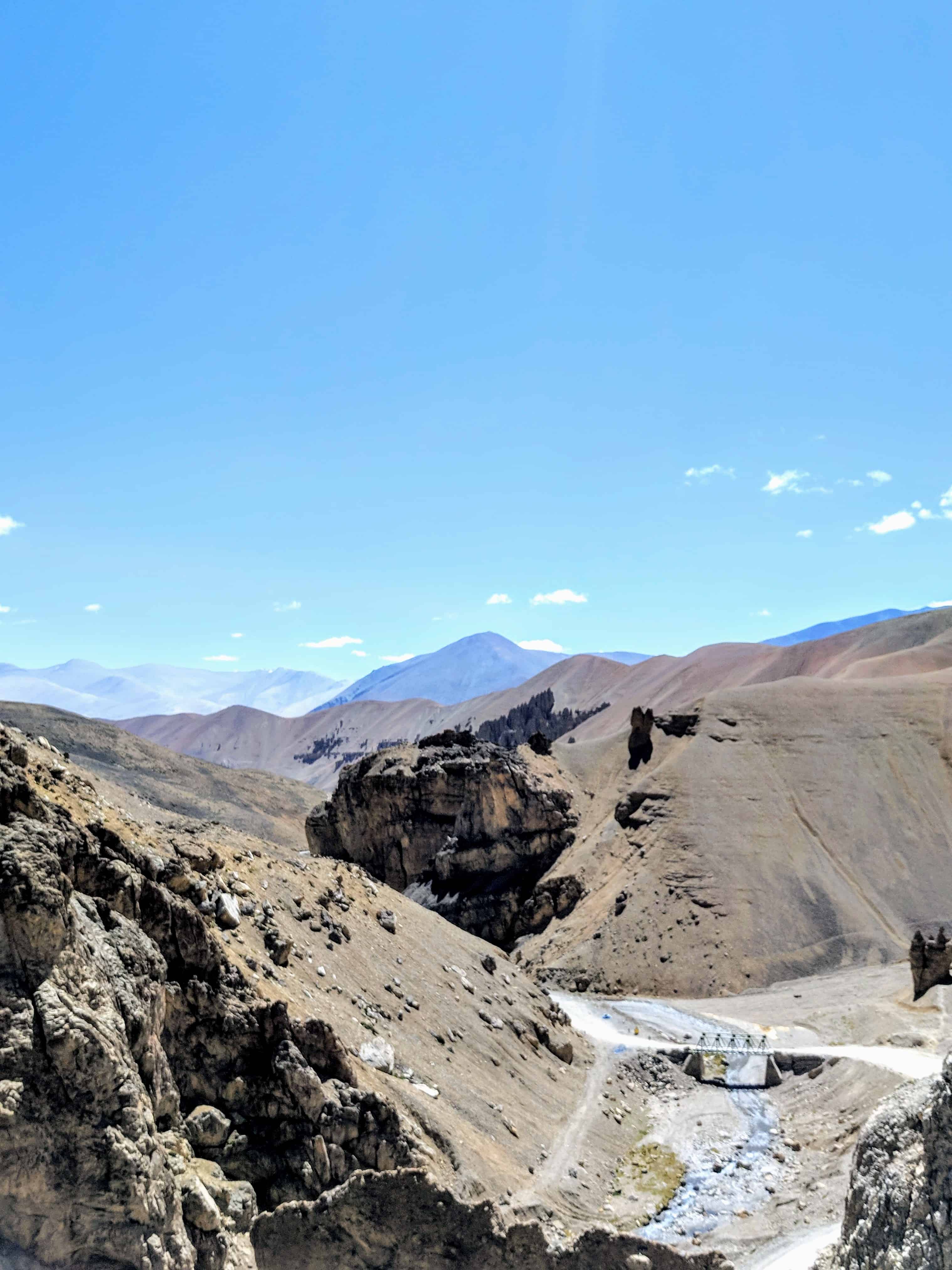
What Are the Road Conditions Between Nakee La and Pang?
In June, the roads at both Nakee La and Lachalung La were in decent shape. BRO (Border Roads Organisation) does a commendable job getting the highway open every year, but the section after Lachalung La on the descent towards Pang was terrible when we drove it. Broken tarmac, loose gravel, and washboard surfaces made it a painful 45-minute drive.
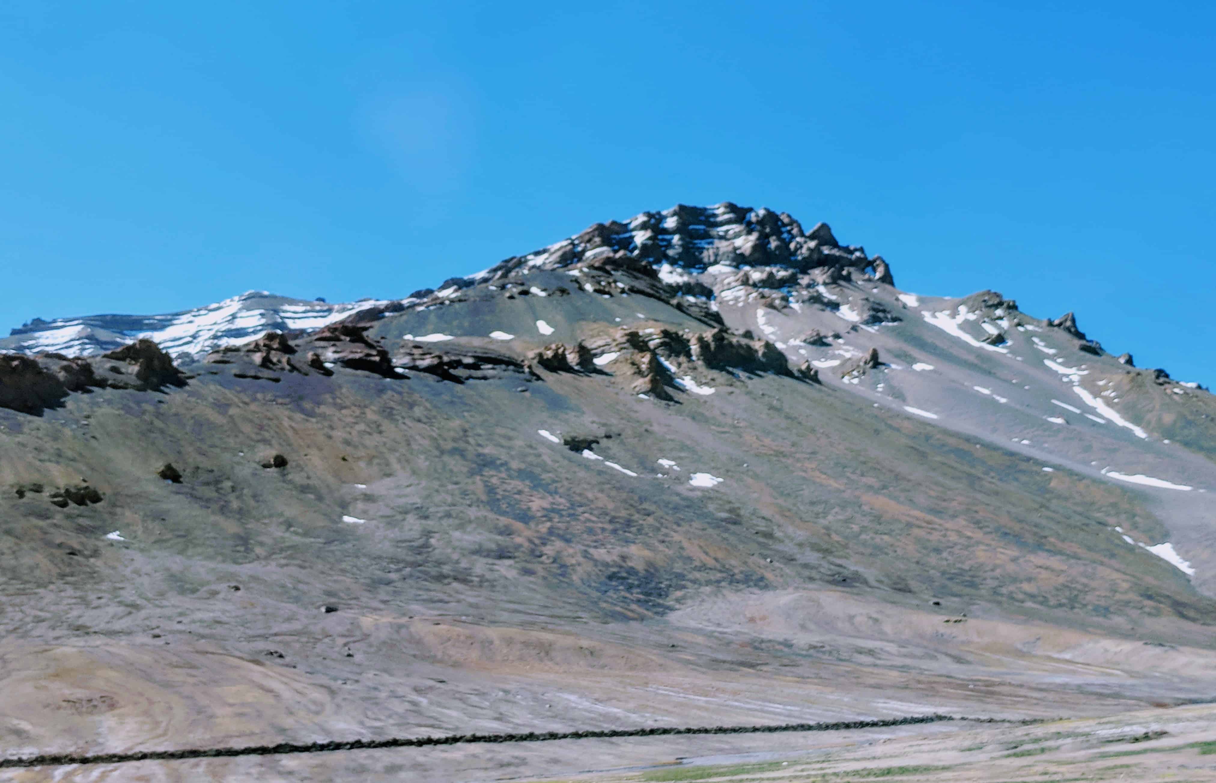
Most of us were already exhausted by this point. It was not even 11 AM, and the fatigue was real. Some of my friends dozed off in the car. As the navigator, I was keeping the driver company, and honestly, the mountains kept us both occupied. The hills had changed shapes, forms, and colors entirely. We started spotting faces in the rock formations. One mountain looked like it was giving us the middle finger. Another one looked like a family of three just sitting and chilling.
If you are planning a self-drive to Ladakh, do not take any shortcuts or dirt roads around Nakee La. Many vehicles have lost control on these unmarked paths, especially while descending with burned-out brakes. Stick to the main BRO-maintained road.
What to Expect at Pang After the Passes?
As we approached Pang, we passed the iconic natural rock arch bridge that every Manali-Leh traveler photographs. We should have stopped, but tiredness, exhaustion, and hunger did not permit. Pang itself is a small settlement at 15,280 ft with a few dhabas, a military camp, and the most basic facilities you can imagine.
![What are tips for long-distance bike ride in Ladakh or Spiti? [10 Practical Tips]](https://discoverwithdheeraj.com/yt_vid_thumbs/ladakh/86.png)
The blue skies, barren hills, a terrible makeshift hole-in-the-ground “bathroom,” and some amazing Thukpa later, we were sorted. A group of bikers coming from Leh told us the route ahead (towards More Plains and Tanglang La) involved more climbing. Classic Manali-Leh Highway humor.
Here is the thing about the Leh Ladakh road trip via Manali. You earn your views. Whether it is the brutal climb after Sarchu, or the surprise of More Plains after Pang, this route always makes you work for the beauty. And that is exactly what makes it worth every bit of the pain.
How Should You Prepare for Nakee La and Lachalung La?
Based on my experience crossing these passes, here are the things that actually matter. These are not textbook tips. These are lessons I learned the hard way at 16,000 ft.
- Stay hydrated. Drink 3-4 liters of water throughout the day. Dehydration at altitude makes AMS symptoms significantly worse. This was my biggest mistake.
- Do not skip meals, but eat light. An empty stomach made my nausea worse. But eating heavy right before Lachalung La made my friend vomit. Light snacks (biscuits, dry fruits, glucose) are the way to go.
- Carry Diamox (consult your doctor first). Start taking it 24 hours before reaching high altitude. It helps with acclimatization. Not a cure, but a safety net.
- Keep a portable oxygen can. We did not carry one and regretted it. You can rent proper oxygen cylinders in Leh, but for this stretch, a portable can (available at chemists in Manali) is sufficient.
- Stay overnight at Jispa instead of Sarchu. Jispa (10,500 ft) gives your body more time to acclimatize compared to Sarchu (14,070 ft). I always recommend Jispa over Sarchu for first-timers on this route.
- Fill your fuel tank at Tandi. The last petrol pump on the Manali side is at Tandi (32-35 km before Jispa). The next one is at Karu, about 30 km before Leh. That is roughly 365 km with zero fuel stations.
- Carry warm layers. Even in June, temperatures at Lachalung La can drop below freezing. Wind chill makes it worse.
- Do not take shortcuts. Unmarked dirt paths around Nakee La are dangerous. Stick to the BRO-maintained road.
What Is the Best Time to Cross Nakee La and Lachalung La?
The Manali-Leh Highway typically opens in late May and closes by mid-October, depending on snowfall. The best window for crossing Nakee La and Lachalung La is June to September. Early June can still have patches of snow on the road, particularly near Baralacha La, but by mid-June the passes are usually clear. Check the Manali-Leh Highway status page for real-time updates before you plan your trip.
July and August bring monsoon rains, which can cause landslides and water crossings on various sections of the highway. September offers the most stable weather but shorter daylight hours. In case you are considering the Srinagar-Leh route instead, read our comparison of why Srinagar-Leh might be a better choice for some travelers.
Key Distances and Altitudes: Sarchu to Pang via Both Passes
Here is a quick reference table for this section of the highway. All distances are approximate and measured from Sarchu.
| Location | Distance from Sarchu | Altitude | Facilities |
|---|---|---|---|
| Sarchu | 0 km | 14,070 ft (4,290 m) | Tent camps, dhabas, no fuel |
| Gata Loops (start) | 24 km | 13,740 ft (4,190 m) | Nothing |
| Gata Loops (end) | 31 km | 15,190 ft (4,630 m) | Nothing |
| Nakee La | 37 km | 15,547 ft (4,739 m) | Nothing |
| Whisky Nala | 44 km | ~14,500 ft (~4,420 m) | Seasonal dhabas (June-Sept) |
| Lachalung La | 54 km | 16,616 ft (5,065 m) | Nothing |
| Pang | 78 km | 15,280 ft (4,660 m) | Dhabas, military camp, basic toilets |
The total drive time from Sarchu to Pang is 3 to 4.5 hours depending on road conditions and stops. In a typical Manali to Ladakh itinerary, this stretch is covered on Day 2 (if starting from Jispa/Sarchu) as part of the drive to either Pang or directly to Leh.
Frequently Asked Questions
What is the altitude of Nakee La and Lachalung La?
Nakee La sits at 15,547 ft (4,739 m) and Lachalung La at 16,616 ft (5,065 m). Both passes are on the Manali-Leh Highway between Sarchu and Pang. Lachalung La is the second highest pass on the highway after Tanglang La (17,480 ft).
Is there food or fuel available at Nakee La or Lachalung La?
No. There is absolutely nothing at either pass. No dhabas, no fuel, no habitation. The only food stop between Sarchu and Pang is at Whisky Nala, which has a few seasonal dhabas operating from June to September. Always carry your own water, snacks, and emergency supplies.
How do I prevent altitude sickness at these passes?
Stay hydrated (3-4 liters of water daily), eat light meals, carry Diamox (consult a doctor first), and spend the previous night at a lower altitude like Jispa (10,500 ft) instead of Sarchu (14,070 ft). Carry a portable oxygen can and do not exert yourself at the pass. Read our complete AMS prevention guide for detailed preparation tips.
When does the Manali-Leh Highway open for these passes?
The highway typically opens in late May and closes by mid-October. The best window for crossing Nakee La and Lachalung La is June to September. Check the Manali-Leh Highway status page for real-time updates on opening dates and road conditions.
Can I cross Nakee La and Lachalung La on a motorcycle?
Yes, thousands of bikers cross these passes every season. The road is motorable (though rough in patches), and BRO maintains it during the open season. Carry extra fuel, warm riding gear, and ride in groups if possible. Do not stop for too long at the pass top. Read our self-drive tips for Ladakh for more preparation advice.
What is Whisky Nala and where is it located?
Whisky Nala is a small spot between Nakee La and Lachalung La at roughly 14,500 ft. It gets its name from a seasonal stream. During the highway season (June-September), a few dhabas operate here serving basic meals and chai. This is your only food stop between Sarchu and Pang, about 44 km from Sarchu.
Should I stay at Sarchu or Pang for the night?
Neither is ideal for altitude acclimatization. Sarchu is at 14,070 ft and Pang at 15,280 ft. Both are too high for a comfortable first night at altitude. I strongly recommend staying at Jispa (10,500 ft) instead of Sarchu. If you must stay at Pang, do not exert yourself and hydrate well. Tent camps at both locations cost Rs 800-1,500 per night with meals (as of 2024, verify locally for current rates).
If you are planning your first Ladakh trip via Manali, feel free to drop a comment below or connect with the DwD community. These passes are tough but they are part of the experience. You earn your views on this highway, and that is what makes every bit of the struggle worth it 🙂
Last Updated: March 2026