


Every year around October, my inbox starts filling up with a very specific question. “I want a winter trek where I can actually see Nanda Devi, but I am not fit enough for something serious. What do I do?” Nine times out of ten, the honest answer is the Kuari Pass trek.
Kuari Pass sits above Joshimath in Chamoli district, and it is one of the very few treks in India where a beginner walks onto a ridge and gets an unobstructed look at Nanda Devi, the highest mountain entirely inside Indian territory. The British called this route the Curzon Trail.
Let me be straight with you about where this information comes from, because you are going to spend leave days and real money on it. I have driven up to Joshimath and Auli myself on more than one trip, so the road section, the town, and the Auli side of this story are my own. The trek beyond Dhak village I have put together from research, operator route data, and reports from DwD community members who have walked it recently. I will tell you which is which as we go along.
What Is the Kuari Pass Trek?
Quick answer: Kuari Pass is a 4 to 6 day trek in Uttarakhand’s Chamoli district, usually starting from Dhak village near Joshimath. It covers roughly 22 to 25 km round trip, tops out at about 12,500 ft, and is graded easy to moderate. It is best known as a winter snow trek with direct views of Nanda Devi, Dronagiri and Chaukhamba.
| Summit altitude | Approx 12,500 ft at the pass (sources vary, see below) |
| Trek distance | Approx 22 to 25 km round trip, varies by route and campsites |
| Duration | 4 days of walking, 5 to 6 days including road travel |
| Difficulty | Easy to Moderate |
| Base village | Dhak, near Joshimath, Chamoli district |
| From Rishikesh | Approx 250 to 260 km to Joshimath, 9 to 11 hours by road |
| Best time | Late December to February for snow, also March to June and September to November |
| Typical operator fee | Approx Rs 7,000 to Rs 11,000 per person, operator dependent |
| Peaks visible | Nanda Devi, Dronagiri, Kamet, Chaukhamba, Trishul, Hathi Ghoda Parvat, Neelkanth |
| Permit | Forest permission required, normally arranged by your operator |
| Last verified | September 2026 |
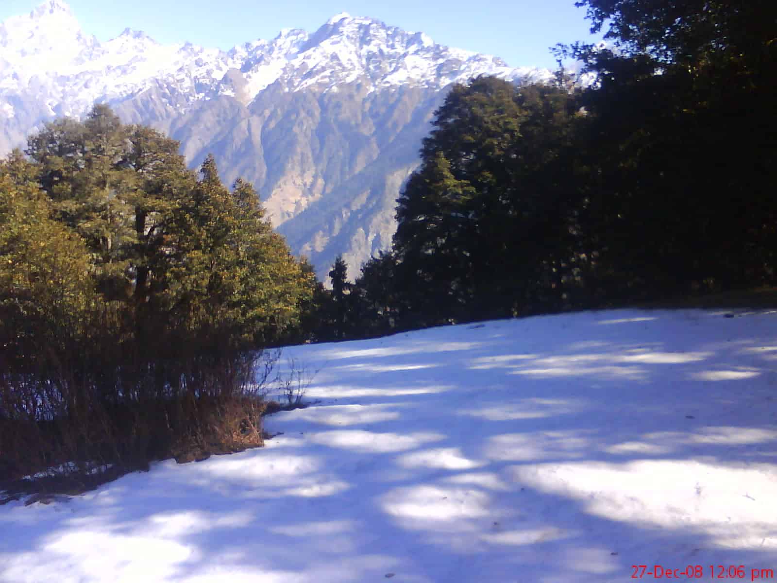
Why Is Kuari Pass Called the Curzon Trail?
Quick answer: The route is named after Lord Curzon, Viceroy of India in the early 1900s, who is said to have travelled a section of this trail. The name stuck, and most operators still market the trek as the Curzon Trail even though the modern 4 day route is much shorter than the original crossing.
Keep in mind that the historical Curzon Trail was a long traverse across Garhwal, not the compact out-and-back people walk today. “Kuari” means doorway, which describes what the pass does. It opens a gap in the ridge separating the Joshimath side from the inner Garhwal ranges.
The reason it has stayed popular for over a century is simple geography. The pass sits on the outer rim of the Nanda Devi sanctuary, close enough that the big peaks fill the horizon, but low enough that someone with average fitness can walk there. Most viewpoints this good in the Himalayas cost you a week and a lot of suffering.
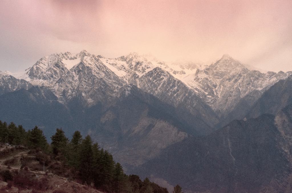
On a clear morning the list of peaks from the pass and the ridge above it typically includes Nanda Devi at 7,816 m, Dronagiri, Kamet, Chaukhamba, Trishul, Hathi Ghoda Parvat and Neelkanth. Nanda Devi is the one people come for. It is the highest mountain located entirely within India, and its inner sanctuary has been closed to visitors for decades, which is part of why seeing it from a legal, accessible ridge feels like such a big deal.
How High Is Kuari Pass, and Why Do Sources Disagree?
Quick answer: Most reliable sources put Kuari Pass at roughly 12,500 ft, or about 3,810 m. You will however see figures anywhere from 12,000 ft to 12,750 ft quoted by different operators, because they measure different points on the ridge and some quote the viewpoint above the pass rather than the pass itself.
I am flagging this because it confuses a lot of people. Here is what you run into when comparing operator pages.
| Figure you will see | What it usually refers to |
|---|---|
| 12,000 ft / 3,650 m | A rounded-down figure, often the pass itself measured conservatively |
| 12,516 ft | The most commonly repeated number for the pass |
| 12,716 ft / 12,750 ft | Usually the higher viewpoint on the ridge above the pass |
| Above 13,000 ft | Almost always the Pangarchulla add-on summit, a separate and much harder objective |
Does the difference matter? For your lungs, not much. Anything in this band is a moderate altitude where most reasonably healthy people do fine with a sensible ascent profile. Where it does matter is booking. If an operator is quoting you 13,000 ft plus, ask specifically whether the itinerary includes Pangarchulla, because that changes the difficulty grade completely and it is not a beginner objective. Hence, always ask what the highest point of your specific itinerary is, in writing.
What Does the Kuari Pass Route Look Like Day by Day?
Quick answer: The standard route runs Dhak village to Gulling or Chitrakantha, then to Khullara, then a summit day to Kuari Pass and back down. Most operators run it as 4 walking days bookended by two long road days from Rishikesh or Dehradun.
| Day | Section | Notes |
|---|---|---|
| 1 | Rishikesh or Dehradun to Joshimath | Full driving day, 9 to 11 hours along the Badrinath highway |
| 2 | Drive to Dhak, trek to Gulling or Chitrakantha | Short walking day through oak and rhododendron forest |
| 3 | Gulling to Khullara | Forest opens into meadows, first big views appear |
| 4 | Khullara to Kuari Pass and back to Khullara or Tali | Summit day, early start, longest day on the trek |
| 5 | Descend to Dhak, drive to Joshimath | Mostly downhill, hard on the knees in snow |
| 6 | Joshimath to Rishikesh or Dehradun | Full driving day out |
Campsite names vary between operators, and this is the biggest source of confusion when comparing itineraries. Gulling and Chitrakantha are used almost interchangeably. Tali is sometimes a camp and sometimes a lunch stop. Some operators approach from Karchi village instead of Dhak, which shifts the round trip distance by a few kilometres. It is just how the trail has developed.


What I would watch instead is the number of nights above roughly 10,000 ft. Two nights is comfortable. One makes the summit day noticeably harder. In case an operator offers a compressed 3 day version, skip it. You save one leave day and give up most of the acclimatisation.
When Is the Best Time to Do the Kuari Pass Trek?
Quick answer: Late December to February gives you the deep snow that Kuari Pass is famous for. March to June and September to November give you clearer long-range views, easier walking and green meadows. Avoid July and August, when the monsoon makes the approach road genuinely risky.
![How to safely carry luggage or extra fuel on Spiti or Ladakh Bike Ride? [10 Safety Tips]](https://discoverwithdheeraj.com/yt_vid_thumbs/ladakh/87.png)
This is one of the few Himalayan treks genuinely worth doing in more than one season.
- Late December to February. Snow on the upper sections, cold nights well below freezing, and the classic winter trek experience. This is peak season and also peak crowd season around New Year. Snow depth varies year to year, so nobody can promise you a specific amount.
- March to June. Snow melting off, rhododendrons flowering lower down, comfortable daytime walking. Good if you want the views without the cold.
- July and August. Skip it. The problem is not the trek, it is the Rishikesh to Joshimath road, which is prone to landslides during heavy monsoon rain.
- September to November. My personal pick if you care most about seeing Nanda Devi clearly. Post-monsoon air is the cleanest of the year and the long-range visibility is excellent.
Before booking winter dates, it is worth checking the current forecast on the India Meteorological Department site. Heavy snowfall spells can close the higher sections temporarily, and a good operator will reroute rather than push through.
How Difficult Is the Kuari Pass Trek, Really?
Quick answer: Kuari Pass is graded easy to moderate and is a legitimate first Himalayan trek for a reasonably fit person. In winter the grade effectively rises because of snow, cold and shorter daylight, so a December ascent is meaningfully harder than the same route in October.
The walking days are short by Himalayan standards, often 5 to 7 km. What makes people struggle is not distance, it is continuous gradient, altitude and, in winter, walking in snow with a pack. Snow roughly doubles the effort of any given stretch.
My fitness suggestion is the same one I give for any moderate Himalayan route. Start six weeks out, build to a comfortable 5 km jog in around 35 minutes, and add stair or incline work, because that mimics the trail. Manage that and you will enjoy Kuari Pass rather than endure it.
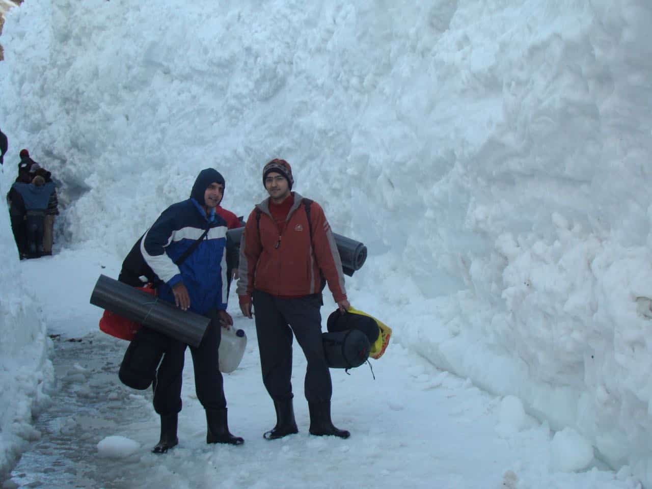
Keep in mind that the descent is where most injuries happen. Coming down from Khullara to Dhak on packed snow is hard on the knees, and this is exactly where people who saved money by skipping microspikes end up regretting it. If you are new to trekking in the mountains, our guide on what to carry on a trip covers the packing side in detail.
How Much Does the Kuari Pass Trek Cost in 2026?
Quick answer: Operator trek fees for the Dhak to Dhak portion run roughly Rs 7,000 to Rs 11,000 per person. Adding travel from Delhi, gear rental and buffer, a realistic all-in budget is about Rs 11,000 to Rs 27,000 per person depending on how you travel.
| Item | Budget | Comfort |
|---|---|---|
| Delhi to Rishikesh or Haridwar | Rs 400 to 700 (bus) | Rs 1,200 to 2,000 (AC / train) |
| Rishikesh to Joshimath return | Rs 1,200 to 1,800 (shared) | Rs 3,500 to 5,000 (shared taxi) |
| Operator trek fee, Dhak to Dhak | Rs 7,000 to 8,500 | Rs 9,000 to 11,000 |
| Gear rental (jacket, spikes, poles) | Rs 500 to 1,000 | Rs 1,500 to 2,500 |
| Hotel night in Joshimath | Rs 800 to 1,500 | Rs 2,000 to 3,500 |
| Food off-trek and buffer | Rs 1,000 to 1,500 | Rs 2,000 to 3,000 |
| Approximate total | Rs 11,000 to 15,000 | Rs 19,000 to 27,000 |
These figures come from operator listings and transport rates checked in September 2026, and they move around. Treat them as a planning range, not a quotation. Rates in the hills have a habit of going up my friend, especially around the New Year window.
Two things genuinely reduce cost. Travel in a group of four, because taxi and room costs divide neatly. As I always say, four is the magic number for budget mountain trips. And rent heavy gear in Joshimath rather than buying it in the city for a single trek.
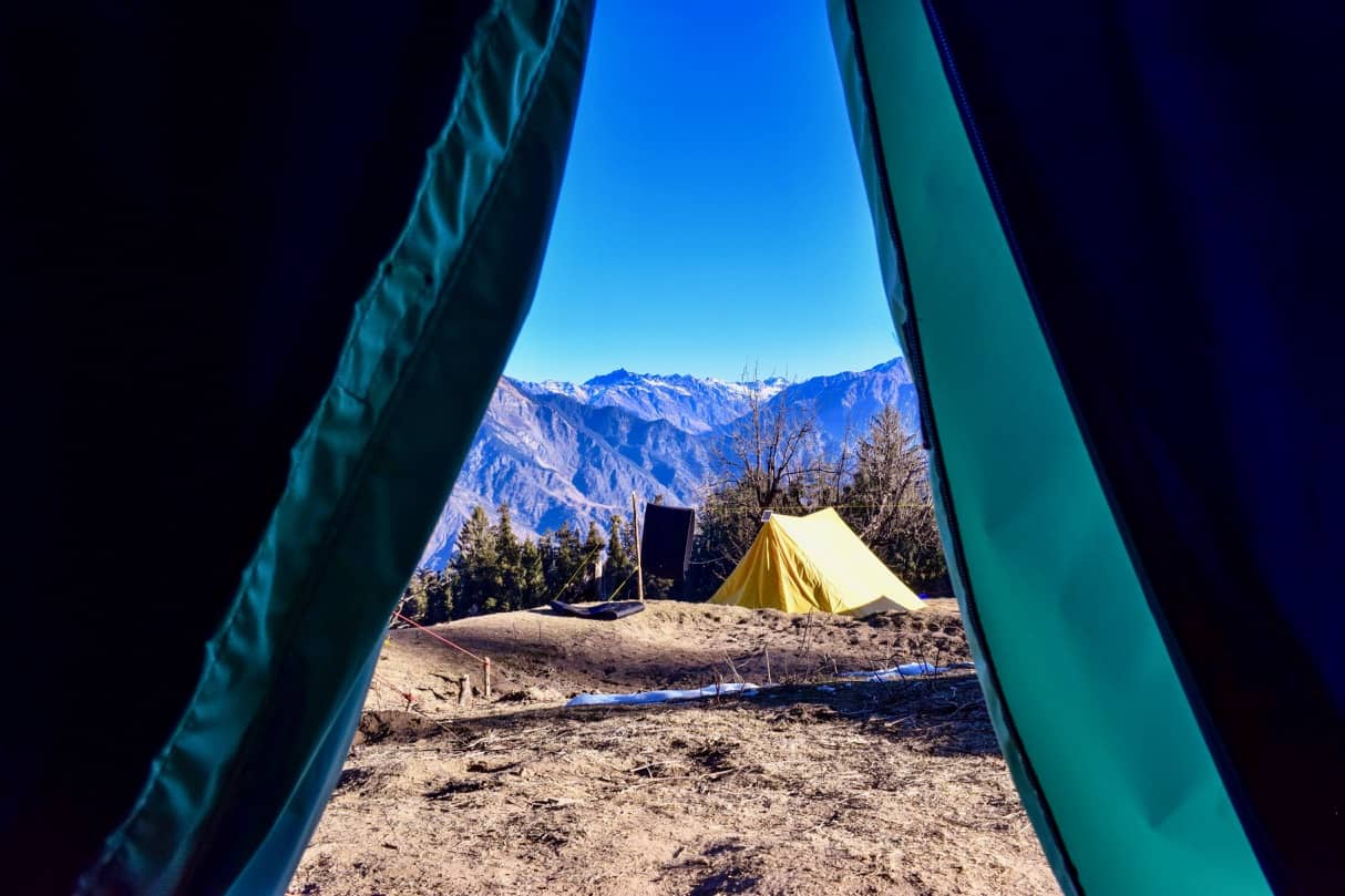
Kuari Pass vs Brahmatal vs Kedarkantha: Which Should You Pick?
Quick answer: Pick Kuari Pass for the best mountain views, especially Nanda Devi. Pick Brahmatal if you want the gentlest introduction with a frozen lake. Pick Kedarkantha if you want a proper summit feeling and do not mind crowds.
These three compete for the same December to February booking, and people agonise over the choice more than they need to. Here is how I separate them.
| Kuari Pass | Brahmatal | Kedarkantha | |
|---|---|---|---|
| Base village | Dhak, near Joshimath | Lohajung | Sankri |
| Highest point | Approx 12,500 ft | Approx 12,250 ft | Approx 12,500 ft |
| Grade | Easy to moderate | Easy to moderate | Easy to moderate |
| Best for | Big peak views, Nanda Devi | Gentlest option, frozen lake | Summit feeling, first-timers |
| Crowds | Moderate | Moderate | Heavy in peak winter |
| Signature sight | Nanda Devi from the ridge | Trishul and Nanda Ghunti | 360 degree summit panorama |
If your priority is photographs of named 7,000 m peaks, Kuari Pass wins and it is not particularly close. If your priority is the lowest possible chance of a bad time on your first trek, our complete Brahmatal trek guide makes the case for that route. And if you want a wider comparison set, we have covered easy treks in Uttarakhand for beginners and easy winter treks across Uttarakhand and Himachal in detail.
How Do You Reach the Kuari Pass Trailhead?
Quick answer: Reach Joshimath first, which is about 250 to 260 km and 9 to 11 hours from Rishikesh along the Badrinath highway. From Joshimath, Dhak village is a short drive of roughly 12 to 14 km, and that is where the walking starts.
- By road. Delhi to Rishikesh is about 230 km, then Rishikesh to Joshimath via Devprayag, Rudraprayag, Karnaprayag and Chamoli on NH-7. Buses from Rishikesh to Joshimath generally leave early morning, so plan a night in Rishikesh.
- By train. Haridwar and Rishikesh are the practical railheads, roughly 270 to 290 km short of Joshimath.
- By air. Jolly Grant airport at Dehradun is the nearest, about 280 km from Joshimath, followed by a long road transfer.
Now for the part that most Kuari Pass articles still get wrong, and it matters if you are planning to combine the trek with Auli. The Joshimath to Auli ropeway has been closed since January 2023, after subsidence was detected near one of its lower towers during the Joshimath land subsidence crisis. It has not reopened. A replacement project has been proposed at a reported cost of around Rs 480 crore, with a first phase from Joshimath to Auli and a second phase continuing from Auli up to Gorson, but there is no confirmed operational date.

Hence, if you are adding an Auli stay to your trek, budget for the 16 km road journey from Joshimath instead of the 25 minute cable car that older guides describe. In heavy snow that road can be slow or temporarily blocked. Our full Auli travel guide covers the destination side, and Malari village is worth a look if you want somewhere genuinely offbeat near Joshimath.
On permits, Kuari Pass lies in forest land within the wider Nanda Devi Biosphere Reserve region, and forest permission is required. In practice your operator arranges this and it is bundled into the trek fee. Independent trekkers should check directly with the forest division office in Joshimath, and carry government photo ID for everyone in the group. I am deliberately not quoting a fee here, because published permit rates for this area are inconsistent and I would rather you verify locally than budget from a wrong number.
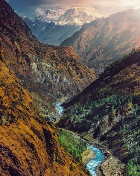
Is Joshimath Safe to Visit After the Subsidence?
Quick answer: Tourism through Joshimath has continued and the town functions as a transit base, but the subsidence issue is real and ongoing. The affected zone is concentrated in parts of the lower town, not on the trekking routes above it. Check current advisories before you travel.
I want to be measured here rather than alarming. Joshimath developed significant cracks in early 2023, families were relocated from unsafe buildings, and the town remains under geological monitoring. It still serves as the gateway for Badrinath, Hemkund Sahib and Auli, and trekking operations from Dhak have carried on.
My suggestion: treat Joshimath as a transit stop rather than a base for a long stay, prefer newer accommodation on the upper side of town, and check the Uttarakhand Tourism site for advisories close to your travel date. The subsidence should inform how you plan, not stop you from going.
What Safety Precautions Does This Trek Need?
Quick answer: The main risks are cold injury, slips on frozen descents and mild altitude sickness. At about 12,500 ft, AMS is possible but usually manageable. Carry microspikes in winter, layer properly, and never let a summit day start late.
- Altitude. Kuari Pass is not extreme altitude, but headaches and poor sleep at Khullara are common. Our detailed guide on preventing acute mountain sickness applies directly here.
- Traction. Microspikes are the single most useful thing you can carry in December to February. Most operators rent them, but confirm in advance rather than assuming.
- Cold. Night temperatures at the higher camps drop well below freezing in peak winter. A sleeping bag rated for genuine sub-zero use matters more than an expensive jacket.
- Daylight. Winter days are short. Summit day should start before sunrise so you are off the exposed ridge well before the afternoon.
- Connectivity. Mobile network is patchy to absent above Dhak. Tell someone your itinerary before you lose signal.
Related Reading
- Auli Travel Guide 2026, the destination side near the trailhead
- Brahmatal Trek 2026, the closest alternative winter trek in Chamoli
- Roopkund Trek, with the camping ban update
- Tungnath and Chandrashilla, a shorter Garhwal trek with big views
- Valley of Flowers 2026, the other big Chamoli trek from the Joshimath side
- Gwaldam, an offbeat Garhwal and Kumaon crossover base
Frequently Asked Questions
Is the Kuari Pass trek suitable for beginners?
Yes. Kuari Pass is graded easy to moderate and is one of the standard recommendations for a first Himalayan trek. Walking days are short, usually 5 to 7 km. In peak winter the snow makes it harder, so a first-timer choosing December or January should train properly and carry microspikes.
Can you actually see Nanda Devi from Kuari Pass?
Yes, and it is the main reason people choose this trek. On a clear day the pass and the ridge above it give direct views of Nanda Devi at 7,816 m, along with Dronagiri, Kamet, Chaukhamba, Trishul and Hathi Ghoda Parvat. Post-monsoon months from September to November usually offer the clearest long-range visibility.
How many days does the Kuari Pass trek take?
The walking portion takes about 4 days from Dhak village. Including the two long road days from Rishikesh or Dehradun, most operator packages run 5 to 6 days in total. Compressed 3 day versions exist but they cut acclimatisation and are not recommended.
What is the best time for the Kuari Pass trek?
Late December to February for snow, which is what the trek is best known for. March to June and September to November are also excellent, with easier walking and clearer views. Avoid July and August because monsoon landslides affect the Rishikesh to Joshimath road.
How much does the Kuari Pass trek cost in 2026?
Operator fees for the Dhak to Dhak portion are approximately Rs 7,000 to Rs 11,000 per person. A realistic all-in budget from Delhi, including transport, gear rental and accommodation, works out to roughly Rs 11,000 to Rs 27,000 per person depending on whether you travel budget or comfort. Verify current rates before booking.
Is the Joshimath to Auli ropeway working in 2026?
No. The Joshimath to Auli ropeway has been closed since January 2023 following subsidence near one of its lower towers, and it has not reopened. A replacement project has been proposed at a reported cost of around Rs 480 crore, but no operational date is confirmed. Reach Auli by the 16 km road from Joshimath instead.
Do you need a permit for the Kuari Pass trek?
Yes, forest permission is required as the route lies in forest land in the wider Nanda Devi Biosphere Reserve region. Registered operators normally arrange it within the trek fee. Independent trekkers should check with the forest division office in Joshimath and carry government photo ID for every member of the group.
Kuari Pass or Brahmatal, which is better for a first winter trek?
Choose Kuari Pass if mountain views are your priority, because the Nanda Devi panorama is better. Choose Brahmatal if you want the gentlest possible introduction, since it is slightly lower at about 12,250 ft and centres on a frozen lake. Both are graded easy to moderate and both hold snow from late December to February.
How high is Kuari Pass?
Kuari Pass is most commonly cited at about 12,500 ft, roughly 3,810 m. You will see figures from 12,000 ft to 12,750 ft because operators measure different points, and anything quoted above 13,000 ft usually refers to the separate Pangarchulla summit, which is a much harder objective.
Wrapping Up
If you want one Himalayan trek that gives a beginner a genuinely world-class view without demanding a mountaineer’s fitness, Kuari Pass is very hard to beat. Four walking days, short daily distances, an easy to moderate grade, and Nanda Devi standing in front of you at the top of it.
My honest recommendation, if you are flexible on dates, is to go in October rather than January. You lose the deep snow but you gain the clearest views of the year and a much gentler introduction to Himalayan trekking. If snow is the whole point for you, then go mid-January, carry microspikes, and add a buffer day for weather. Either way, book with an operator who will tell you in writing what the highest point of your itinerary is, and plan the Auli leg around the road rather than the ropeway.
For trip discussions, queries, or finding travel partners, do join the DwD Community. If you have any questions, feel free to ask in the comments section below 🙂
Last verified: September 2026
