
The Old Silk Route in East Sikkim is one of those places in India that genuinely surprised me. Most people planning a trip to Sikkim focus on Gangtok and North Sikkim, and this region gets overlooked. That is a mistake. From the foothills at Rongli to the high-altitude Nathang Valley at 13,500 ft, this circuit packs history, stunning landscapes, and a quiet solitude that is hard to find anywhere else in the northeast. In this guide, I will share everything you need to plan your trip here, whether you are coming from Siliguri, Gangtok, or anywhere else.
Let's quickly dive into the details:
What Is the History Behind the Old Silk Route in Sikkim?
The Old Silk Route through East Sikkim was part of the ancient trade network that connected Lhasa in Tibet to the port of Tamralipta (present-day Tamluk in West Bengal, where the Haldia Port now stands). The distance between Lhasa and Tamluk was roughly 900 km. Traders and their horse caravans crossed from the Chumbi Valley in Tibet, through Nathu La and Jelep La passes, and descended through the hills of East Sikkim before reaching the plains of Bengal.
This trade circuit was an offshoot of the larger historical Silk Route that connected China to Europe. Chinese silk was the primary luxury commodity, hence the name. However, the caravans carried far more than goods. Knowledge, ideas, religion, and cultural exchanges traveled along these paths for centuries, predating any modern form of communication.
In modern times, this route is no longer traversable in its entirety due to international borders. The Indian portion, however, from Rongli up to Nathu La, is open for travelers. And what a rewarding stretch it is.
Why Should You Travel the Old Silk Route in East Sikkim?
The region is spectacular and remarkably thrilling, beyond all the history it carries. This part of East Sikkim is slowly getting the recognition it deserves on the otherwise popular tourism scene of Sikkim. It remains thankfully offbeat owing to the absence of any major towns en route. The road condition is excellent, maintained by BRO as a strategically important route for army supply lines to forward bases at the international border with China.
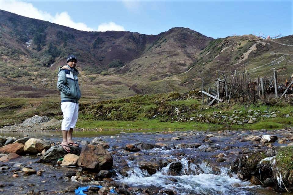
The trail climbs from about 5,000 ft at Rongli to 14,500 ft at Nathu La over roughly 70 km, passing through lush greenery at its beginning, then glacial lakes and icy mountain passes higher up. Mountain streams, military camps, small villages, waterfalls, and viewpoints line the route. The landscapes here are genuinely extraordinary.
As I discussed in my Gangtok and Nathu La guide, this route connects with the Tsongo-Nathu La road from Gangtok. So technically, you can travel the Old Silk Route from both ends. If you prefer to travel the route without Gangtok, or if the upper stretch is snowed out during winter, you can start and end from Rongli, traversing the same road up and down. Sillery and Icchey, which I covered in an earlier article, can also serve as starting or ending points since they are quite close to Rongli.
Settlements are sparse en route. Apart from places at the foothills near Rongli like Pedong and Aritar, which have a couple of resorts, only basic homestay accommodations are available along the circuit.
What Are the Key Places to Visit on the Silk Route?
Whether you travel from Rongli upward or descend from the Gangtok side, the route will reward you equally. Here is a place-by-place breakdown of the entire circuit.
Rongli
A small yet important town in East Sikkim. This is the first and last settlement on the route that can actually be called a town. Set amidst greenery with the river Rongpo flowing by, Rongli can be your first stopover on Day 1 coming from Siliguri or NJP.
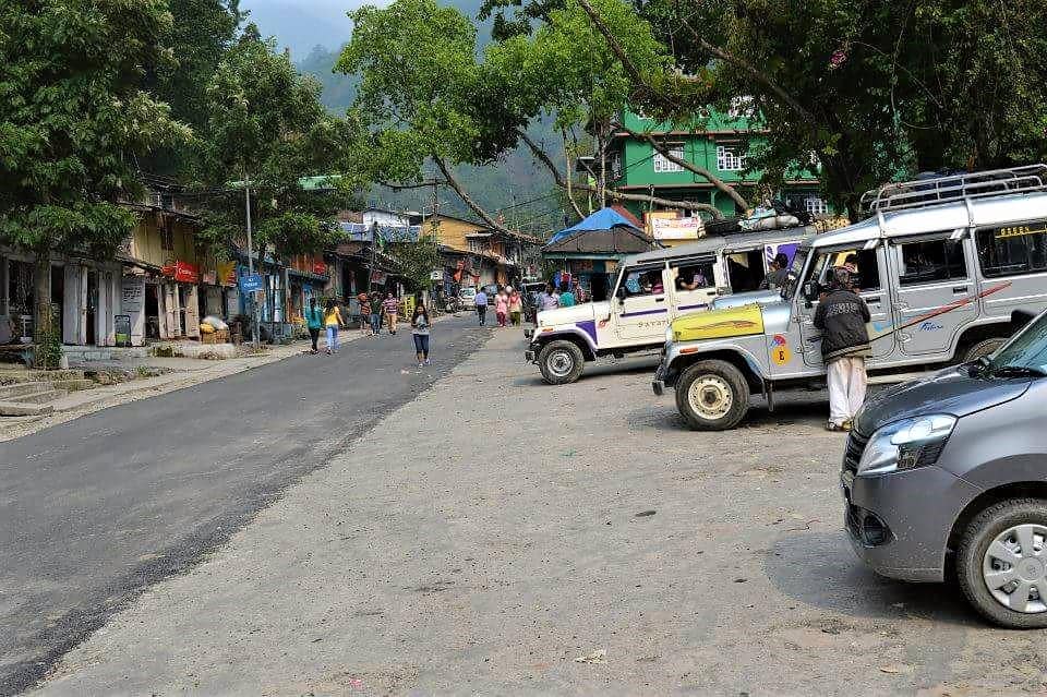
Rongli is also where you must obtain the mandatory Protected Area Permit (PAP) from the SDPO office to travel further on the Silk Route. Many nature trails lead out of Rongli, through forest paths and by the river. Being a sub-divisional headquarter, Rongli has a police station, ATMs, provision stores, medical facilities, and liquor shops. North of here, these facilities gradually disappear, so stock up on cash and essentials before heading out.
Reshikhola
About 20 km south of Rongli, at a modest altitude of around 2,000 ft, Reshikhola is slowly becoming a popular eco-tourism spot. Technically on the edge of West Bengal, where the river Reshi marks the border with Sikkim, surrounded by evergreen forests and a charming khola (small rivulet in Nepali), this place was first conceptualized as an eco-tourism destination by a local gentleman named Mr. Sebastian Pradhan about two decades ago.
Much of what the Old Silk Route has become from a tourism perspective can be attributed to the effort and farsightedness of this man. He convinced locals to start homestays in various villages along the circuit. There are now about 5 resorts in Reshikhola including his Eco Prakriti, which is the oldest. The resorts are generally wooden cottages by the river stream. Activities include bonfires by the river bed, angling, taking a dip in the cold water, and walks inside the surrounding forests. Reshikhola is one of the most popular starting points for the Old Silk Route, thanks to its proximity to Rongli and its beautiful location among nothing but a gentle river, greenery, and silence.
Aritar, Lampokhari and Mankhim
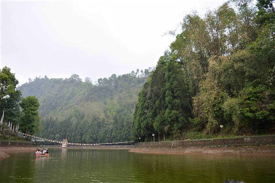
Aritar, at around 4,000 ft and 20 km from Rongli, is another popular starting or ending point. This is a slight detour from the actual Old Silk Route. What makes it worth a visit is Lampokhari (an artificial lake with boating facilities, probably the only one in Sikkim), a British-era Dak Bungalow inside a forest where tourists can stay, and a hilltop viewpoint offering a clear sight of Mt. Kanchenjunga on a good morning.
The lake, Lampokhari (Pokhari in Nepali means small lake or pond), was originally a natural lake, later reconstructed to facilitate paddle-boating. There is also an upscale resort nearby called Lampokhari Village Resort.
Around 3 km and 2,000 ft uphill from the lake, through a forested trail, is Mankhim Top. En route, the Aritar Dak Bungalow is situated, a heritage structure with a colonial past. Mankhim is a small village atop the hill, inhabited by the Rai ethnic group of Nepali lineage. There is a temple at the pinnacle with a tastefully built viewpoint beside it. From here, a cemented footpath descends through the forests and ends at the lake. The specialty of this place is the absence of any taller mountain nearby, which grants Mankhim a commanding 360-degree view. I personally recommend the Kanchenjunga Mirror Homestay, run by a warm Rai family, located just 20 steps below the temple. The view from the bed itself is extraordinary.
All the places discussed till now are before Rongli, so no permits are required to visit them. These places are generally used as a stopover for the first or last night of the Old Silk Route trip. That said, they have tremendous tourism potential by themselves.
What Is the Journey Like Beyond Rongli?
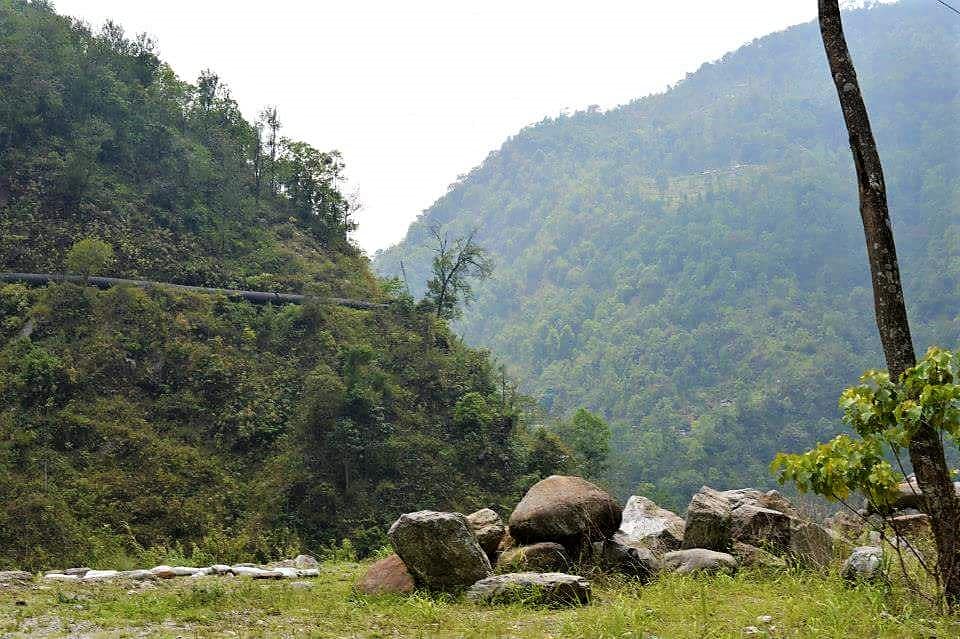
Once the necessary permits are obtained from Rongli, the actual fun begins. The smooth tarmac is a pleasure for those driving their own vehicles. Take a moment to consider that centuries ago, caravans of horses commuted these same paths with items of trade. Beyond articles of business, cross-cultural wisdom, the spread of Buddhism, and inter-regional exchanges of humanity took place here for hundreds of years.
Lingtam
Shortly after getting started from Rongli, Lingtam is where permits are checked. The names of travelers are registered to keep track until you exit the region from either the Gangtok side or back here. A few homestays have come up here in recent years. There is a small park by the road beside the river with big rocks scattered around, a nice spot for a quick break.


Padamchen or Phadamchen
Around 15 km up from Rongli at roughly 8,000 ft, Padamchen is all about greenery and solitude. The place offers sweeping views of the adjoining valleys with Himalayan evergreen forests, a pleasant climate year-round, untouched walking trails inside the forests, and if you are lucky, sightings of rare species like the Himalayan Black Bear, Red Panda, and Steppe Eagles.
There is a wooden Forest Rest House dating back to the colonial era where tourists can stay, along with several homestays that have come up recently.
Related Reading: Dzongu, the Little Known Paradise of the Lepchas

Zuluk or Dzuluk
Probably the most popular place on the entire Silk Route. Zuluk sits at about 10,000 ft, roughly 10 km up from Padamchen through thrilling hairpin bends. Until recently, it was just a roadside Himalayan bustee of about 100 houses. A local named Mr. Gopal Pradhan started the first homestay, Dilmaya Retreat, on the insistence of Mr. Sebastian Pradhan of Reshikhola. Together, they pulled this circuit out of oblivion and into public access. At least 6-7 homestays exist now in Zuluk, some with better facilities than Dilmaya.
Zuluk is also known for its spring bloom of rhododendrons, which paint the treeless slopes in vivid hues of red and purple. The mornings here are stunning. When the sun rises from the horizon and the valleys below are engulfed in clouds, you get a sensational scene of sunrise above the white mist.
In winter, Zuluk experiences heavy snowfall which carpets the slopes and roads in white. There is a large army base here as well. Apart from the Sikkim hills, a portion of Bhutan in the east can also be seen from Zuluk.
The Viewpoints: Ganek, Thambi and Lungthung
Zuluk, despite its elevation, does not offer a clear view of the Kanchenjunga Range and the Trans-Himalaya. Three strategic viewpoints nearby are popular for that, especially for sunrise, as it generally gets foggy in the afternoon.
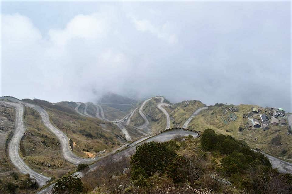
Just 6 km from Zuluk is Ganek, more popular for the view of the Zuluk Loops. Around 30 hairpin bends are visible on a clear day.
Thambi Viewpoint at 11,600 ft is particularly famous for the sunrise over Kanchenjunga, while also offering a view of the loops that look like a serpent draped over a mountain ridge. Carry binoculars.
Lungthung, 16 km from Zuluk through about 32 hairpin bends at around 12,000 ft, is in my opinion the best of the three. The entire panorama of Kanchenjunga is visible from here in direct line of sight. Start early from Zuluk if you want to catch the sunrise.
As the eastern night sky starts to bleed the first light before the sun actually rises, while the billion stars are still twinkling, the morning star the brightest, keep peeping westward. While everything is still pitch dark, suddenly at a moment of miracle, the summit of Kanchenjunga, invisible till then, will bloom up in vivid red. Gradually, the victory of light over darkness unfolds, as if ceremoniously celebrated by nature itself. The hues on the great Kanchenjunga change from red to pink, then gold to silver. The eastern horizon brightens spectacularly, vanishing the stars, revealing a sea of clouds underneath your feet.
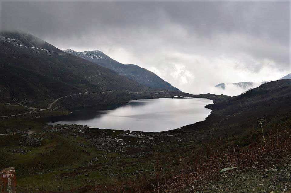
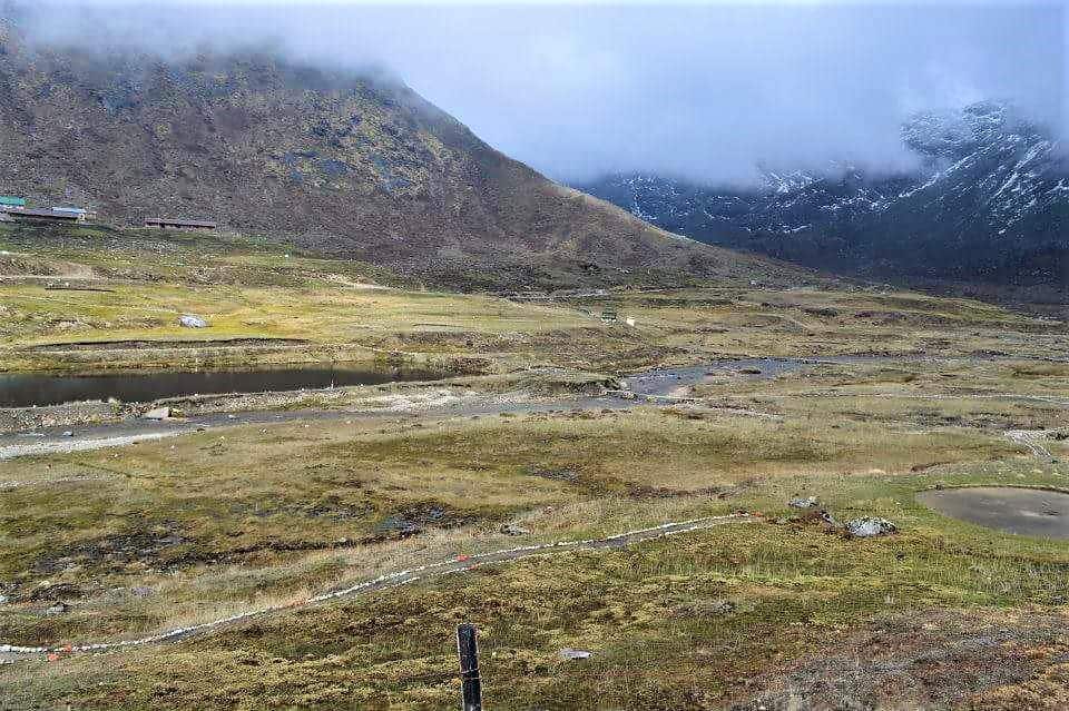
Nathang or Gnathang Valley
The highlight of the entire Silk Route. Nathang Valley at 13,500 ft is magnificent. Originally inhabited by Tibetan yak herders, this valley is gaining popularity for its pristine landscapes. Sometimes called the “Ladakh of the East,” and it genuinely has similarities: a flat grassy valley interspersed by winding streams of glacial melt, surrounded by barren mountains. It witnesses a riot of colors during the rhododendron blooming season between June and September. Unlike other places on the Silk Route, this small village of about 50 modest wooden houses is inhabited by people of Tibetan origin.
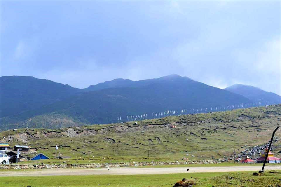
The valley changes its character constantly. From thick fog where visibility drops to less than a meter, to brilliant sunshine in the mornings. Around 5 homestays take guests now (Rs 900-1,500 per person per night with meals, as of 2026), some in traditional wooden houses. The altitude makes it quite chilly at night, and if it is windy, it can get unbearable. There is a temple on a hilltop in the village. Be cautious before exerting yourself on the steps at this altitude, but if you make it to the top, the view of the entire village and extended valley will stay with you. Prayer flags adorn every corner.
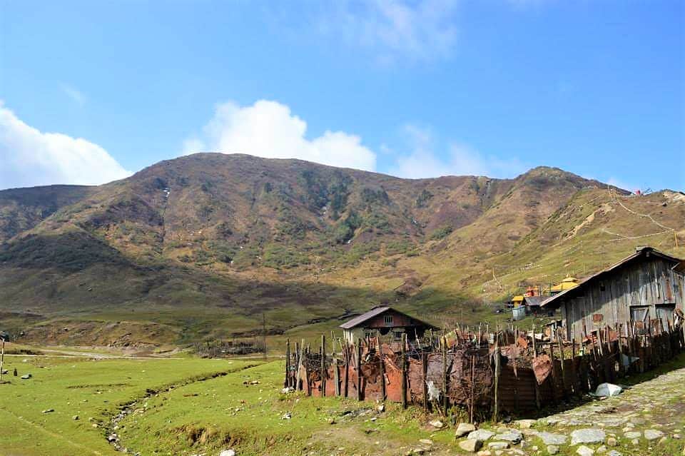
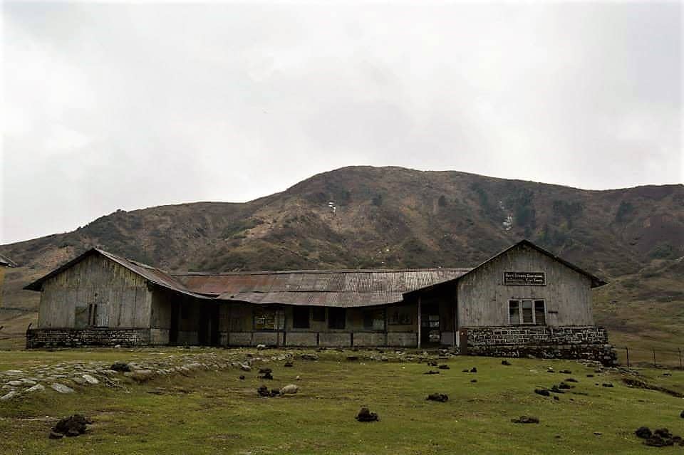
There is a wooden high school in the village, remarkable given its remoteness. The village gets intermittently inaccessible in winters under thick blankets of snow. The surrounding slopes are being considered for winter sports by the Sikkim government. Apart from homestays, an old Dafter Bungalow has been renovated for accommodation. After Thangu in North Sikkim, Nathang Valley is the second highest place in Sikkim where tourists can stay. Keep in mind, spending a night at 13,500 ft requires proper acclimatization.
Eagle’s Nest Bunker
This place is elusive. Very few people know where it actually is. Even locals of Nathang Valley and army officers posted there could not tell us about it. It is definitely somewhere within a 5 km radius of Nathang Valley on the main road. A friend of mine managed to locate it and witnessed a sunrise that left him, in his words, “spellbound.”
It is an old army bunker atop a hill. A short uphill walk from the road takes you there. The walls have bullet marks from the 1962 Sino-Indian war. The location is perfectly strategic, offering a 360-degree unhindered view. At sunrise, the bunker floats above a sea of clouds, with views of the Kanchenjunga massifs, the plains of Tibet where the Brahmaputra (known as Tsangpo in China) can be seen like a winding stream of gold, peaks of the Tibetan Plateau, western Bhutan, the Terai plains of Bengal, and even the hill town of Darjeeling in the distance. Truly one of the most remarkable sunrise points in all of Sikkim.
Related Reading: Guide to Gurudongmar Lake and Chopta Valley
Kupup Lake
On a clear day, if a lake manifests emerald blue hues and appears in the shape of an elephant, it will be Kupup Lake. At the center of a glorious adjoining valley, the small village of Kupup, with a sparse population and a police check post, sits on the banks. Locally called Bitan Cho, the lake is also referred to as Elephant Lake (or Hati Lake) due to its shape as seen from above.
Memencho Lake
Memencho Lake is another gorgeous high-altitude lake close to Kupup. Unlike Bitan Cho, this lake is surrounded by straight-standing conifers on all sides, making it especially alluring after a fresh snowfall when the trees wear a layer of white. The lake cannot be accessed directly by car. A downward trek of about 4 km through a winding road is required. There is a viewpoint at the banks. A few years back, accommodation in an inspection bungalow was attempted beside it but could not be sustained due to the harsh climate. Fed by melts from the Jelep La mountains just above, the lake is known for changing colors with shifting light conditions throughout the day.
Tukla Valley
About 15 km from Kupup, an untouched valley remains relatively unknown due to its proximity to the international border. Tukla Valley, an extension of the lower Tibetan Plateau, sits at 13,000 ft. Vast and flat, with the Trans-Himalayan mountains watching over it, Tukla has the potential to become what Yumthang has managed in North Sikkim. Only a small part of the valley is accessible to civilians toward its eastern end. The valley turns red during blooming season with rare orchids and rhododendrons. The access to Jelep La (out of bounds for civilians) passes through here. A memorial for lives lost during Colonel Younghusband’s 1904 British expedition to Lhasa through Jelep La still stands in Tukla.
A fascinating landmark here is an 18-hole golf course that holds a place in the Guinness Book of World Records as one of the highest in the world at 13,025 ft. Called the Yak Golf Course, senior golfers are transported across the fields on yaks. The course spreads across natural streams, and tournaments like the Kalimpong Cup have been held here.
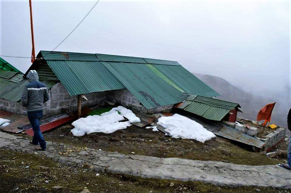
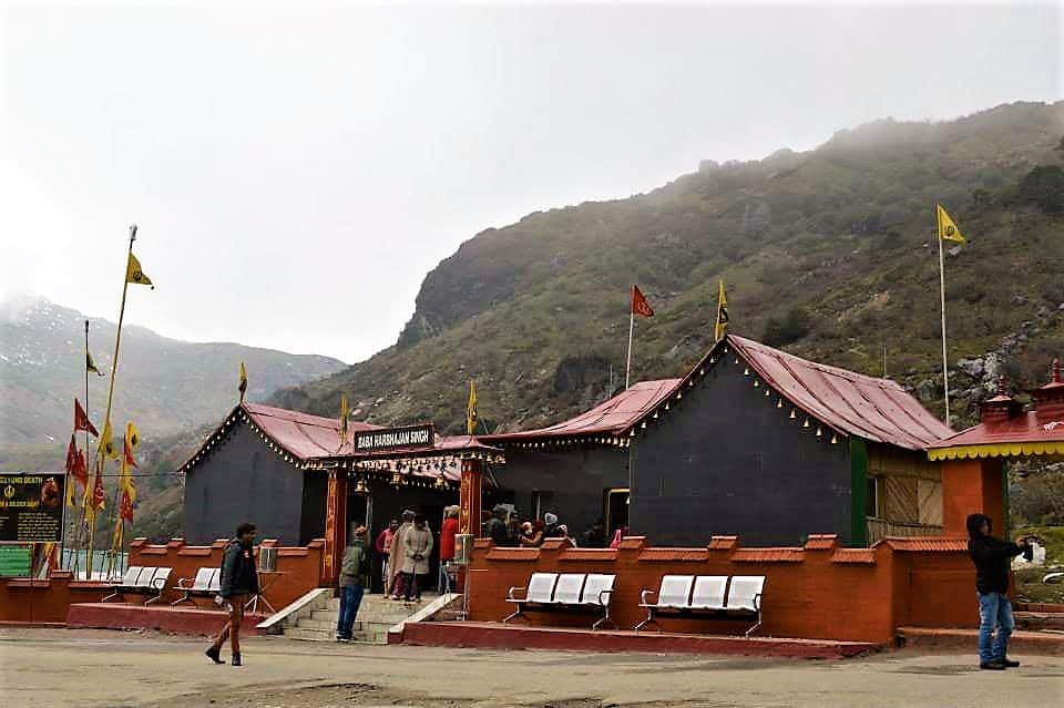
Old Baba Mandir or Baba’s Bunker
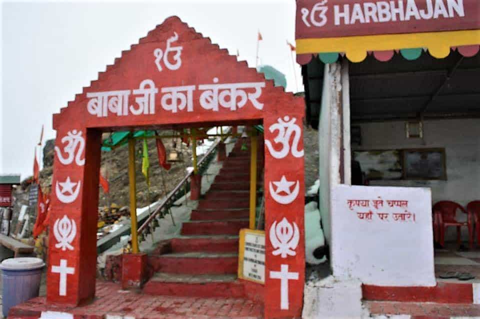
The new Baba Mandir, which is a standard part of the Changu-Nathu La day trip out of Gangtok, is a newer structure built in honor of Baba Harbhajan Singh. The actual bunker where Baba resided falls on the Old Silk Route. It is maintained with pure devotion by the jawans of whichever regiment serves here.
You can go inside the bunker and see Baba’s bed, shoes, and other personal articles. Many stories surround this place. The bed is neatly draped every day and found crumpled every morning, as if someone has slept on it. The shoes are found mud-laden after being polished. What struck me most was the conviction in the eyes of the soldiers narrating these stories. The trekking trail for Memencho Lake starts opposite the road from here. The backyard of the bunker is cordoned off, said to be strewn with landmines laid during the 1962 war in anticipation of a Chinese invasion that never happened, attributed by the soldiers to “blessings of Baba.” Baba’s favorite dry fruits are served as prasad to every visitor.
About 10 km from here is the new Baba Mandir, and shortly after that, the Silk Route merges with the conventional road toward Nathu La from Gangtok.
When Is the Best Time to Visit the Old Silk Route?
The best time to visit the Old Silk Route is mid-April to mid-June and October to November, avoiding the monsoon months. Spring (April-May) brings the spectacular rhododendron bloom that paints the slopes in vivid reds and purples. Autumn (October-November) offers clear skies and the best Kanchenjunga views.

Winters are generally harsh with the risk of roads getting blocked due to snowfall. However, BRO clears this route with priority. Gnathang Valley and Zuluk are becoming increasingly popular as winter destinations for witnessing snowfall and clearer mountain views. In case you plan a winter trip, be prepared for temperatures dropping well below freezing at Nathang Valley and roads potentially closing without notice.
Where to Stay and Eat on the Silk Route?
Apart from the foothills, all staying options along the circuit are homestays. You can expect clean rooms with attached western toilets in almost all of them. Some offer TVs and room heaters. Rates range from Rs 900 to Rs 2,500 per person per night including meals (as of 2026), varying with the place, season, group size, and your negotiation skills. The quality of food is generally quite good, with local Sikkimese, Tibetan, and Nepali dishes like momos, thukpa, and gundruk.
Apart from Rongli, there are no restaurants or standalone eateries. My personal recommendations: Kanchenjunga Mirror Homestay at Mankhim Top for the view, and Palzor Homestay at Nathang Valley for the authentic experience. I stayed at both and loved them.
What Is the Best Itinerary for the Old Silk Route?
Ideally, spend 4 days exploring this route. The region deserves that time. A 2-night, 3-day trip can work too, but it will only give you enough reason to come back someday.
Day 1: Reach NJP or Bagdogra (IXB) and proceed to Sillery, Pedong, Kalimpong, Reshikhola, Rongli, Aritar, or Mankhim. You can add an extra day here to explore two or more of these places.
Day 2: Reach Rongli in the morning and obtain the permits. Proceed on the Silk Route. Plan the second night at Padamchen, Zuluk, or Nathang Valley.
Day 3: Witness the sunrise from Eagle’s Nest or Thambi Viewpoint. Go sightseeing to Kupup, Tukla, Baba’s Bunker, and Memencho Lake. You can descend to a foothill town for the night or proceed toward Gangtok.
Day 4: Return or continue to another destination in Sikkim.
If travelling from Gangtok, after visiting Changu Lake, Nathu La, and the New Baba Mandir, proceed toward Gnathang Valley or Zuluk for the first night. On Day 2, catch the sunrise, do the sightseeing, and proceed to the foothills, exiting on Day 3.
Related Reading: Himalayan Zoological Parks, an Attempt to Introduce Wildlife to Tourists
What Are the Important Things to Remember?
- The region is heavily militarized. Do not photograph army bases, military vehicles, or defense infrastructure. People have faced trouble for this.
- If doing the entire circuit (Rongli to Gangtok or reverse), avoid winter months as conditions get unpredictable above Zuluk.
- Zuluk is at 10,000 ft and Nathang Valley is even higher. If travelling with elderly family members or small children, take precautions. At any point, if anything goes wrong, head straight to the nearest army camp. They have medical facilities and are helpful.
- If self-driving, give army trucks a little leeway as this road is primarily theirs.
- Zuluk and Nathang Valley get windy and extremely cold at night, even in peak summer. Carry appropriate woolens and thermals.
- Avoid driving after sunset. There is hardly any vehicular movement after dark, and there are no street lights on the route.
How to Get the Permit for the Old Silk Route?
Until about two decades ago, this region was completely off limits for everyone except local villagers. Even now, foreigners are not allowed on this route. Only Indian nationals, on providing an identity proof and a passport-sized photograph, are issued the required Protected Area Permit (PAP). Keep an original ID proof handy as it will be checked at checkpoints along the route.
The permit can be obtained from the SDPO office in Rongli or the Sikkim Tourism Office in Gangtok. In practice, it is best to let your homestay owner or vehicle driver handle the permit process, which they are quite experienced at. There is one important catch: as far as I am aware, the Nathu La permit is only issued from Gangtok. This means if you enter from Rongli and exit toward Gangtok, you cannot visit Nathu La. Do check with your homestay owner once, as locals sometimes know workarounds.
How Is Mobile Network and ATM Availability on the Silk Route?
BSNL, Airtel, and Jio work at most places along the route. However, between Sherathang and Nathang Valley, network coverage is patchy to nonexistent. Carry an offline map on your phone. BSNL postpaid generally has the widest coverage in this belt.
Between Rongli and Gangtok, there is one PNB ATM near Changu Lake within an army transit camp, claimed to be the highest functioning ATM in India at over 12,000 ft. Do not rely on this. Carry enough cash from Rongli or Gangtok (both have multiple ATMs). Rs 3,000-5,000 per person should be sufficient for a 3-4 day trip, given that homestays are the main expense.
There are no hospitals between Gangtok and Rongli on this route. The army camps are more than helpful in emergencies, and locals depend on army medical facilities too.
Related Reading: Pelling, an Offbeat Place in West Sikkim
Where Is the Old Silk Route and What Are the Altitudes?
All the places discussed in this article are parts or short detours of the Old Silk Route, which falls entirely in the district of East Sikkim in the Indian state of Sikkim. The altitude ranges from about 2,000 ft (Reshikhola) to 14,500 ft (Nathu La). Across the borders to the north lies Tibet (China) and to the east, Bhutan.
How to Reach the Old Silk Route in East Sikkim?
By Air: Bagdogra (IXB) is the nearest operational airport, about 160 km from Rongli. Pakyong Airport in Sikkim, though inaugurated in 2018, does not have regular commercial flights as of 2026. Do not plan your trip around Pakyong. Fly into Bagdogra and take a taxi or shared jeep from there.
By Train: New Jalpaiguri (NJP) is the nearest railhead, well connected to Kolkata, Delhi, and other major cities. From NJP, shared jeeps to Gangtok cost Rs 200-400 per person (4-5 hours). For Rongli, direct share jeeps are fewer. Break your journey at Rangpo or Kalimpong.
By Road: Public transport is available frequently from NJP and Siliguri to both Gangtok and Rongli. SNT (Sikkim Nationalized Transport) buses run from Siliguri to Gangtok for Rs 150-200.
For the Silk Route itself, shared jeeps are not available on a regular basis. Travel agents club people together into larger vehicles. For couples or small families on a budget, a conducted package (starting from Rs 9,500 per person for a 3-night, 4-day trip as of 2026, minimum 4 people) works out cheaper than hiring an entire vehicle. Feel free to drop a comment if you need recommendations for reliable agents.
Frequently Asked Questions
Is the Old Silk Route in Sikkim safe for solo travelers?
Yes, the Old Silk Route is safe for solo travelers. The route is well-maintained by BRO, the army has a strong presence throughout, and the locals in homestays are warm and helpful. The main challenge for solo travelers is cost, since hiring a vehicle alone is expensive. Joining a group package through a local travel agent is the best option for solo budgets.
Can foreigners visit the Old Silk Route?
No, the Old Silk Route from Zuluk to Nathang Valley and beyond is restricted to Indian nationals only. Foreigners are not permitted in this sector. Foreign tourists can visit Gangtok, Tsongo Lake, and parts of North and West Sikkim with a Restricted Area Permit (RAP), but the Silk Route and Nathu La are off limits.
How much does a Silk Route trip cost from NJP or Siliguri?
A budget trip covering 3 nights and 4 days on the Silk Route costs roughly Rs 8,000-12,000 per person when traveling in a group of 4 or more. This includes transport, homestay accommodation with meals, and permit charges. Solo travelers hiring a private vehicle should budget Rs 15,000-20,000 for the same duration.
Is Nathu La part of the Old Silk Route?
Nathu La is the historical endpoint of the Silk Route where it crossed into Tibet. Tourists can visit Nathu La, but the permit for it is only issued from Gangtok. If you are entering the Silk Route from Rongli, you typically cannot get the Nathu La permit. You can do the Silk Route circuit and visit Nathu La separately from Gangtok.
What should I pack for the Old Silk Route trip?
Carry warm woolens and thermals (even in summer, nights at Nathang Valley drop to near freezing), a windproof jacket, comfortable trekking shoes, sunscreen with high SPF, a first-aid kit with basic altitude sickness medication (Diamox), enough cash (ATMs are unreliable after Rongli), an original photo ID, two passport-sized photographs for the permit, and a power bank since electricity can be erratic at homestays.

Is self-driving possible on the Old Silk Route?
Yes, self-driving is possible and the roads are well-maintained by BRO. However, you still need a local driver or guide registered with the permit authority. In practice, many self-drivers hire a local guide who accompanies them in the vehicle. The roads are narrow with steep drops, so mountain driving experience is strongly recommended. Avoid driving after dark.
Does the Silk Route get snow? When?
Yes, the upper reaches of the Silk Route (Zuluk, Nathang Valley, Kupup, and beyond) receive heavy snowfall from December to February. Zuluk and Nathang Valley are becoming popular for winter snowfall trips. However, roads can close without notice and conditions become unpredictable. If planning a winter visit, keep flexible dates and confirm road status with your homestay host before starting.
That covers pretty much everything you need to know about the Old Silk Route in East Sikkim. If you have any questions or need more specific information, feel free to drop a comment below or reach out through the Gangtok and Nathu La guide for the connected route. You can also join our community for more updates and fellow traveler experiences. Happy travels, my friend 🙂
Last Updated: March 2026
3 Comments
Comments section gets closed in 90 days. To ask your travel questions, you can follow my YouTube Channel for a faster reply or for a much slower reply follow me on Instagram. :)
We are a family of two adults and a child of 5 years age. We are planning for silk route tour between 23rd of March and 29th of March. Please get in touch with us asap. Thanks.
Arun is based in Kalimpong and can provide transportation for Sillery, Ecchey and the entire Silk route. 09679705875. 08927473119
Another person based at Zuuk (Collected from a source) Namgyal Bhutia – 09832043666, 09734955289
Hope it helps. have a great trip.
Can you please provide contact no of few car operator for hire A car to visit zuluk n nathang for one day.