
Last Updated: June 2026
If you are looking for a trek to Panchachuli Base Camp at 12,992 ft without the crowds of Kedarnath or the costs of a commercial operator circuit, Darma Valley in Pithoragarh district is it. While Kedarnath and Char Dham routes get packed with lakhs of pilgrims every season, Darma Valley sits quietly in the far eastern corner of Kumaon, right along the Indo-Tibetan border. The trek covers about 60 km over 8-10 days, is rated moderate to difficult, passes through 12 ancient Shauka tribal villages, and ends at the base of the Panchachuli glacier. As of 2026, the Inner Line Permit is free for Indian nationals and issued same-day at the SDM office in Dharchula. No quota, no expensive trek company required.
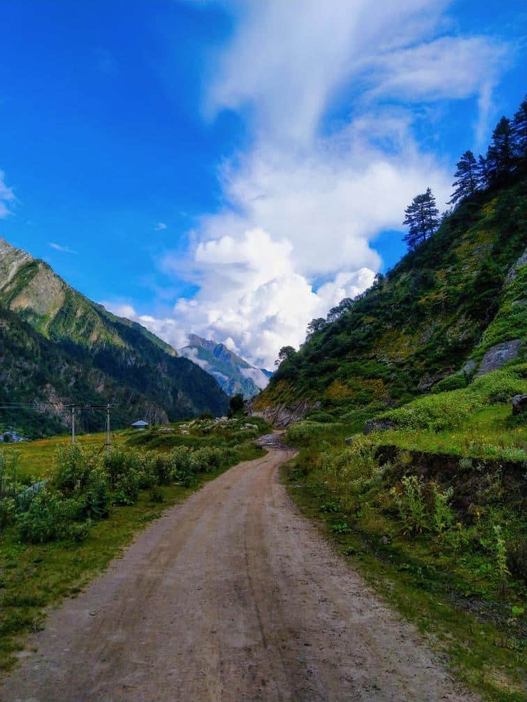
The Darma Valley trek and the Panchachuli Base Camp trek follow the same route for the most part. What sets this trek apart from more popular Uttarakhand treks is the raw, untouched feeling of the valley. You will walk through villages where the Shauka (Rung) tribe has lived for centuries, trading across the Himalayan passes into Tibet. The waterfalls, glaciers, and wildflower meadows along the route are unlike anything you will find on more crowded trails.
Quick Answer: Darma Valley trek leads to Panchachuli Base Camp at 12,992 ft (3,960 m) in Pithoragarh district, Uttarakhand. The route is 60 km over 8-10 days, rated moderate to difficult, starting from Dharchula (about 600 km from Delhi). The Inner Line Permit is free for Indian nationals and issued same-day at the SDM office in Dharchula. Best season is May to June and mid-September to October. Independent trek costs Rs 8,000-15,000 per person. No crowds, no quota system, no expensive permits. Just a glacier, 12 Shauka tribal villages, and one of the most genuine remote treks left in the Kumaon Himalayas.
Let's quickly dive into the details:
What Is Darma Valley and Why Should You Trek Here?
Darma Valley sits in the far eastern corner of Kumaon, right along the Indo-Tibetan border. The valley is carved by the Darma (Dhauliganga) River, sandwiched between the Kuthi Yangti Valley to the east and the Lassar Yangti Valley to the west. Gangachal Dhura connects Darma Valley with Lassar Valley, while Sinla Pass and Nama Pass link it with Kuthi Yangti.
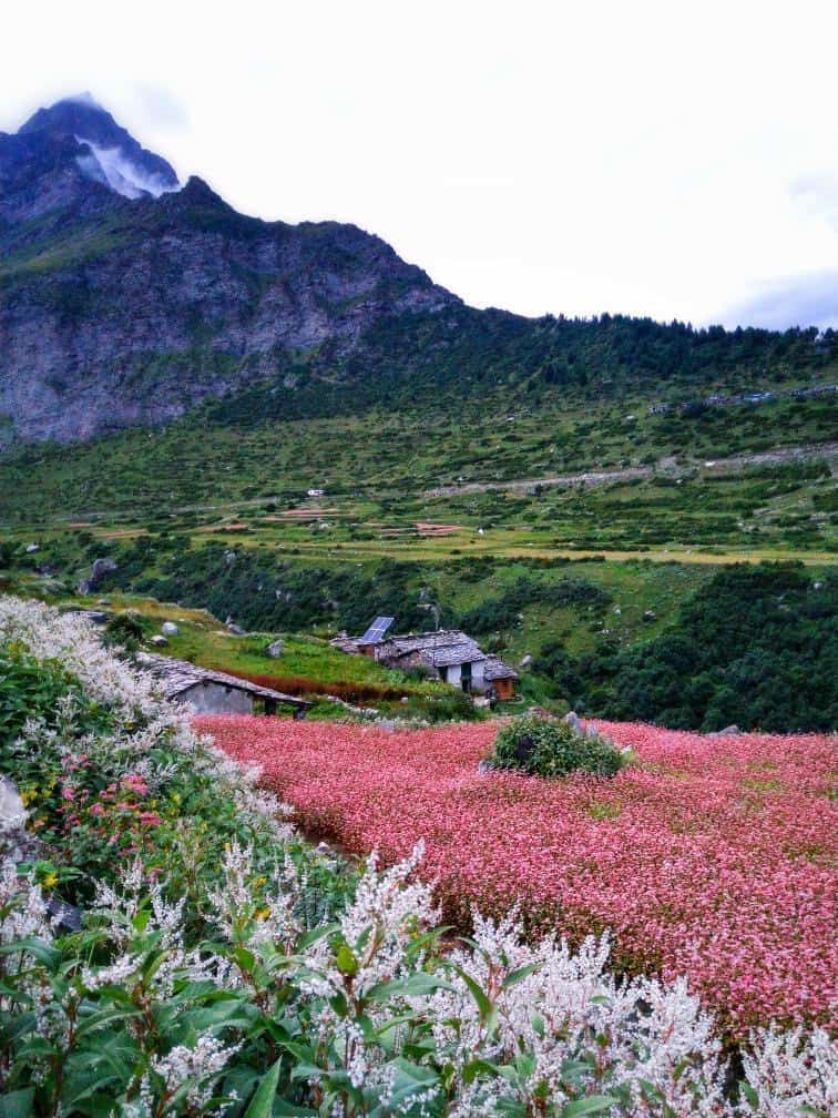
The valley has 12-14 villages, and the population here is mostly from the Shauka (Rung) community. These are indigenous Himalayan people whose ancestors were high-altitude traders connecting India with Tibet through ancient mountain passes. The trade routes through Sinla Pass and Nama Pass were active for centuries, and you can still sense that history in the old wooden homes and traditional architecture of Nagling and Duktu. Today, the villagers are primarily into livestock rearing and cultivating buckwheat and potato. The homestays in these villages let you experience Kumaon’s rural culture up close, with home-cooked meals and stories around the fire.
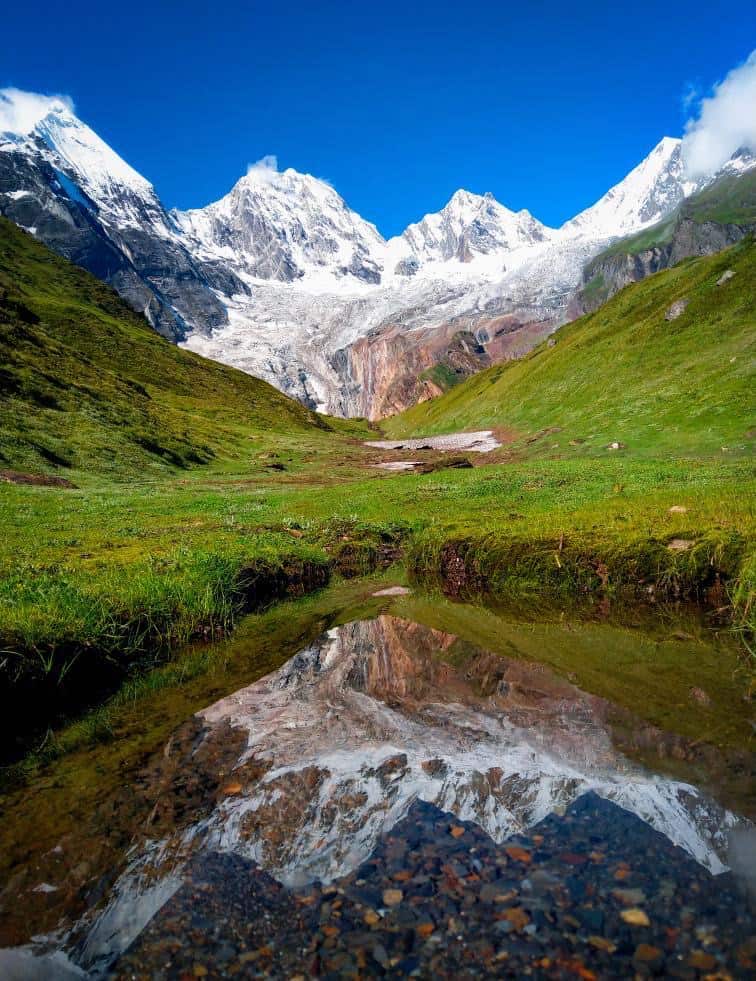
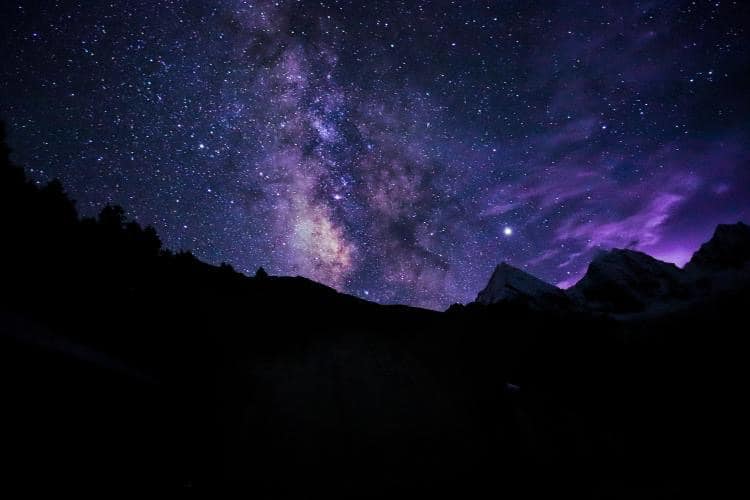
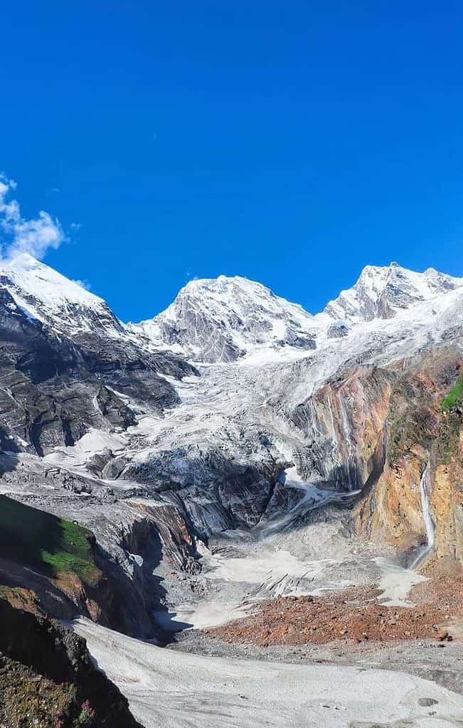
The biggest draw, of course, is the Panchachuli massif. The name comes from Sanskrit: “Pancha” (five) and “Chuli” (cooking hearths). According to Mahabharata legend, these five peaks represent the five cooking hearths where the Pandava brothers prepared their last meal before ascending to heaven. Whether you believe the mythology or not, standing at the base of these peaks with glaciers towering above you is something that stays with you.
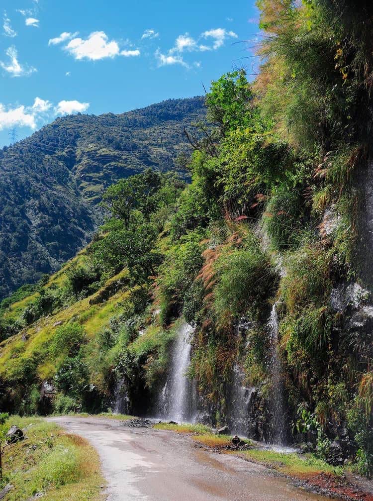
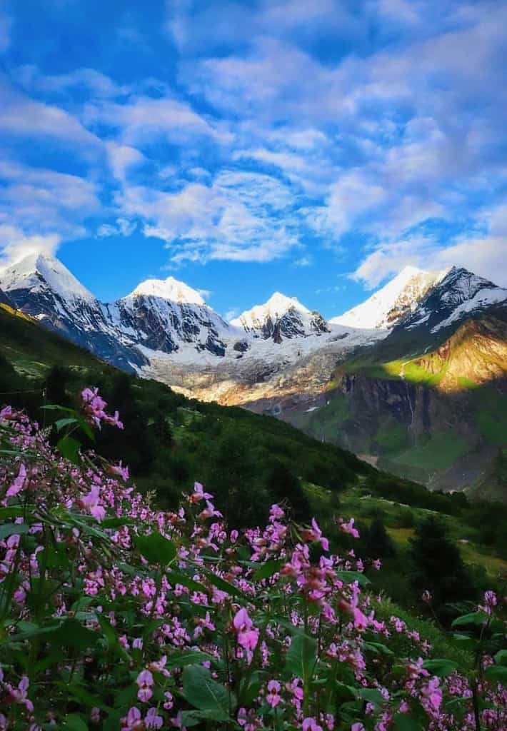
The region is blessed with magnificent flora, including orchids in large numbers, lush alpine meadows, thick forests, and waterfalls and streams at every turn. If you are looking for a trek that feels genuinely remote, walks you through living tribal villages, and rewards you with views that most Indian travelers have never seen, Darma Valley is it. And unlike the more popular Uttarakhand circuits that are becoming increasingly crowded, this valley still gives you the silence and space that a real Himalayan trek should.

What Is the Best Time to Visit Darma Valley?
The best time to trek in Darma Valley is May to June and mid-September to October. These two windows give you the most reliable weather and the best views.
May to June: The snow starts melting, wildflowers begin blooming, and the weather is pleasant during the day (10-20 degrees Celsius). Nights can still be cold at higher campsites (0-5 degrees). This is the ideal window if you want to see the Panchachuli glacier up close before the monsoon hits.
Mid-September to October: Post-monsoon is equally good, and in some ways better. The rains wash everything clean, so the greenery is at its peak, the skies are crystal clear, and the mountain views are sharper. The waterfalls are also at their strongest after the monsoon.
Avoid July to mid-September: This is full monsoon season. Landslides are common on the road to Dharchula and on the trek route itself. The trail can become dangerously slippery, and river crossings become risky. Keep in mind that the Kumaon Himalayas receive heavy rainfall, and this is not the time to be on exposed mountain trails.
Winter (November to March): The valley gets buried under heavy snow. Most villages above Dar are abandoned during winter as temperatures drop well below freezing. The trek is not feasible during these months.
How to Reach Darma Valley from Delhi?
Darma Valley is about 600 km from Delhi. The journey takes 14-18 hours by road depending on stops and conditions. The base town is Dharchula in Pithoragarh district, and from there you drive to Tawaghat and then Sobla before the trek begins. Here are your options to get there.
2026 Road Update: The Border Roads Organisation (BRO) has been steadily pushing the road deeper into Darma Valley. As per recent reports, the motorable road now extends close to Dugtu/Dantu villages in good weather, which means a few trekkers are now driving most of the way and only walking the last 4-5 km to Panchachuli Base Camp. Keep in mind that this road is rough, weather-dependent, and not always passable. The classic 60 km trek through all the villages remains the recommended way to experience the valley properly.
By Road (Self-Drive or Bus)
The route from Delhi goes through Haldwani/Kathgodam, then climbs through the Kumaon hills. Here is the breakdown:
- Delhi to Haldwani/Kathgodam: 285-320 km, 6-7 hours via NH9
- Haldwani to Almora: 87 km, 2.5 hours
- Almora to Dharchula: 207 km, 7-8 hours via Pithoragarh
- Dharchula to Tawaghat: 17 km, 1 hour
- Tawaghat to Sobla: 13 km, 45 minutes
- Sobla to Dar: 5 km (trek begins here)
UTC (Uttarakhand Transport Corporation) buses run from Delhi (ISBT Anand Vihar) to Dharchula. The fare is approximately Rs 890 one way and the journey takes about 14 hours. Buses typically leave in the evening and reach Dharchula by next morning. You can check schedules and book online at utconline.uk.gov.in.


If you prefer breaking the journey, take an overnight bus or train from Delhi to Kathgodam (leaves around 10-11 PM, reaches by 6 AM). From Kathgodam, catch a morning bus or hire a shared taxi to Almora. Then take another bus or cab to Dharchula. This two-day approach is easier on the body and lets you explore the beautiful Kumaon region along the way.
By Air
The nearest airport is Pantnagar Airport (about 290 km from Dharchula). It has daily flights from Delhi. From Pantnagar, you will need to hire a taxi or take a bus to Dharchula, which takes about 10-12 hours. This option saves you the Delhi-to-Haldwani leg but the onward road journey is still long.
By Rail
The nearest railway station is Tanakpur (about 240 km from Dharchula) or Kathgodam (about 300 km from Dharchula). Kathgodam is better connected with Delhi and has more bus/taxi options onward. The Shatabdi Express and Ranikhet Express are popular trains from Delhi to Kathgodam.
![How to prepare for cold weather motorcycle ride in Ladakh or Spiti Valley? [13 Important Tips]](https://discoverwithdheeraj.com/yt_vid_thumbs/ladakh/83.png)
Local Transport from Dharchula
From Dharchula, you can hire a jeep or shared taxi to reach Tawaghat and then Sobla. The road from Tawaghat onward is rough and requires a vehicle with good ground clearance. Beyond Sobla, the trek begins with a 5 km walk to Dar village, the actual starting point of the Darma Valley trek. The valley is accessible only on foot after this point, so let go of your inhibitions and get walking!
Do You Need a Permit for the Darma Valley Trek?
This is probably the most common concern I hear from people planning this trek. The short answer: the Inner Line Permit is free for Indian nationals and takes just a few hours to process. Do not let permit confusion stop you from doing this trek. Here is how it works as of 2026.
For the standard Darma Valley/Panchachuli Base Camp trek: An Inner Line Permit (ILP) is technically not mandatory for the basic trek up to Duktu village. However, the ITBP (Indo-Tibetan Border Police) has checkposts at Sela and Baling where they register all trekkers. In practice, having an ILP makes the process smoother and avoids any complications at these checkpoints.
If you plan to go beyond Duktu towards Om Parvat, Lipulekh Pass, or Gunji, you must obtain an ILP from the SDM (Sub-Divisional Magistrate) office in Dharchula. You need to submit your route map and a passport-sized photograph. The process is straightforward and usually takes a few hours.
For foreign nationals: A Protected Area Permit (PAP) is required, which involves additional documentation and approval from the Ministry of Home Affairs. This takes longer, so plan ahead.
My suggestion: get the ILP from the SDM office in Dharchula regardless. It is free, takes minimal effort, and saves you from any argument at the ITBP checkposts. You will need to show this permit at Sela, Baling, and ITBP camps along the route. The permit cannot be obtained online as of 2026, so plan to visit the SDM office on the day you arrive in Dharchula before starting the trek the next morning.
What Is the Complete Darma Valley Trek Itinerary?
The full Darma Valley trek takes about 8-10 days from Delhi to Delhi. The trekking portion itself is about 60 km over 6-7 days. Here is a day-by-day breakdown that works well for most trekkers.
| Base Location | Dar Village |
| Duration | 8-10 days (Delhi to Delhi) |
| Maximum Altitude | 3,960 meters (12,992 ft) at Panchachuli Base |
| Total Trek Distance | ~60 km |
| Difficulty | Moderate to Difficult |
| Best Season | May-June, Sep-Oct |
Day 0: Delhi to Kathgodam/Almora
Leave Delhi late at night by bus or train. The overnight journey to Kathgodam takes about 6-7 hours. From Kathgodam, catch a morning bus or shared cab to Almora (87 km, 2.5 hours). Alternatively, you can fly to Pantnagar and then take a cab. I would suggest you crash at Almora for the night and explore this charming hill town. Trying to push all the way to Dharchula on the same day is exhausting (another 7-8 hours of mountain roads) and not worth it.
Day 1: Almora to Dharchula (207 km, 7-8 hours)
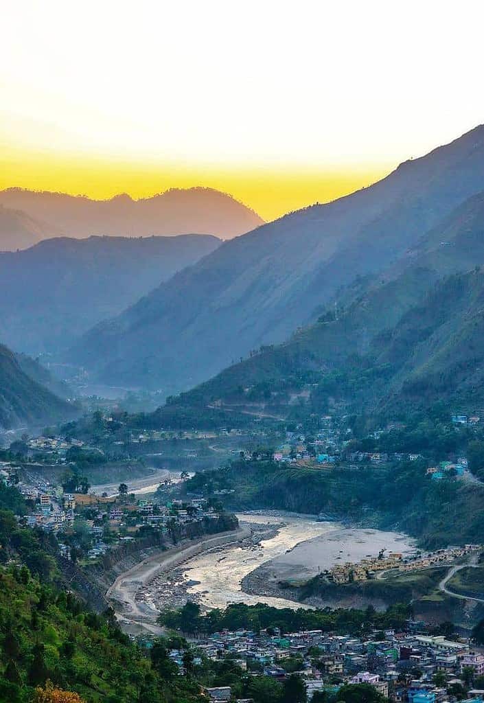
This is a long day on the road. Leave as early as possible and enjoy the drive through the heart of Kumaon. The most scenic portion is crossing Jouljibi, where River Gori and River Kali converge. River Kali enters India from Nepal near Dharchula, and the views at this confluence are worth stopping for. The road conditions vary seasonally, but the route is generally well-maintained. Spend the night in Dharchula. Budget hotels here cost Rs 800-1,500 per night.
Day 2: Dharchula to Sobla to Dar (35 km drive + 5 km trek)
Drive from Dharchula to Sobla via Tawaghat. The road journey takes about 2 hours, and the road from Tawaghat onward is rough and dusty but manageable. From Sobla, the trek begins with a relatively easy 5 km walk to Dar village. The trail follows the river valley and gives you a gentle introduction to what lies ahead. Camp at Dar for the night.
Day 3: Dar to Sela (12 km, 6-7 hours)
This is the toughest day of the trek. The trail from Dar to Sela takes you through hillsides and pastoral fields, but there is a narrow, intimidating stretch of about 1 km where the path clings to the mountainside. You may spot mule carcasses with vultures circling above, which makes the beginning feel intense. But after this stretch, the trail eases and Darma Valley suddenly opens up in front of you. Sela has an ITBP checkpost where your permits and identity will be checked. The campsite here is surrounded by mountains on all sides.
Day 4: Sela to Baling (11 km, 5-6 hours)
Easier than the previous day but still a long walk. The trail is fairly simple and takes you through hillsides with gentle ascents and descents. Views of distant glaciers start appearing, and the landscape shifts dramatically. Baling has another ITBP camp where permits are checked again. This is a beautiful campsite surrounded by alpine scenery, and you should rest well here because the coming days need your strength.
Day 5: Baling to Duktu (6 km, 3-4 hours)
You are now reaching the last human settlements of the valley. Duktu and its neighboring village Dantu are the final inhabited villages. In winter, Dantu is completely abandoned as temperatures become unbearable. Today’s 6 km walk is relatively short, and the Panchachuli glacier comes into full view. Right before Duktu, you enter a massive meadow that feels like it belongs in a different world. You can camp here or book a homestay in the village. Homestay rates in these remote villages are quite affordable, roughly Rs 50-100 per person for a bed and Rs 30-50 per meal (as of research data, verify locally for current rates).
Day 6: Duktu to Panchachuli Base Camp and Back (8 km round trip)
This is the highlight of the entire trek. You trek about 4 km alongside the Yuli river towards the Panchachuli glacier. The panoramic views of the five peaks from the base camp at approximately 3,960 meters (12,992 ft) are incredible. The glacier is both massive and humbling. You will trek back to Duktu for the night. In case you are feeling strong, the round trip takes about 4-5 hours, leaving you plenty of time to soak in the views.
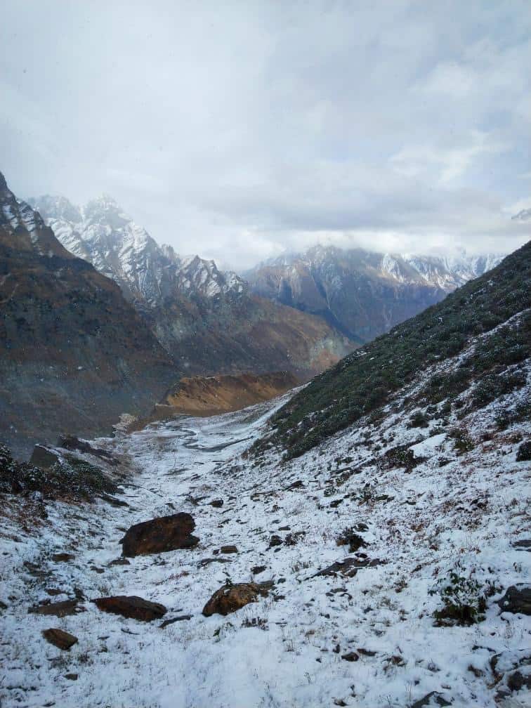
Day 7: Duktu to Nagling (11 km descent, 4-5 hours)
The return trek begins. The descent from Duktu to Nagling covers 11 km and takes about 4-5 hours depending on your pace. Be careful on the descents, they require more attention than climbing. Nagling village is gorgeous with old wooden homes that have intricate carvings. The Shauka culture is visible in the architecture and the warmth of the villagers here.
Day 8: Nagling to Sobla/Dharchula (12 km trek + drive)
The last trekking day covers 12 km from Nagling back towards Sobla or Bungling, from where you can catch a jeep back to Dharchula. The walk is long but mostly downhill. Once you reach the road, a jeep ride takes you back to Dharchula in about 2 hours. You can explore nearby Chaukori or stay in Dharchula before heading home.

Day 9: Dharchula to Delhi
The long road journey back. You can take an overnight UTC bus from Dharchula or drive back via Almora and Haldwani. If time permits, break the return journey at Kausani or Kasar Devi for a night to decompress before reaching Delhi.
How Much Does the Darma Valley Trek Cost?
The cost depends heavily on whether you go independently or with an organized trek operator. Here is a rough breakdown for both approaches as of 2026.
Independent/Budget Trek
- Delhi to Dharchula (bus): Rs 890-1,200 one way
- Dharchula to Sobla (jeep): Rs 1,500-2,500 (shared/private)
- Inner Line Permit: Free for Indian nationals (SDM office, Dharchula)
- Homestays on trek: Rs 50-100 per person per night, meals Rs 30-50 per thali
- Food and supplies: Rs 300-500 per day
- Porter/guide (recommended): Rs 800-1,200 per day
- Total (independent, 10 days): Rs 8,000-15,000 per person approximately
Organized Trek (with operator)
Trek operators offer packages starting from Rs 15,000 per person (Kathgodam to Kathgodam) plus 5% GST. These typically include transport, camping equipment, meals, guide, and porters. Luxury or custom treks with better tents and more support can go up to Rs 20,000-25,000 per person.
What Should You Pack for the Darma Valley Trek?
The Darma Valley trek requires proper preparation. Here is what you should carry, keeping in mind that the nearest market is in Dharchula and you will not find supplies on the trek.
- Clothing: Layered clothing (base layer, fleece, waterproof jacket), warm cap, gloves, good trekking shoes with ankle support
- Camping gear: If going independently, carry a tent, sleeping bag rated for 0 degrees, and a sleeping mat
- Food and water: Water purification tablets, dry fruits, energy bars, electrolyte sachets. Water sources are plentiful on the trek, but always purify before drinking
- Medical kit: Basic first aid, Diamox (consult your doctor), ORS, painkillers, blister plasters
- Documents: ID proof (Aadhar/passport), 2 passport-sized photos for the ILP, printout of any permits
- Electronics: Power bank (no charging points on the trek), torch/headlamp with extra batteries
- Cash: Carry enough cash from Dharchula. There are no ATMs beyond Dharchula and no UPI/card payment options in the valley
For a comprehensive packing list, feel free to check out the must-have things to carry on a trekking trip guide on this blog.
What About Mobile Network and Connectivity in Darma Valley?
Let me be straightforward here. Mobile connectivity in Darma Valley is extremely limited. BSNL has some signal in Dharchula and may work intermittently in a few villages closer to the road. But once you cross Sobla and start trekking, expect zero mobile network for most of the route. Jio and Airtel do not have coverage in this area.
Keep in mind that this means no UPI payments, no Google Maps, no phone calls. Inform your family about the lack of connectivity before you start the trek, and give them an expected return date. Some organized trek operators carry satellite communication devices for emergencies, which is one more reason to consider a guided group if you are new to remote trekking. This is one of those treks where you are truly disconnected from the world.
How Difficult Is the Darma Valley Trek?
The Darma Valley trek is rated moderate to difficult. It is not a beginner’s first trek. Here is what makes it challenging and what makes it manageable.
Challenging aspects: The Day 3 stretch from Dar to Sela (12 km) has a narrow, exposed section that can be intimidating. The total trek distance of 60 km over multiple days requires good stamina. The altitude reaches nearly 4,000 meters at Panchachuli Base Camp, which can cause mild altitude discomfort. The remoteness means there is no rescue helicopter or nearby hospital if something goes wrong.
Manageable aspects: Most days involve 6-12 km of walking on relatively clear trails. The altitude gain is gradual, which helps with acclimatization. AMS (Acute Mountain Sickness) is generally not a major concern at 3,960 meters for most healthy adults, though consult your doctor if you have pre-existing conditions. Diamox is usually not required for this trek.
If you have done at least one multi-day trek before (like Kedarkantha or Har Ki Dun), you should be able to handle this trek with proper preparation. If this is your very first trek, I would suggest building some experience on easier trails first.
Tips for the Darma Valley Trek
- Hire a local guide: The trail is not always well-marked, and a local guide from the Shauka community adds both safety and cultural depth to the experience. Guides can be arranged in Dharchula or Sobla.
- Start early each day: Weather in the mountains changes quickly. Start trekking by 6-7 AM to cover the maximum distance before afternoon clouds roll in.
- Carry enough cash: The last ATM is in Dharchula. Carry at least Rs 3,000-5,000 more than you think you will need.
- Respect the villages: These are real communities, not tourist attractions. Ask before photographing people, carry your trash out, and support local businesses by buying from village shops.
- Acclimatize properly: Do not rush through the itinerary. If you feel any symptoms of altitude sickness (headache, nausea, dizziness), rest for a day before going higher.
- Water is everywhere, but purify it: Streams and waterfalls are abundant throughout the trek. Always use purification tablets or a filter before drinking.
- Keep your documents handy: ITBP checks permits at Sela and Baling. Keep your ILP, ID proof, and passport photos in an easily accessible waterproof pouch.
Frequently Asked Questions
Is Diamox required for the Darma Valley trek?
No, Diamox is generally not required for this trek. The maximum altitude is about 3,960 meters (12,992 ft), and AMS is uncommon at this elevation for most healthy adults. The gradual altitude gain over multiple days also helps with acclimatization. However, always consult your doctor before the trek, especially if you have any pre-existing health conditions.
Is the Darma Valley trek suitable for beginners?
The trek is moderate to difficult and not ideal as a first-ever trek. It involves 6-12 km of walking per day over varied terrain for multiple days, with some exposed and narrow sections. If you have completed at least one multi-day Himalayan trek before, you should be fine with proper fitness and preparation.
Are there enough water sources on the trek?
Yes, plenty of water sources are available throughout the trek. Streams and waterfalls are everywhere in Darma Valley. Carry your own water bottle and purification tablets, and refill at every opportunity to stay hydrated.
What is the difference between Darma Valley trek and Panchachuli Base Camp trek?
They follow the same route. The Darma Valley trek typically refers to the full traverse through the valley’s villages (Dar, Sela, Baling, Duktu), while the Panchachuli Base Camp trek specifically targets reaching the base of the Panchachuli glacier from Duktu. Most itineraries combine both into a single trek.
Can I do the Darma Valley trek without a guide?
Technically yes, but it is not recommended for first-timers on this route. The trail is not always clearly marked, and the remoteness means help is far away if something goes wrong. A local guide from the Shauka community costs Rs 800-1,200 per day and significantly enhances both safety and cultural understanding.
Is there mobile network on the Darma Valley trek?
BSNL has limited signal in Dharchula and some nearby villages, but there is essentially no mobile network once you cross Sobla village and enter the valley. Jio and Airtel do not work in this area. Plan for complete disconnection during the trek.
How do I get the Inner Line Permit for Darma Valley?
Visit the SDM (Sub-Divisional Magistrate) office in Dharchula with your ID proof (Aadhar or passport), 2 passport-sized photos, and your planned route details. The permit is free for Indian nationals and usually takes a few hours to process. As of 2026, online applications are not available, so go in person. Get it on the day you arrive in Dharchula before starting the trek.
Can I drive all the way to Panchachuli Base Camp now?
The BRO has been steadily extending the road through Darma Valley, and in recent reports the motorable track now reaches close to Dugtu/Dantu in good weather. Some travelers do drive most of the way and walk only the final 4-5 km to the base camp. Keep in mind that this road is rough, weather-dependent, and not always passable. The full 60 km trek is still the recommended way to experience the valley properly.
What are the nearest places to visit along with Darma Valley?
From Dharchula, you can also visit Munsiyari (about 90 km, famous for Panchachuli views without trekking), Chaukori (tea gardens and mountain views), and the Adi Kailash/Om Parvat route (requires additional permits). On your return via the Kumaon route, stops at Kausani, Binsar, and Lohaghat are worth considering.
Wrapping Up
The Darma Valley trek is one of those rare experiences where you get to touch a glacier, walk through villages that feel frozen in time, cross meadows and waterfalls, and spend days in a valley that most Indian travelers have never heard of. The free Inner Line Permit removes one excuse. The uncrowded trails remove another. The 60 km over 8-10 days tests your body, but the views and the silence of this offbeat corner of Uttarakhand make every step worth it.
If you have done this trek before, I would love to hear about your experience. Drop a comment below with your tips and stories. And for anything else, queries, finding travel partners, or sharing your trip plans, feel free to join the DwD Community through the link in the main menu. Happy trekking, my friend 🙂 …
1 Comment
Comments section gets closed in 90 days. To ask your travel questions, you can follow my YouTube Channel for a faster reply or for a much slower reply follow me on Instagram. :)
Hi Shefali.
Firstly, thanks for the article. Secondly, I do not use I Instagram, so I want to ask a question here.
I am considering a Darma Valley trek during either March-May or August-October, using public transport to get to/from the trailhead and Kasar Devi (Almora).
Are there plenty of dhabas along the Darma Valley trekking route? I prefer to not carry a tent, cooking utensils and food…even no sleeping bag if it is not absolutely necessary. What do you think?
Thanks for any reply.