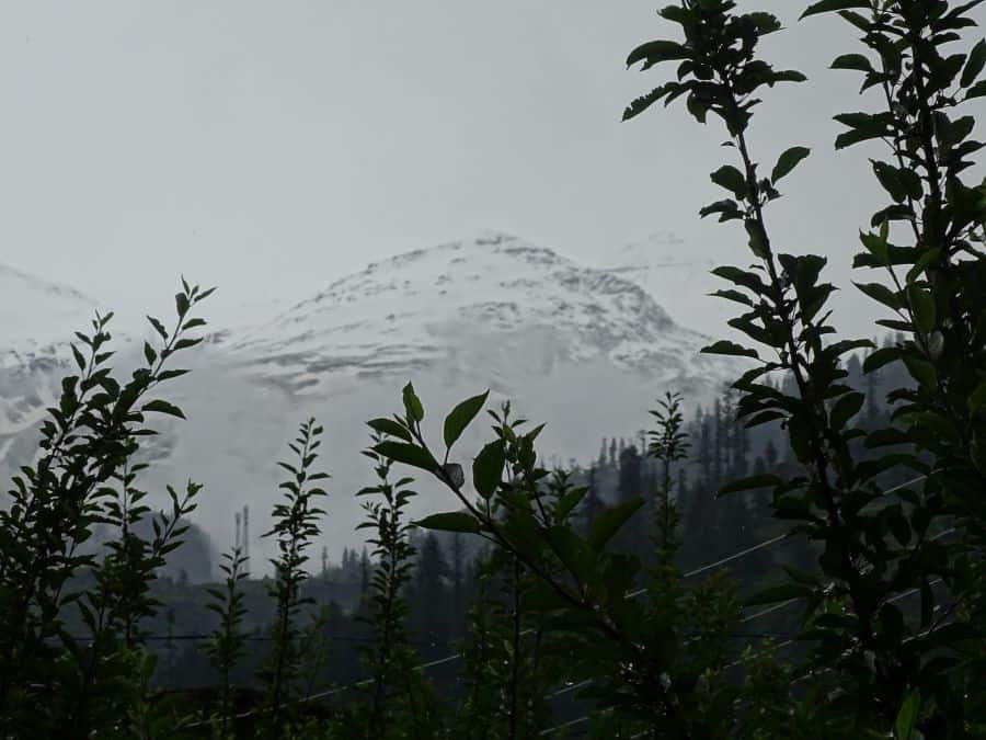
The Beas Kund trek is one of the most rewarding beginner treks near Manali, and I say this from personal experience. It takes you to the very source of the Beas River, a glacial lake sitting at 12,772 feet, surrounded by snow-covered peaks of the Pir Panjal range. If you have a long weekend and want to experience real Himalayan trekking without extreme difficulty, this is the one to pick.
We were a group of three, a mix of beginner and experienced trekkers, and my quest took me to the source of River Beas, the Beas Kund glacier. Here is my experience and a detailed travel guide to help you plan your Beas Kund trek in 2026.
Quick Info: Beas Kund sits at 12,772 ft (3,890 m) in Kullu district. The trek is 16 km round trip from Dhundi, takes 2-3 days, and costs Rs 3,500-6,000 independently or Rs 5,000-8,500 with an operator. Best months are mid-May to June and September to mid-October.
Let's quickly dive into the details:
What Is the Beas Kund Trek and Why Should You Do It?
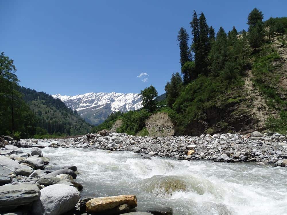
Beas Kund is a glacial lake at 12,772 feet (3,890 m) in the Kullu district of Himachal Pradesh. It is the origin point of the Beas River, one of the five rivers of Punjab. The trek covers about 16 km round trip from Dhundi and takes 2-3 days to complete.
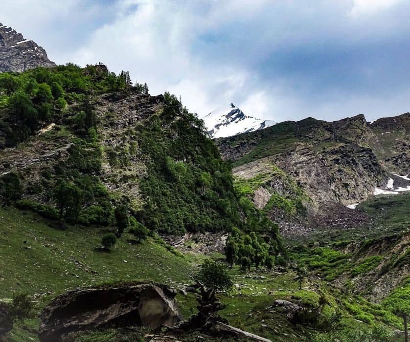
There are three solid reasons to do this trek. First, it is one of the easiest treks around Manali that gives you panoramic views of the Pir Panjal range, including Friendship Peak, Hanuman Tibba, Deo Tibba, Ladakhi, and Shitidhar. Second, it is a beginner-level trek that brings you close to glaciers, glacial lakes, and towering peaks. Third, tracing a river to its source is a genuinely fascinating experience. You walk through meadows, cross streams, climb boulders, and finally arrive at a pristine lake that feeds an entire river system.
You may also check our article on the list of easy treks in Himachal Pradesh if you are looking for more options after completing Beas Kund.
How Difficult Is the Beas Kund Trek?
The difficulty level is easy to moderate. The initial trail from Dhundi to Bakarthach is a gradual ascent through meadows with well-marked paths. The section from Bakarthach to Beas Kund gets steeper with boulder fields, but nothing that requires technical climbing skills. If you can walk 6-8 km a day on inclined terrain, you can do this trek.
Keep in mind that monsoon conditions (July-August) make the trail significantly harder due to slippery rocks and swollen stream crossings. I would recommend this trek for anyone with basic fitness levels, but do not underestimate the altitude. At 12,772 feet, you will feel the thin air, so pace yourself.
When Is the Best Time to Do the Beas Kund Trek?
The best window is mid-May to June and September to mid-October. May and June offer snow on the trail with patches of green meadows coming alive. September and October bring clear skies with the best mountain visibility, though nights get cold.
Mid-May to June is ideal if you want snow on the trail. September to October gives the clearest views of the Pir Panjal peaks.
Avoid August and early September when heavy monsoon rain lashes this part of the Himalayas. Stream crossings become dangerous, and visibility drops to near zero in heavy mist. Pro trekkers attempt this during winter too, when several feet of snow covers the entire stretch. However, that is not advisable for beginners as conditions turn unpredictable.
How Do You Reach the Beas Kund Trek Starting Point?
Manali is the base for this trek. It is well connected with major cities by road and air. From Delhi, overnight buses (both HRTC and private Volvo) reach Manali in about 12-14 hours. HRTC Volvo fare is around Rs 1,300-1,600, and private sleeper buses cost Rs 1,500-2,500. Bhuntar airport (50 km from Manali) receives flights from Delhi and Chandigarh.
From Manali, you need to reach Dhundi (21 km from Manali, 8 km beyond Solang Valley). The road to Dhundi passes through the south portal area of the Atal Tunnel. You can hire a local taxi from Manali to Dhundi for Rs 800-1,200. A budget-friendly option is the HRTC local bus from Manali bus stand to Solang (Rs 30-50 per person, departures in the morning and around noon), and then arrange a shared cab or walk the remaining 8 km to Dhundi. Keep in mind that BRO maintains a barrier on the Solang-Dhundi road, and private or commercial vehicles sometimes need special permission to pass through. Confirm the current status at Solang before starting.
What Does the Beas Kund Trek Cost in 2026?
If you go with a trek operator, packages range from Rs 5,000 to Rs 8,500 per person for 3 days/2 nights, including meals, camping gear, guide, and permits. Prices vary by season and group size. If you do it independently (which we did), your costs will be lower but you need your own camping gear.
Here is a rough independent budget breakdown for 2026:
| Expense | Budget (per person) |
|---|---|
| Delhi to Manali bus (HRTC Volvo) | Rs 1,300-1,600 |
| Manali to Solang local bus | Rs 30-50 |
| Solang to Dhundi taxi (shared) | Rs 200-400 |
| Camping at Dhundi/Bakarthach (own tent) | Rs 0 (own gear) / Rs 500-800 (rented) |
| Food (3 days, home-cooked/packed) | Rs 500-800 |
| Guide (optional, split among group) | Rs 500-800/person |
| Forest permit | Rs 50-150 |
| Manali to Delhi bus (return) | Rs 1,300-1,600 |
| Total (independent, budget) | Rs 3,500-6,000 |
If you hire a local guide from Manali or Solang, expect to pay Rs 1,500-2,500 per day. Several operators at Solang and Manali also offer camp setups at Dhundi if you prefer not to carry your own tent. In case you are on a tight budget, splitting the guide cost among a group of 3-4 trekkers makes it very affordable.
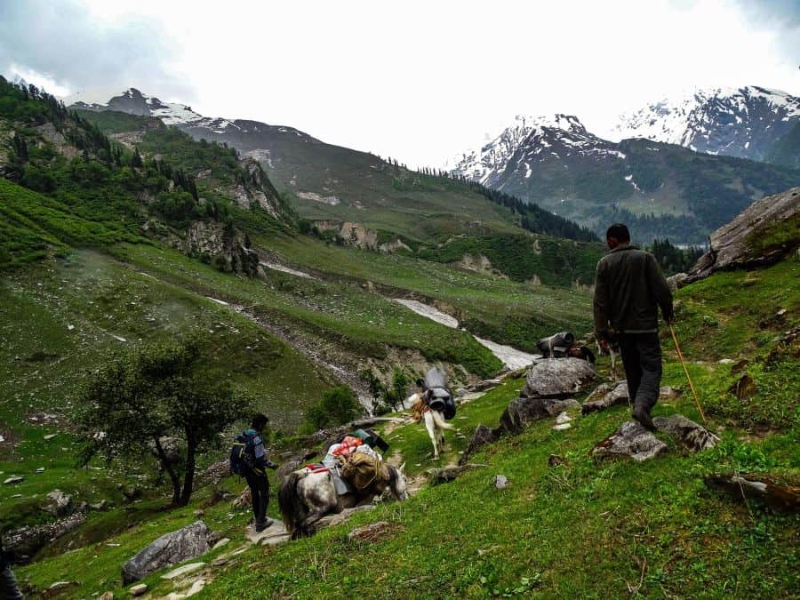
What Is the Beas Kund Trek Trail Like? A Day-by-Day Breakdown
The trail goes: Manali to Solang to Dhundi to Bakarthach to Beas Kund. Some trekkers start from Solang (adding 8 km), but most drive to Dhundi and start the hike from there. Here is what each section looks like.


The trail is Manali – Solang – Dhundi – Bakarthach – Beas Kund
Manali and Solang Valley
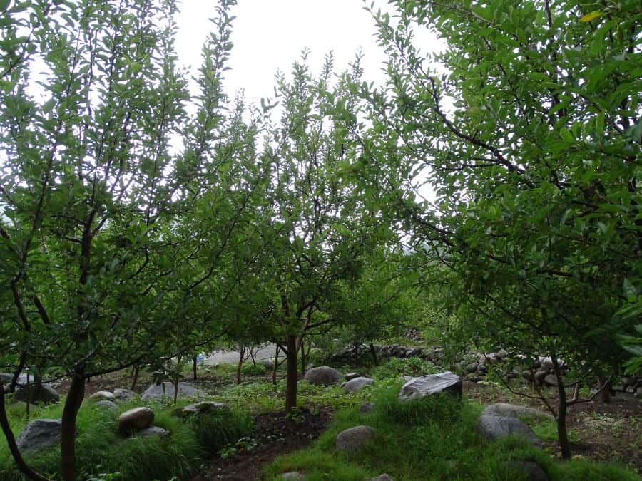
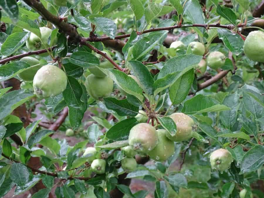
Manali hosts trekkers and travelers planning to explore the nearby mountains. We reached after an overnight road journey from Delhi and moved straight to Solang for a day’s rest. If you plan to explore Manali, I recommend visiting the villages of Shanag and Burwa, located a few km above Old Manali. Apple and walnut orchards line the fields around rustic stone houses there.
Solang Valley sits at 8,400 feet, 13 km above Manali. It is famous for snow sports, paragliding, and the Gondola ride. The Beas River flows through it, and there are beautiful riverside spots. We spent the night before and after the trek at Solang.
Some trekkers start from Solang Valley and some from Dhundi. Choose your starting point depending on how much distance you want to cover on foot.
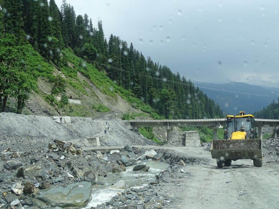
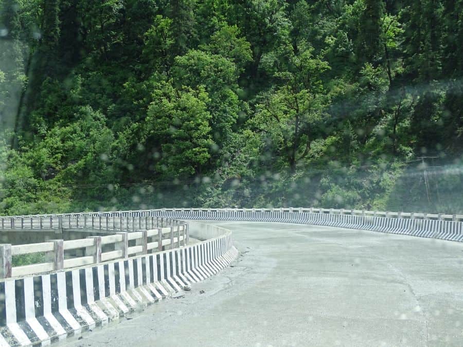
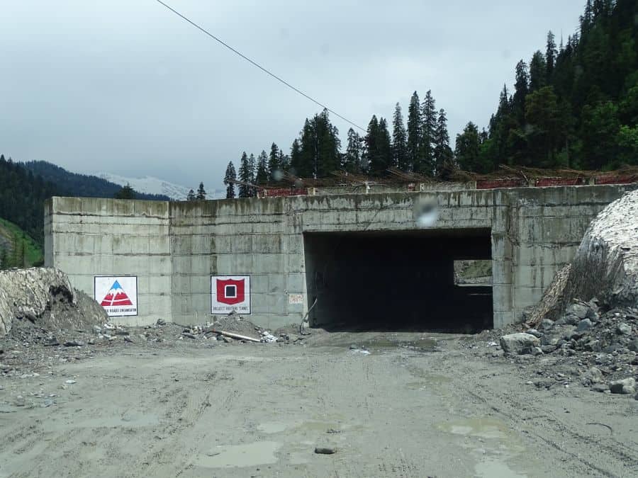
There is a well-paved road from Solang to Dhundi. The road crosses near the south portal of the Atal Tunnel (opened October 2020). The area is prone to avalanches, and you will see warning signs along the road. The BRO has constructed snow shelters in this section for protection during unpredictable avalanches.

Tunnel work-site Road from Solang to Dhundi Atal Tunnel south portal near Dhundi
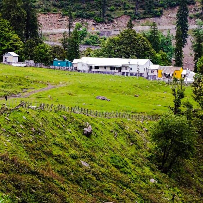
Dhundi (8,500 ft) – The Trek Starts Here
Dhundi is the last village of Solang Valley, about 8 km from Solang. The green meadows of the trek start from here, their beauty gradually increasing with altitude. The motorable road ends at the Dhundi weather observatory, a research station that has been instrumental in recording weather patterns, predicting snow conditions, rainfall, and avalanches for decades.
This observatory has seen the Beas River change course, rising temperatures, eroding forest cover, and even the black snowfall in 1991 caused by Kuwait’s oil well fires. Dhundi is also where the Beas River is joined by its first tributary. The water gets much clearer as you go higher.
Multiple streams near Dhundi give you chances to refill your water bottle with fresh mountain water.
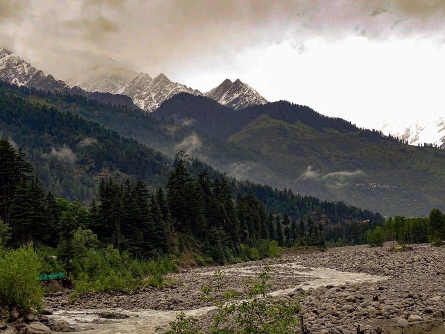
Dhundi to Bakarthach (10,800 ft) – About 4.5 km, 3-4 Hours
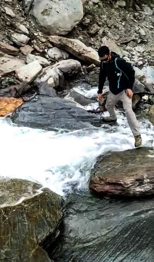
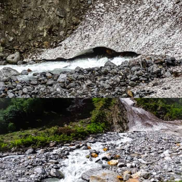
From Dhundi there is a gradual ascent of about 4.5 km to Bakarthach, taking approximately 3-4 hours. The trail is well marked except during winter when snow covers everything. We crossed the wildly flowing stream a few times. The trick is to keep your balance on slippery rocks and cross at a narrow point. Do not hesitate to ask for help from a fellow trekker or a local while jumping over the stream.
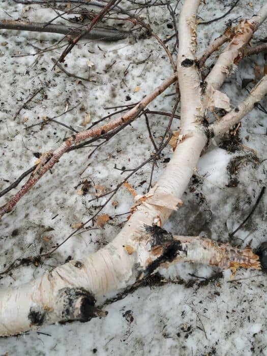
After about two hours (two stream crossings), you start noticing Bhoj Patra (Birch) trees. This entire stretch is locally known as the Bhoj Patra meadow. These trees grow at elevations between 10,000-15,000 feet, and their paper-like bark was used in ancient times to write scriptures. I found a fallen Birch tree along the way, and it was exciting to peel a small piece of its bark as a souvenir.
The trail takes a right turn after the Bhoj Patra meadow, with Bakarthach barely half an hour away. At this point, we noticed a batch of students from the Atal Bihari Vajpayee Institute of Mountaineering practicing snow and ice craft in the rain. These meadows serve as their summer training grounds.
Do not forget to check our list of must-have things to carry on a trekking trip before you head out.
What Is Bakarthach Like as a Campsite?
Bakarthach is a high-altitude grazing ground used by the Gaddi community. “Thach” in the local dialect means “meadow.” It is a stunning camping spot at the end of Day 1. The beauty here is hard to describe. Unspoiled grasslands, wild plants everywhere, and you feel completely in sync with nature.
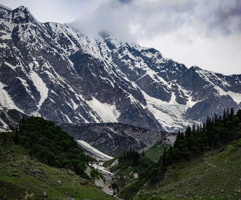
From Bakarthach, you get majestic views of the Pir Panjal range and several popular peaks: Friendship Peak, Hanuman Tibba, Deo Tibba, Ladakhi, and Shitidhar.
What Himalayan Flora Will You See on the Trail?
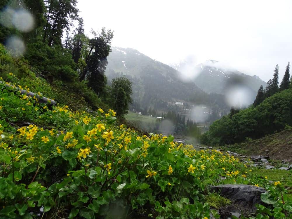
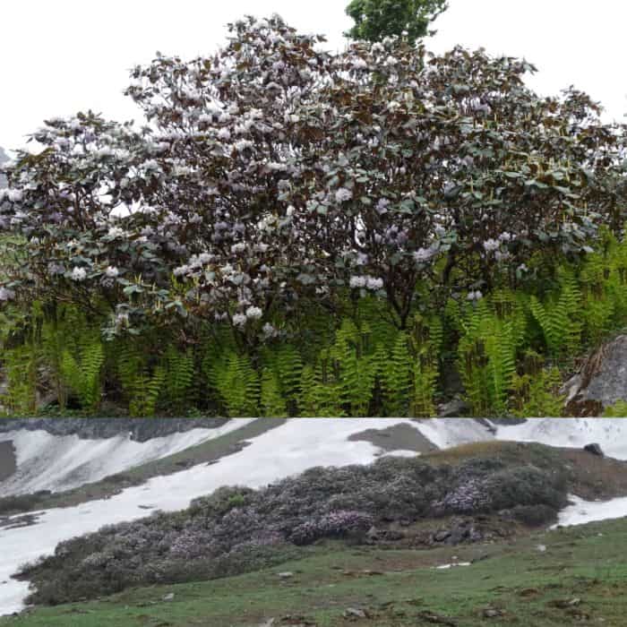
This was one of the most surprising parts of the trek for me. In this section of Pir Panjal, I discovered an incredible variety of wild Himalayan plants. The most visible flower at 8,000 feet was Marsh Marigold (King Cup). As I climbed higher, large shrubs of light pink Rhododendron covered almost the entire stretch between Dhundi and Bakarthach. I call it “the pink valley.”
A local told us he had consumed Rhododendron flowers on a certain occasion, which made him feel dizzy. I would advise against eating those flowers, especially at altitude. Rhododendron is the state flower of Himachal Pradesh, and the pink variety is facing extinction.
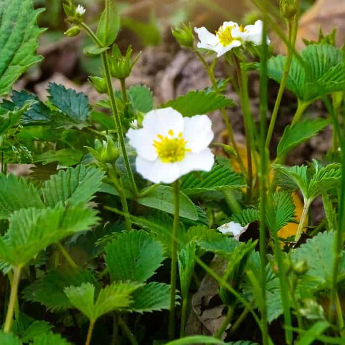
Wild strawberries, wild roses, and Himalayan thistle lined the trail. I picked some wild mint leaves that smelled and tasted like carom seeds (ajwain), used in making herbal teas. We also saw fronds of Lingdi (Fiddlehead fern), which locals use to make pickle, commonly sold as “Kasrod ka achar.”
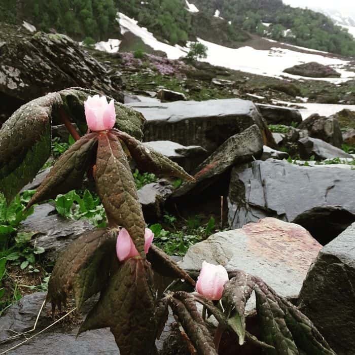
I was lucky to spot Naag Chhatri, an endangered herb with high medicinal value that is notorious for being smuggled to international markets. We also found remnants of Guchchi (Morel Mushroom), one of the most expensive foods in the world, sold at up to Rs 30,000 per kg. This mushroom cannot be cultivated and grows only in the wild. Our guide helped us recognize the spot where it had grown that year. The villagers believe consuming these mushrooms once a year increases longevity.

Marsh Marigold 
Pink Rhododendron Naag Chhatri Blooms of Wild Strawberry
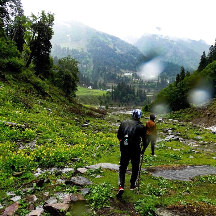
Trekking in the Rain – Lessons from Our Experience
Rain and snowy slopes are not a good combination, especially for beginners. We had to move very carefully, learning to place our feet at the correct angle to avoid slipping down wet slopes. It reduced our speed, but we managed to reach Bakarthach well before sundown. A light drizzle had started at the Bhoj Patra meadow. By the time we reached Bakarthach, it was raining heavily and we could barely see a few meters ahead through the mist.
Getting the right footwear matters a lot. Check our guide on the best trekking shoes under Rs 5,000.
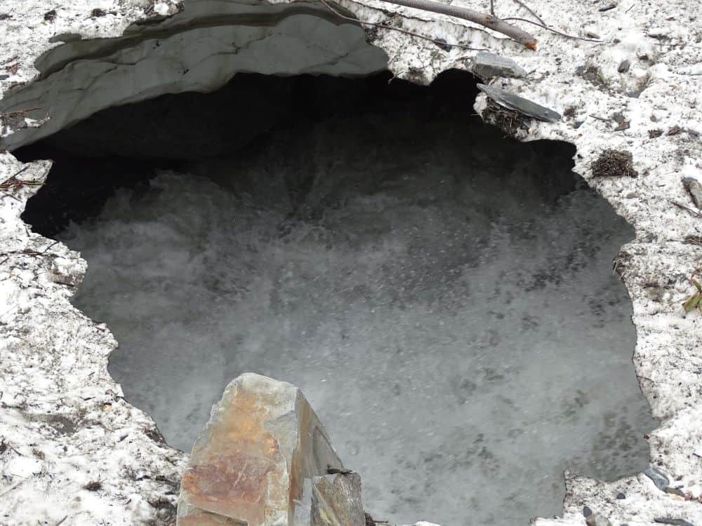
Finding Shelter – The Cave Near Bakarthach
As heavy rain lashed against us, we were desperately looking for shelter. Our guide spotted some tents at a distance, which reminded him of a natural shelter nearby. It was an outgrowth of rock, giving the feel of a cave. Our spirits lifted immediately. If you ever get into a similar situation, keep your hands and feet dry and warm. Once frostbite sets in, moving further becomes very difficult.

If you are caught in rain at altitude, prioritize keeping your hands and feet dry. Wet extremities lose heat rapidly and make further movement dangerous.
We decided to call it a day since moving in the rain was getting increasingly difficult. We camped for the night at Bakarthach.
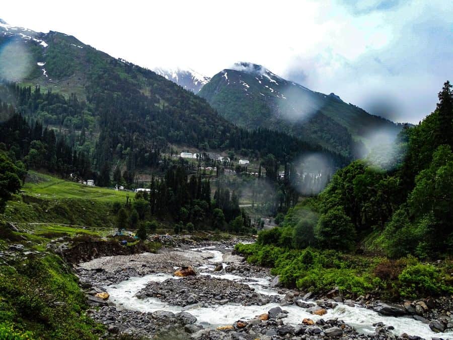
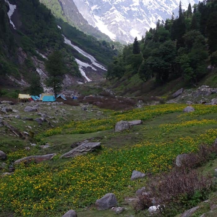
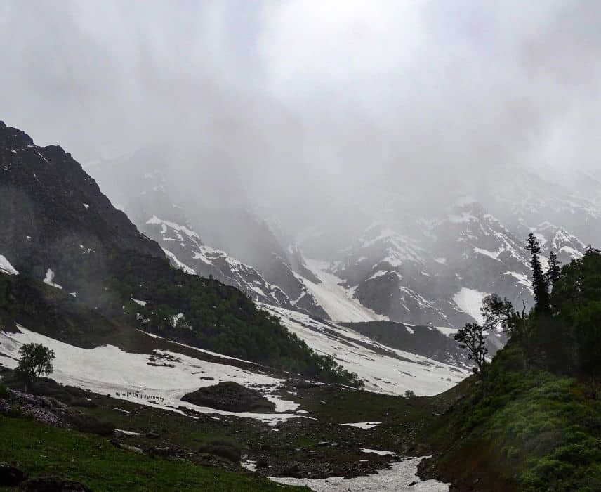
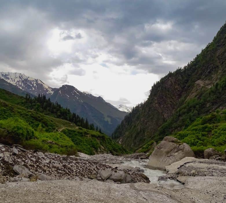
Bakarthach to Beas Kund (12,772 ft) – The Final Push
The final stretch ascends from 10,800 ft to 12,772 ft, covering about 4 km. We started early the next day because streams tend to swell with the sun, and we wanted to spend more time at the lake.
After Bakarthach, the climb gets steeper and full of boulders. You will be climbing up rocks and crossing an expanse of boulders to get to the other side of the river. This stretch ends at a ridge that descends into the Beas Kund valley. The valley is an almost flat field with numerous streams crossing it and waterfalls flowing down from the glacier.
At this point the trail is not well-demarcated, and you might feel lost. Our guide pointed towards a waterfall that we had to follow to reach the lake. A steep climb of a few meters takes you to the point where you get the first view of the lake. And it is magical.
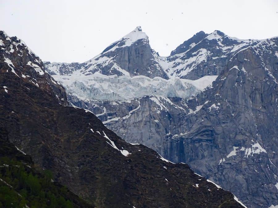
What Does Beas Kund Look Like When You Arrive?
A pristine glacial lake sits in the middle of snow-covered mountains, releasing a small stream that develops into the wild Beas River tumbling down 12,000 feet. After the climb and effort you put in, it gives you a genuine sense of accomplishment. More than that, it feels almost divine to be present there.
The mythological story states that the narrator of Mahabharata, Rishi Ved Vyas, took his daily bath in this lake. He is believed to have created the Beas River from this Kund. The river is named after him (Vyas became Beas).
About the Beas River
Beas is one of the most well-known rivers in the Himalayas, flowing through Himachal Pradesh and Punjab before merging with the Sutlej at Harike in Punjab. It has a drainage basin of 20,303 sq km and a length of 470 km. The river beautifies two of the most scenic valleys in the Himalayas, the Kullu Valley and the Kangra Valley.
It nourishes several cities and towns along its course. Some historians believe crossing the Beas was the biggest hurdle for Alexander’s invasion of India. Reaching the origin of such a significant river is what makes this trek so rewarding.
What Is the Best Beas Kund Trek Itinerary for 2026?
Here is the most practical itinerary that works for a long weekend:
- Day 0 (Evening): Board an overnight bus from Delhi to Manali. Alternatively, drive to Manali (530 km, 12-14 hours).
- Day 1 (Morning): Arrive Manali. Drive to Dhundi (21 km, 45 min). Start trek to Bakarthach (4.5 km, 3-4 hours). Camp at Bakarthach.
- Day 2: Start early. Trek from Bakarthach to Beas Kund (4 km, 3-4 hours). Spend time at the lake. Return to Bakarthach or continue down to Dhundi.
- Day 3: If you stayed at Bakarthach, descend to Dhundi (4.5 km, 2-3 hours). Drive back to Manali. You can visit Naggar Castle on the same day before heading back.
Some experienced trekkers do the entire trek in a single day from Dhundi and back. It is doable if you are fit and start early, but you will miss the magic of camping at Bakarthach under the stars.
What Should You Carry for the Beas Kund Trek?
Here is a practical packing checklist based on my experience:
- Footwear: Good trekking shoes with ankle support (essential for stream crossings)
- Clothing: Layered system. Base layer (thermal), mid layer (fleece), outer layer (waterproof jacket and pants). Avoid cotton as it takes long to dry.
- Rain gear: Waterproof backpack cover and a light rain jacket
- Camping: Tent, sleeping bag rated for 0 degrees Celsius, sleeping mat (if going independent)
- Food: Energy bars, dry fruits, packed meals for the trek days
- Water: Refillable water bottles. Streams along the trail provide fresh water.
- Extras: Trekking pole, gaiters, extra pair of socks, sunscreen, basic first aid
What Are Essential Tips for Trekking During Monsoon?
Since the Beas Kund trail is often attempted during or right after monsoon, here are some monsoon-specific tips from our experience:
- Layer up: Dress in layers to adapt as the weather changes. Use fleece or super-dry shirts (not cotton). A warm middle layer, plus a waterproof outer layer that is light and breathable.
- Waterproof your gear: Carry a waterproof backpack and spare plastic bags to keep electronics and clothes dry.
- Keep snacks accessible: Store snacks in waterproof pockets so you do not have to open your bag every time you feel hungry.
- Extra socks: Carry at least two extra pairs. Wear gaiters to keep water out of your boots.
- Plan pit stops: Identify natural shelters beforehand. Rock overhangs saved us.
- Check weather forecasts: Always check predictions before starting each day’s trek.
- Use trekking poles: They provide critical support on wet, slippery trails.
- Hire a local guide: Especially during monsoon, a guide who knows alternate routes can be a lifesaver if trails are blocked.
If you love trekking, check our comprehensive guide for the Kheerganga Trek in Parvati Valley, another excellent beginner trek in Himachal.
What Other Treks Can You Do Near Manali?
If the Beas Kund trek has sparked your interest, there are several other treks near Manali worth considering:
- Bhrigu Lake Trek, another glacial lake trek that also starts near Manali, reaching 14,100 feet
- Hampta Pass Trek, a 5-day moderate trek crossing from Kullu Valley to Lahaul at 14,100 feet
- Prashar Lake Trek, a scenic weekend trek near Mandi with a floating island lake at 8,900 feet
- Easy treks in Uttarakhand if you want to explore beyond Himachal
Practical Information for Beas Kund Trek 2026
| Detail | Information |
|---|---|
| Trek Distance | ~16 km round trip (from Dhundi) |
| Maximum Altitude | 12,772 ft (3,890 m) |
| Duration | 2-3 days (can be done in 1 day by experienced trekkers) |
| Difficulty | Easy to Moderate |
| Best Time | Mid-May to June, September to mid-October |
| Starting Point | Dhundi (21 km from Manali) |
| Base Camp | Bakarthach (10,800 ft) |
| Nearest Town | Manali (13 km to Solang, 21 km to Dhundi) |
| Nearest Airport | Bhuntar (50 km from Manali) |
| Mobile Network | Works till Solang. No network beyond Dhundi. |
| Permits | Forest permit required (Rs 50-150, trek operators include it) |
| ATM | Last ATM in Manali. Carry cash. |
| Guide | Recommended, especially during monsoon (Rs 1,500-2,500/day) |
| Operator Cost | Rs 5,000-8,500/person for 3D/2N (2026 rates) |
Last Updated: April 2026
Frequently Asked Questions
Is the Beas Kund trek suitable for beginners?
Yes, the Beas Kund trek is one of the best beginner treks near Manali. The trail is well-marked, the altitude gain is gradual, and the total distance of 16 km can be covered over 2-3 comfortable days. Basic fitness (ability to walk 6-8 km on inclined terrain) is sufficient.
Do I need a permit for the Beas Kund trek?
Yes, you need a forest permit that costs Rs 50-150 per person. If you are going with a trek operator, the permit cost is included in the package. If trekking independently, you can obtain the permit at the forest check-post near Dhundi.
Can I do the Beas Kund trek without a guide?
Yes, the trail from Dhundi to Bakarthach is well-marked and does not require a guide in good weather. However, the section from Bakarthach to Beas Kund is less defined, especially in mist or rain. I would recommend hiring a local guide during monsoon months (July-September) when trail conditions are unpredictable.
Where can I camp on the Beas Kund trek?
The primary campsite is Bakarthach (10,800 ft), which has flat ground suitable for tents. Some trek operators also set up camps at Dhundi. Carry your own tent if going independent, or book through a Manali-based operator who provides camping equipment.
Is mobile network available on the Beas Kund trek?
Mobile network (Jio, Airtel) works till Solang Valley. Beyond Solang towards Dhundi, the signal becomes intermittent. There is no mobile network at Bakarthach or Beas Kund. BSNL postpaid may get a weak signal at Dhundi, but do not rely on it. Download offline maps before starting.
What is the altitude of Beas Kund?
Beas Kund sits at an altitude of 12,772 feet (3,890 meters) above sea level. The base camp at Bakarthach is at 10,800 feet, and the trek starting point at Dhundi is at approximately 8,500 feet.
![What is the best bike or best motorcycle for Leh Ladakh bike trip? [4 Things to Consider]](https://discoverwithdheeraj.com/yt_vid_thumbs/ladakh/81.png)
How much does the Beas Kund trek cost with an operator?
Trek operator packages for Beas Kund in 2026 range from Rs 5,000 to Rs 8,500 per person for a 3-day/2-night trek. This typically includes meals, camping gear, guide, and forest permits. Transport from Manali to Dhundi may or may not be included, so confirm before booking.
One last thing. Please practice responsible travel in the Himalayas. Carry all your trash back, avoid single-use plastics, and do not disturb the local flora. The Bhoj Patra trees and the medicinal herbs we saw on this trek are already under pressure from climate change and over-harvesting.
I hope this detailed guide to the Beas Kund trek helps you plan your journey well. The combination of meadows, glaciers, Himalayan flora, and that final view of the glacial lake makes this trek worth every step. If you have any questions, feel free to drop them in the comments below or reach out to the DwD Community. We are always happy to help fellow travelers 🙂
Happy trekking!
2 Comments
Comments section gets closed in 90 days. To ask your travel questions, you can follow my YouTube Channel for a faster reply or for a much slower reply follow me on Instagram. :)
It is a delight, that’s true ☺️
I love traveling and tracking. It is very refreshing.