
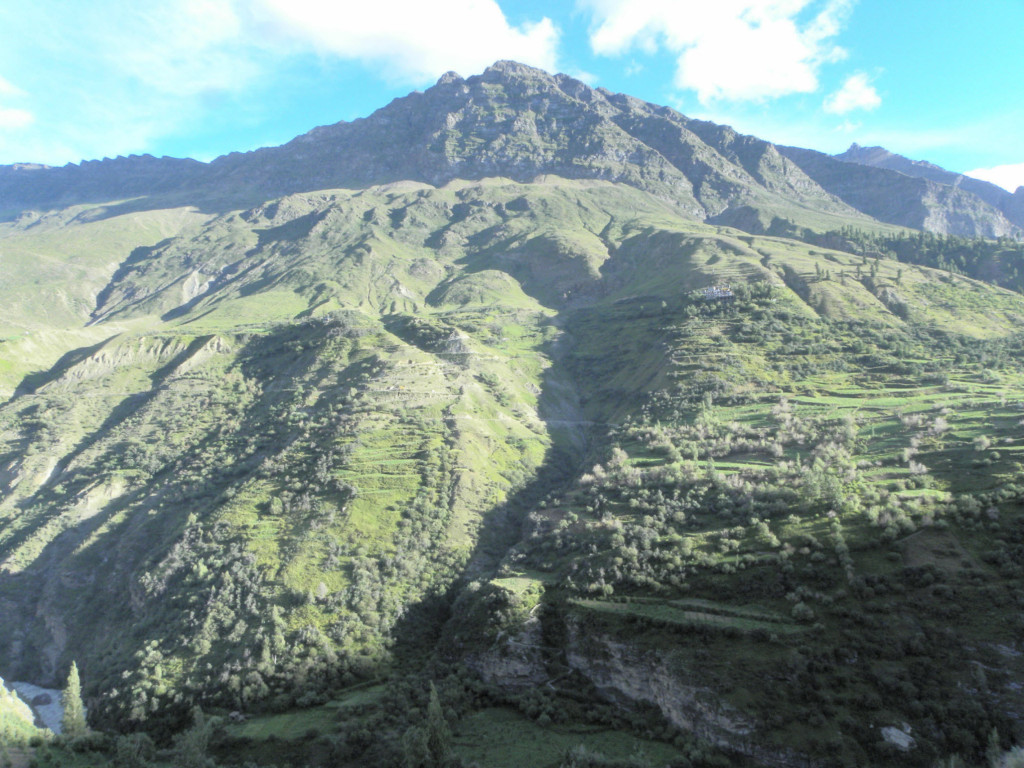
Miyar Valley is one of those rare Himalayan destinations that most people have never heard of. Tucked away in the northwest corner of Lahaul district in Himachal Pradesh, this S-shaped valley stretches over 100 km between Zanskar and Chamba. It is often called the “Valley of Flowers of Lahaul” by locals, and for good reason. Wildflowers carpet the meadows in summer, the Miyar Glacier feeds crystal-clear streams, and 15+ snow-covered peaks form a permanent backdrop. If you love remote treks away from crowds, Miyar Valley should be high on your list.
Last Updated: March 2026
What Makes Miyar Valley Special in 2026?
Miyar Valley is slowly gaining recognition among serious trekkers, but it remains far less crowded than Hampta Pass, Chandratal, or even Pin Parvati. The Atal Tunnel (opened in 2020) has cut travel time from Manali to the trailhead significantly, making the valley more accessible than ever before. Yet the valley itself remains untouched. There are no hotels, no restaurants, no network towers once you start the trek. Just 12 farming villages, about 3,000 inhabitants, Buddhist gompas, and some of the most spectacular high-altitude meadows in the entire Himalayas.
The Miyar Glacier, at nearly 30 km, is the second longest glacier in Himachal Pradesh. The sacred Kesar Yon Chhap (Seven Sacred Pools) near the glacier snout are revered in Buddhist tradition. Peaks like Mt. Menthosa (6,443 m, second highest in Lahaul), Castle Peak, and Tharang I, II, III surround you throughout the trek. Many of these peaks remain unclimbed.
Practical Info Box
| Detail | Info |
|---|---|
| Location | Miyar Valley, Lahaul, Himachal Pradesh |
| Trek Distance | ~60 km (round trip) |
| Duration | 7-9 days (trek) + 2 days travel |
| Highest Point | Miyar Glacier Snout, ~14,600 ft (4,450 m) |
| Difficulty | Moderate to Difficult (BRS 4) |
| Best Time | Mid-June to late September |
| Nearest Town | Udaipur, Lahaul (9,000 ft) |
| Starting Point | Shukto/Khanjar village |
| Permits | Forest department permit required. Children under 14 not permitted (since July 2024). Foreigners pay Rs 2,500 extra |
| Budget (with operator) | Rs 14,000-20,000 per person (all-inclusive trek package) |
| Budget (independent) | Rs 5,000-8,000 per person (food, camping, porter/guide) |
| Mobile Network | None on trek. Last signal at Udaipur (BSNL) |
Where Exactly Is Miyar Valley and How Do You Reach It?
Miyar Nala, as locals call it, is an exceptionally long valley that runs roughly northwest from the town of Udaipur in Lahaul. The Miyar River flows through this valley and joins the Chandra Bhaga River at Udaipur. The valley stretches over 100 km, with the Miyar Glacier at its head and the Kang La pass (17,600 ft) connecting it to Zanskar beyond.
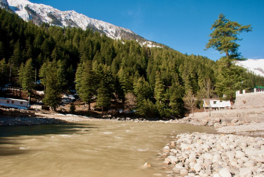
The approach is straightforward now, thanks to the Atal Tunnel. From Manali, you drive through the tunnel into Lahaul, pass Sissu waterfall and Tandi (last fuel pump before Udaipur), and then take the diversion towards Udaipur. The total drive from Manali to Udaipur is about 110 km and takes roughly 3 hours. I have covered an extensive guide on Lahaul Valley and the top sightseeing spots in Lahaul previously, so I will not go into the route details here.
From Udaipur, the road continues about 22-30 km into the valley to Shukto/Khanjar, which is the last motorable point. From here, the trek begins. Keep in mind that the road beyond Udaipur can be rough, especially during monsoon. A high-clearance vehicle is recommended.
How Do You Get to Manali?
Most trekkers start from Delhi or Chandigarh. You can take an overnight Volvo bus from Delhi to Manali (Rs 1,500-2,000 for HRTC Volvo, Rs 2,000-4,000 for private operators) or drive (~530 km, 12-14 hours). From Chandigarh, it is about 310 km to Manali. If you are planning a trip to Manali, that guide covers everything you need for the journey.
Who Are the People of Miyar Valley?
A narrow gorge near the lower end of the valley is home to 12 small farming villages, all lying between 9,300 and 11,500 ft. About 3,000 people currently live here. The villagers are mostly of Buddhist faith, and you will come across small gompas in the villages. The one in Urgos is particularly beautiful.
Cultivation of peas, barley, and grains is the main occupation, and farming ceases at about 12,000 ft. Crops include iceberg lettuce, seed potatoes, apples, sea buckthorn, cauliflower, asafoetida, and medicinal plants like Kuth (Saussurea lappa). The growing season is short, from June to September, and the sheer resilience of these villagers is humbling to witness.
What boggled my mind, particularly, was a cricket field here! No matter where you are in India, no matter what you are doing, if there is a field large enough, it will be converted into a cricket ground. So special! The views from the cricket ground are jaw-dropping too, with nearly 15 snow-covered peaks visible at all times.
What Flora and Fauna Will You See on the Miyar Valley Trek?
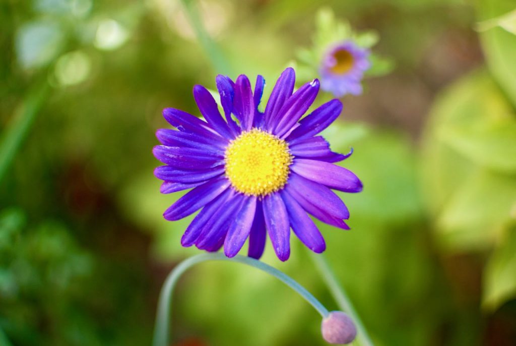
This is a huge draw for me personally. The valley supports an incredible diversity of high-altitude vegetation. You will see Juniper, Willow, Pine, Cedar, Birch, Alder, and Poplar trees, along with colorful orchids. In the summer months (July-August), rare Blue Poppies bloom in the higher meadows, and the entire valley turns into a carpet of wildflowers. Purple fleece flowers (Lupins) are especially common near the Tharang massif.
I encourage you to interact with the local shepherds (gaddi) when you meet them on the trail. They can share insights on the medicinal properties of the herbs you see and help you identify plants. If you are lucky, they will also share stories of leopard encounters and other folklore from the nomadic life. Keep your eyes peeled for the blue sheep (bharal) near Zardong. The valley is also home to snow leopards, Himalayan bears, and many species of migratory birds, though sightings require patience and luck.
What Is the Best Time to Visit Miyar Valley?
Mid-June to late September is the best window for the Miyar Valley trek. Here is a month-by-month breakdown to help you decide.
- Mid-June to early July: Snow begins to melt. The trail is accessible but some river crossings may be challenging. Fewer wildflowers. Good for those who want solitude.
- July to August: Prime time. Wildflowers are at their peak, including the rare Blue Poppy. Weather can be unpredictable with occasional rain, but the valley is at its most spectacular. This is also when most trek operators run their batches.
- September: Post-monsoon clarity. The skies are clearest, the views are sharpest, and the river crossings become easier. Nights get cold. Flowers begin to fade but the landscapes remain stunning.
- October onwards: Snow begins to set in. The trail becomes snowbound and inaccessible. Do not attempt the trek after late September.
Winter months are a complete no-go. The entire valley receives heavy snowfall and becomes inaccessible from late October through May.
What Is the Route for the Miyar Valley Trek?
The standard route follows the Miyar River valley in an out-and-back format. You go in along one side of the valley to the glacier snout, and return the same way. The key stops along the route are:


Shukto/Khanjar → Doksa → Yoling → Thanpattan → Gumba → Zardong → Phalpu → Kesar Yon Chhap → Miyar Glacier Snout (and then return via the same route)
The total trekking distance is approximately 60 km round trip, spread over 7-8 days of actual trekking. I recommend keeping 1-2 buffer days in case of weather delays. The route is well-defined along the river for most sections, but there are tricky boulder patches and river crossings that require attention.
How Does the Day-by-Day Itinerary for the Miyar Valley Trek Look?
- Day 0: Reach Manali. Rest and prepare.
- Day 1: Drive from Manali (6,725 ft) to Udaipur (9,000 ft). Distance: 110 km, Time: ~3 hours via Atal Tunnel. Acclimatization day. Spend the night at a guesthouse in Udaipur.
- Day 2: Drive from Udaipur to Shukto (22 km, ~50 min). Trek to Doksa (12,080 ft). Trek distance: 2 km, Time: 1.5 hours.
- Day 3: Doksa (12,080 ft) to Yoling (12,388 ft). Trek distance: 7.5 km, Time: 5 hours.
- Day 4: Yoling (12,388 ft) to Zardong (12,782 ft). Trek distance: 12 km, Time: 6-7 hours.
- Day 5: Zardong (12,782 ft) to Phalpu (13,008 ft). Trek distance: 7 km, Time: 3-4 hours.
- Day 6: Phalpu (13,008 ft) to Gumba (12,732 ft) via Miyar Glacier Snout (14,599 ft). Trek distance: 15 km, Time: 7-8 hours.
- Day 7: Gumba (12,732 ft) to Doksa (12,080 ft). Trek distance: 12 km, Time: 7-8 hours.
- Day 8: Doksa (12,080 ft) to Shukto (11,400 ft). Trek: 2 km, 1 hour. Then drive from Shukto to Manali (~150 km, 5 hours).
- Day 9: Buffer day or return home.
What Should You Expect on Each Day of the Miyar Valley Trek?
Day 1: Reaching Udaipur from Manali
The journey from Manali to Udaipur has become much easier since the Atal Tunnel opened. You drive through the 9.2 km tunnel and emerge in Lahaul, where the landscape changes dramatically. Gone are the lush green Kullu valley forests, replaced by the stark, arid beauty of Lahaul. Stop at Sissu waterfall for photos and at Tandi to fill up fuel (this is the last petrol pump). From Tandi, you take the left diversion towards Udaipur.

Spend the night in Udaipur, acclimatize, and relax. Udaipur is a small, charming town with basic guesthouses and a few eateries. There is not much to do here, but the surroundings are peaceful and the altitude adjustment is important before you start trekking.
Day 2: Head Towards Shukto, Then Trek to Doksa
Shukto is the last motorable village. Once you reach Shukto, you are starting the real journey. From the village, you cross a suspension bridge to enter the village of Khanjar, roughly 30 km from Udaipur. This village is fascinating. With cultivation only occurring from June to September, you will be impressed by the hard work of the villagers. After crossing the village, the trail takes you through farmlands up to your first campsite, Doksa.
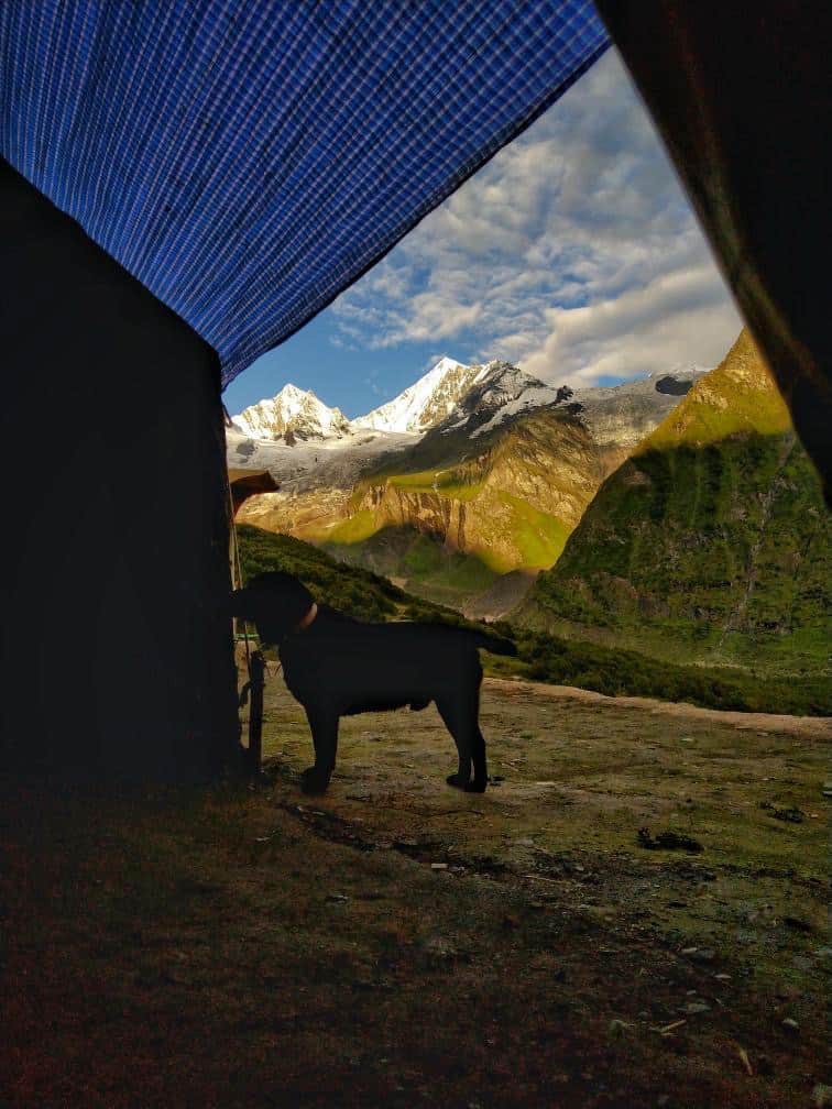
Doksa is a slice of heaven. The meadow here doubles as the local cricket ground (I told you, cricket finds its way everywhere in India!). The mountains around are steep and attractive to rock climbers. Spend the night here with Menthosa, the second highest peak of Lahaul and the crown of Miyar Valley, filling your view.
Day 3: Journey on to Yoling
Today’s trail takes you through multiple villages and farms, with a river bridge crossing early in the day. The path involves a series of descents and ascents on a well-defined trail. You will cross a stupa (the climb is steeper here but lasts only about half an hour). After the stupa, you enter Thanpattan and from here the terrain flattens into easy trekking across meadows.
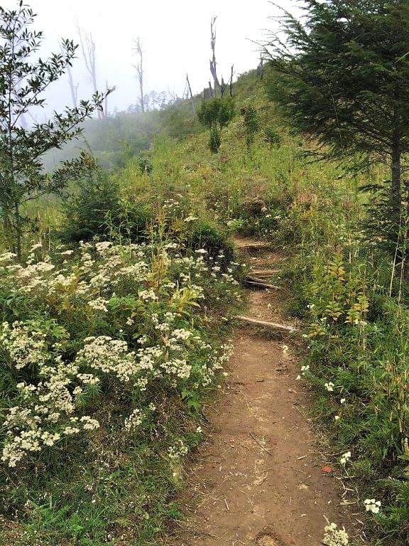
The highlight of today is the wildflowers. Multiple sections burst with flowers of different colors. The path past the Tharang massif is particularly beautiful, with purple Lupins growing in abundance. Your camp for the night is Yoling, which has a water crossing nearby. I hope you get a clear evening here, because the sunsets paint the mountains in colors that shift for hours.
Day 4: Head on to Zardong
The day starts with a level walk and then a steep climb lasting about 30 minutes. You will cross a bridge, climb to the Gompa, and pass a shepherd’s hut near the Gompa lake (fill your water supplies here). After the hut, the trail descends to a flat meadow before entering a challenging boulder section. This patch requires presence of mind as you navigate ascents and descents over loose rock.
Eventually, you reach the river. The sandy shores feel like a reward after the boulders. Walking along the gushing water with the valley widening around you is one of the defining experiences of this trek. The carpet of flowers on this section is unforgettable. You will cross the Gumba Nala and then follow the Miyar Nala northwest to Zardong, your campsite for the night.
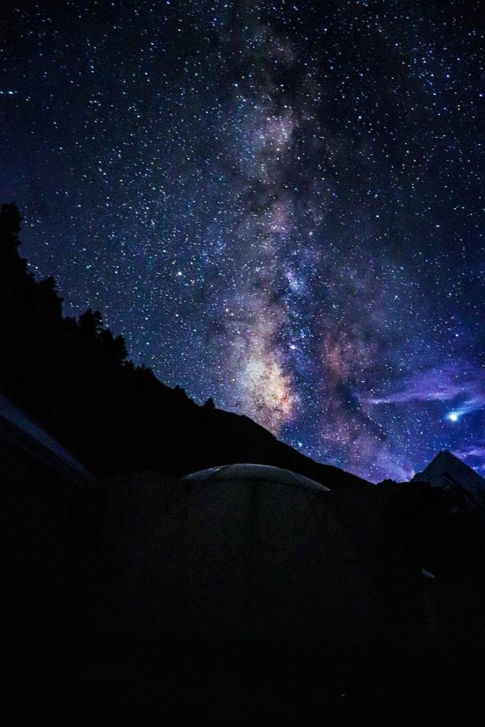
The night sky from Zardong will not let you sleep. With zero light pollution and peaks on all sides, this is one of the best stargazing spots I have experienced in the Himalayas. The entire day, the colors, the visuals, the experience, it is enough to leave even experienced mountain lovers spellbound.
Day 5: Zardong to Phalpu
Today covers about 15 km with a mostly level walk alongside the stream. You will cross a few patches with massive boulders. The highlight is Chhudong, a sprawling meadow right next to the river. The river is wider here than anywhere else on the trek, and the feeling is incredibly peaceful. I would recommend spending some time at Chhudong to soak in the views.
The route follows the river for most of this section, which makes navigation straightforward. After Chhudong, the gorge narrows and you pass through more boulder fields with some water streams to cross. Your campsite for the night is Phalpu, located near Castle Peak with views of Tharang Peaks and Mt. Menthosa.
Day 6: Phalpu to Gumba via Miyar Glacier Snout
This is the big day. You will reach the Miyar Glacier snout! The journey is moderately difficult with 3 icy river crossings and the usual boulder patches. After 5 days of walking deeper into the hills, you will be well-prepared physically.
After reaching the snout at about 14,600 ft, I highly recommend spending quality time here. The feeling of standing next to a massive glacier with almost no one around is hard to describe. The last meadow before the glacier is located about 30 minutes from the snout, near the seven sacred pools, Kesar Yon Chhap. These glacial pools shimmer in shades of emerald and turquoise. They are deeply revered in Buddhist tradition, and you are allowed to take a dip for blessings.
The return follows the same route. You will cross two more river crossings and navigate boulders past Chhudong before reaching Gumba, your final campsite. The vantage point here offers views of both sides of the valley.
Day 7: Gumba to Doksa
The return journey begins in earnest. The end of any trek is bittersweet. You have gained so much, yet the feeling of leaving a part of yourself behind is strong. The route today retraces your steps and is noticeably easier going back. Enjoy your final night at Doksa.
Day 8: Doksa to Shukto, Then Drive to Manali
Only 2 km on foot and you are back in Shukto. From here, drive back to Manali and enjoy readjusting to civilization. If you have a buffer day, spend it in Manali. The town has plenty to offer after a week in the wilderness. For things to do there, check out our complete Manali travel guide.
How Much Does the Miyar Valley Trek Cost in 2026?
The cost depends heavily on whether you go with a trek operator or do it independently. Here is a rough budget breakdown.
With a Trek Operator (All-Inclusive Package)
| Item | Cost (per person) |
|---|---|
| Trek package (7-8 days, includes camping, food, guide, permits) | Rs 14,000 – 20,000 |
| Transport: Manali to trailhead and back | Rs 1,500 – 3,000 (shared) |
| Delhi to Manali bus (round trip) | Rs 3,000 – 8,000 |
| Udaipur guesthouse (1 night) | Included in most packages |
| Trek insurance | Rs 210+ |
| Luggage offloading (if needed) | Rs 500/bag/day |
| Total (approx.) | Rs 20,000 – 32,000 |
Independent Trek (With Local Guide/Porter)
| Item | Cost (per person) |
|---|---|
| Local guide/porter | Rs 1,500 – 2,500/day |
| Food and supplies (8-9 days) | Rs 3,000 – 5,000 |
| Camping gear (if renting) | Rs 500 – 1,000/day |
| Transport (Manali-Udaipur-Shukto round trip) | Rs 2,000 – 4,000 (shared Sumo/Tempo) |
| Udaipur guesthouse | Rs 500 – 1,500/night |
| Permits and fees | Rs 200 – 500 (Indians), Rs 2,500+ (foreigners) |
| Total (approx.) | Rs 15,000 – 30,000 |
For a detailed guide on calculating your Lahaul trip budget, check our dedicated cost guide.
What Should You Carry for the Miyar Valley Trek?
Packing smart is critical for a remote trek like Miyar Valley. Here is what you need.
- Clothing: Layering system. Base layer (thermals), insulating layer (fleece/down jacket), outer shell (waterproof jacket). Quick-dry trekking pants. Warm cap, gloves, buff. Extra socks (wet feet are your enemy during river crossings).
- Footwear: Sturdy trekking shoes with ankle support and good grip. Waterproof preferred. Carry sandals for river crossings and camp.
- Camping gear: If going independent, you need a 3-season tent, sleeping bag rated to -10C, sleeping mat, and headlamp. Most operators provide all of this.
- Power: There is no electricity on the trek. The only charging point is Udaipur (before and after the trek). Carry 2-3 power banks. Remember, batteries drain faster in cold weather.
- Food and water: If independent, carry enough rations for 8-9 days. Water purification tablets are essential. The streams are clean but always purify.
- Other essentials: Sunscreen (SPF 50+), sunglasses, first aid kit, trekking poles, rain cover for backpack, dry bags for electronics.
For trekking-specific packing advice, check out our guide on trekking in the Himalayas.
What Are the Key River Crossings and Challenges on This Trek?
One of the features that sets the Miyar Valley trek apart from most Himalayan treks is the sheer number of river crossings. Throughout the journey, you will cross many wooden bridges over the Miyar River. The river is in full force during summer, and crossing these bridges while hearing the water roar beneath you is thrilling.
There are at least two sections where there are no bridges, and you cross the river itself. These are not dangerous for experienced trekkers, but you need to keep your wits about you. Use trekking poles for balance, unfasten your backpack chest strap (so you can drop it if you lose footing), and wear sandals or shoes with good grip. The water is glacial and numbingly cold.
The boulder sections between Gumba and Zardong can also be challenging. You will navigate over loose rocks with frequent ascents and descents. Take your time on these sections. If you have done treks like Hampta Pass before, the difficulty level is comparable but sustained over more days.
Can You Do the Miyar Valley Trek Solo or Without a Guide?
The trek can be done solo, but only by seasoned trekkers who have exceptional understanding of Himalayan routes and terrain. The route along the river is fairly well-defined, but once you get into the boulder sections, it can be confusing. There are no trail markers, no signboards, and no fellow trekkers to ask for directions on most days.
If you are new to multi-day Himalayan treks, I highly recommend going with a local guide. This also ensures you have access to sufficient food and supplies. A local guide from Udaipur or Khanjar typically charges Rs 1,500-2,500 per day and knows the terrain intimately.
Since July 2024, the Himachal Pradesh tourism department has prohibited children under 14 from doing this trek (following the Sahastra Tal incident). Trek insurance and a medical fitness certificate are now mandatory for getting the forest permit. Keep this in mind during your planning.
What About the Sacred Kesar Yon Chhap Pools?
Near the snout of the Miyar Glacier, at Phalpu, you reach the Kesar Yon Chhap, seven sacred glacial pools. These pools shimmer in shades of emerald green and turquoise blue, and are highly revered in the Buddhist tradition. You are allowed to bathe or dip in them for blessings and prayers. The water is ice-cold (as you would expect from a glacial source), but the experience is deeply spiritual and one of the highlights of the entire trek.
On all sides, unclimbed snow-covered peaks surround you. The proximity of the Castle Peak, Never Seen Tower, and the Tharang group makes this one of the most awe-inspiring amphitheaters in the Indian Himalayas.
How Does the Miyar Valley Compare to Other Lahaul Treks?
If you are deciding between Miyar Valley and other treks in the Lahaul-Spiti region, here is a quick comparison.
| Feature | Miyar Valley | Hampta Pass | Chandratal (drive-in) |
|---|---|---|---|
| Duration | 7-9 days | 4-5 days | 2-3 days |
| Difficulty | Moderate-Difficult | Moderate | Easy (no trek) |
| Crowds | Very few | Popular | Popular |
| Wildflowers | Spectacular | Good | Limited |
| Glacier | Yes (30 km long) | No | Nearby |
| Best for | Solitude seekers, experienced trekkers | First-timers, short trips | Weekend trips, photography |
For other things to see in the region, check our guide on common Lahaul Valley itineraries and planning a weekend trip to Lahaul.
What Are Some Important Tips for the Miyar Valley Trek?
- Keep buffer days: Weather in the valley can change rapidly. Keep 1-2 extra days in your itinerary. If not needed, spend them in Manali.
- Acclimatize properly: Spend at least one night in Udaipur before starting the trek. The trailhead is already at 11,000+ ft, so do not rush.
- Fill fuel at Tandi: If driving, Tandi is the last fuel pump before Udaipur and well into the valley. Do not forget this.
- Carry cash: There is no ATM in Udaipur or beyond. The nearest ATM is in Keylong, about 50 km from Udaipur. Carry enough cash for the entire trek.
- No mobile network on trek: BSNL works in Udaipur (intermittently). Beyond Shukto, there is zero mobile connectivity. Inform your family about the communication blackout before you leave.
- Respect the culture: The Buddhist gompas and the sacred Kesar Yon Chhap pools are deeply significant to locals. Dress modestly, ask before photographing people, and do not litter.
- Waste management: Carry all your waste back. This is a pristine valley and it needs to stay that way. No plastic, no wrappers left behind.
Frequently Asked Questions
How difficult is the Miyar Valley trek?
The Miyar Valley trek is rated moderate to difficult (BRS 4). It involves sustained walking over 7-8 days at altitudes between 12,000 and 14,600 ft, with multiple river crossings and boulder sections. You should have completed at least one multi-day Himalayan trek (like Hampta Pass or Kedarkantha) before attempting Miyar. If you can jog 4 km in 30-35 minutes, your fitness level should be adequate.
Do I need a permit for Miyar Valley trek?
Yes. You need a forest department permit. Trek operators typically arrange this for you. Independent trekkers can get the permit from the forest office in Udaipur. Foreign nationals pay an additional Rs 2,500. Since July 2024, a medical fitness certificate and trek insurance are mandatory. Children under 14 are not permitted on this trek.
Is there mobile network on the Miyar Valley trek?
No. There is zero mobile connectivity once you cross Udaipur. BSNL works intermittently in Udaipur, but beyond Shukto there is no signal at all. Inform your family before you leave and carry a satellite phone if you want emergency communication.
Can beginners do the Miyar Valley trek?
This is not recommended for first-time trekkers. The trek is long (7-8 days), remote, and involves challenging terrain including boulder fields and river crossings. Beginners should start with easier treks like Beas Kund or Bhrigu Lake before attempting Miyar Valley.
What is the best month for the Miyar Valley trek?
July and August are the best months if you want to see the valley at its most spectacular, with wildflowers in full bloom including the rare Blue Poppy. September offers clearer skies and easier river crossings but fewer flowers. Mid-June is also viable but trails may still have residual snow.
How do I reach the Miyar Valley trek starting point?
From Delhi, take an overnight bus or drive to Manali (530 km, 12-14 hours). From Manali, drive through the Atal Tunnel to Udaipur (110 km, 3 hours). From Udaipur, drive to Shukto/Khanjar (22-30 km, 50 min). This is the trek starting point. If going with an operator, transport from Manali is usually included.
Is there accommodation in Udaipur, Lahaul?
Yes. Udaipur has basic guesthouses and homestays. Expect to pay Rs 500-1,500 per night. The options are simple but adequate for one night before and after the trek. There is no accommodation beyond Shukto, only campsites.
What is the Kang La Pass and can I cross it?
Kang La (17,600 ft / 5,364 m) is the high pass at the head of the Miyar Valley that connects to Zanskar Valley in Ladakh. Crossing Kang La turns this into a full trans-Himalayan expedition of 12-15 days and is only for very experienced mountaineers with proper permits and equipment. The standard Miyar Valley trek goes up to the glacier snout and returns, without crossing Kang La.
Final Thoughts
It is hard to describe the feeling of being in a place so untouched. With no one around for miles, the silence is almost overwhelming at first, and then deeply calming. Miyar Valley is not for everyone. It is long, remote, and physically demanding. But if you are the kind of person who finds joy in solitude, in watching flowers bloom at 13,000 ft, in sleeping under stars that seem close enough to touch, this valley will give you memories that last a lifetime.
As always, if you have any questions about the Miyar Valley trek or need help planning your itinerary, feel free to drop a comment below or reach out through the DwD YouTube channel. The community here is always happy to help fellow travelers. Happy trekking, my friend! 🙂