


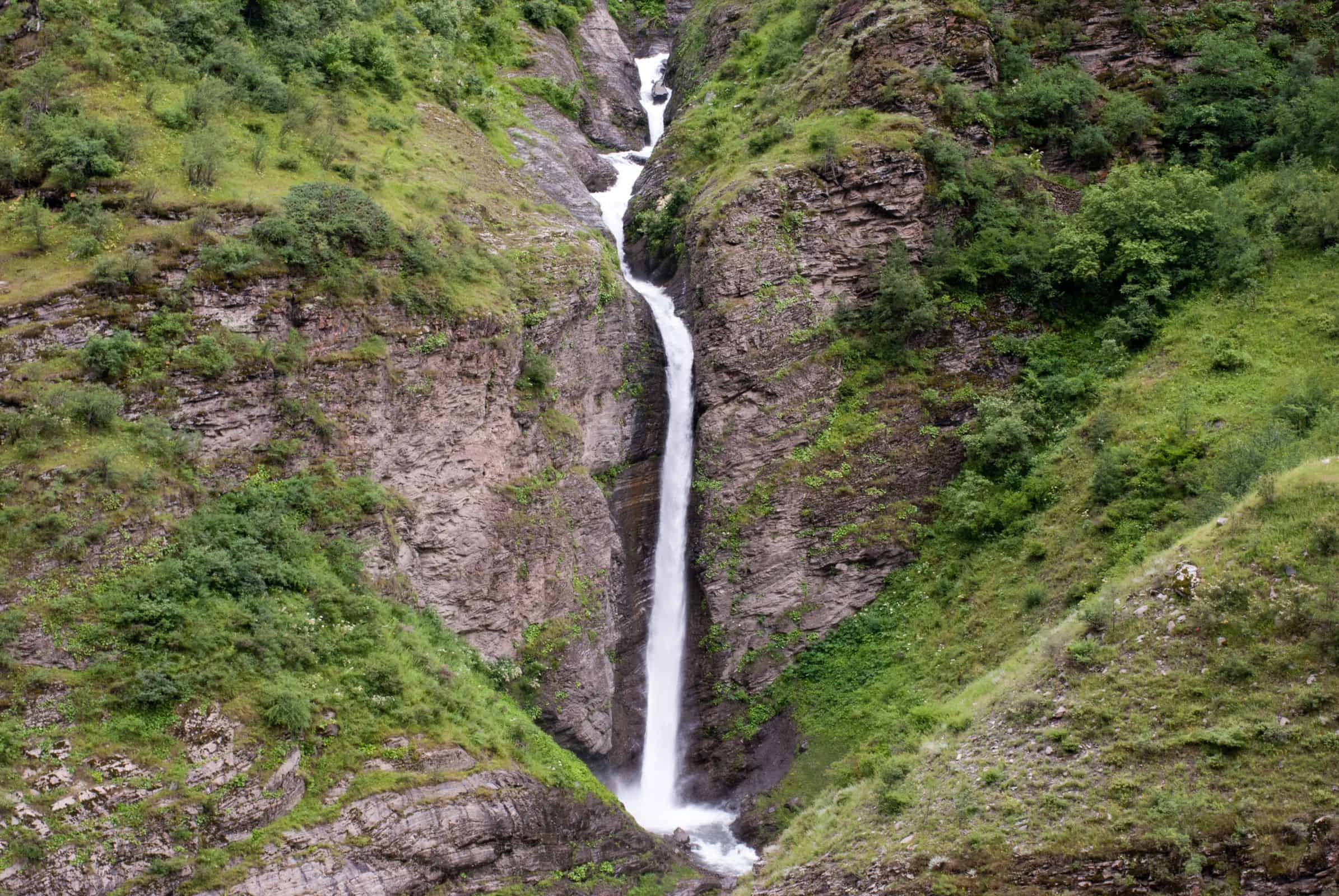
The Killar to Kishtwar road is not just another mountain road. It is a 114 km stretch of raw, unpaved trail carved into vertical cliff faces, with a 1,000 ft drop straight into the Chenab river on one side and overhanging rock on the other. Officially part of National Highway 26, this road has earned its reputation as one of the most dangerous roads in the world. I have driven through some of the toughest roads in the Himalayas, but let me tell you, the Killar to Kishtwar road is in a league of its own.
Last Updated: July 2026
Quick Facts: Killar to Kishtwar Road
Distance: 114 km, 7-10 hours
Status (July 2026): Open, monsoon caution advised
Best time: Mid-June to early September
Vehicle: High-clearance SUV (4×4) or motorcycle only
Fuel: None between Killar and Gulabgarh (about 65 km), carry extra
Permits: None for Indian nationals
Mobile network: BSNL only, patchy to none for most of the route
Kishtwar sits about 112 km from the Himachal Pradesh border at Sansari Nallah, the boundary point on the Kishtwar-Killar road. BRO restored this stretch, including a section at 8,759 ft, on 1 February 2026 after 4-5 feet of January snowfall closed it, reconnecting Jammu and Kashmir’s Chenab valley with Himachal Pradesh.
Let's quickly dive into the details:
What Makes the Killar to Kishtwar Road So Dangerous?
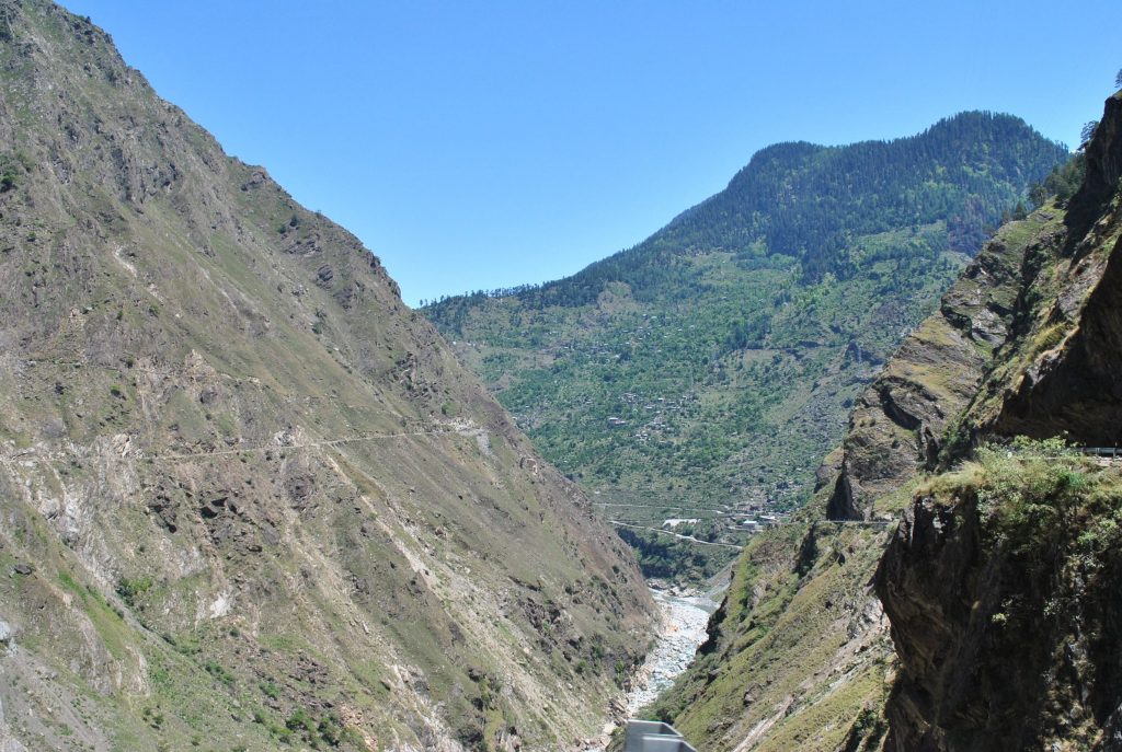
The road connects Killar in Pangi Valley (Himachal Pradesh) to Kishtwar in Jammu and Kashmir. It runs along the Chenab river gorge at elevations ranging from 2,524 m (8,280 ft) at Killar to 1,638 m (5,374 ft) at Kishtwar. The entire stretch is a single-lane track made of loose gravel, rocks, and sand, literally kissing the side of a cliff. There are no crash barriers, no guardrails, and at several points, the road is barely wide enough for one vehicle to pass.
The vertical drop of hundreds of meters into the Chenab river below is constant throughout. Add to that frequent landslides, overhanging rocks that obstruct your view of oncoming traffic, and blind turns that can stop your heartbeat, and you understand why this road has been nicknamed “The Cliffhanger” by the Border Roads Organization (BRO) themselves. Some travelers have also called it the “Almost Killer Road,” which honestly feels accurate once you have been on it. BBC Science Focus Magazine lists it among the world’s most dangerous roads too, and its own reporting confirms exactly what I keep telling readers, drivers often have to reverse for hundreds of meters, sometimes close to a kilometer, just to find a spot wide enough for oncoming traffic to pass.
Quick Answer: The Killar to Kishtwar road is dangerous because it is a single-lane, unpaved cliff-edge track with a 1,000 ft drop into the Chenab river, no guardrails, blind turns, and frequent landslides. Vehicles that meet head-on often have to reverse close to a kilometer to find a passing spot. This is not exaggeration for effect, it is the daily reality of the route.
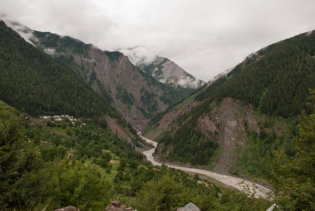
How Do You Reach the Killar to Kishtwar Road?
There are two primary approaches to this road, depending on your direction of travel. Most travelers coming from Himachal Pradesh will reach Killar via Sach Pass, starting from Chamba or Dalhousie. Sach Pass reopened for the 2026 tourist season in mid-May, though different reports quoted the exact reopening day anywhere between 15 and 17 May, which is normal for a pass this remote. The Sach Pass route itself is demanding, crossing the pass at 14,528 ft (4,429 m), but after you reach Killar and think the tough part is over, the Killar to Kishtwar road raises the bar even further.
If you are coming from the Jammu side, you would drive from Jammu to Kishtwar (235 km, roughly 8-9 hours) and then take the road towards Killar. However, most travelers prefer the Killar to Kishtwar direction because it connects naturally with the Pangi Valley circuit.
The common itinerary looks like this: Delhi to Chamba, Chamba to Killar via Sach Pass, spend a day exploring Pangi Valley, and then take the Killar to Kishtwar road to exit into Jammu and Kashmir. From Kishtwar, you can continue to Srinagar or head back to Jammu. In case you want a compressed itinerary rather than a long trip, I have also written a separate guide on how to do the Sach Pass trip in just 4-5 days, which some travelers combine with a quick Killar-Kishtwar exit.
Quick Answer: Most travelers reach Killar from Chamba or Dalhousie via Sach Pass (open roughly mid-May to October), then drive the Killar to Kishtwar road onward into Jammu and Kashmir. Coming from the Jammu side, you drive Jammu to Kishtwar (235 km) first and then head towards Killar.
Is There an Alternate Route to Killar via Manali and the Pangi Valley Road?
Yes, and many self-drive groups from Manali and Lahaul use it. Instead of crossing Sach Pass from the Chamba side, you can reach Killar from the Manali side via Udaipur and Tandi, on what locals call the Kullu-Pangi road (also referenced as the Sansari-Kilad-Thirot-Tandi-Udaipur-Killar stretch). This route lets you combine a Lahaul-Spiti trip with a Pangi Valley exit through Kishtwar, without needing to backtrack to Chamba at all.
Keep in mind, my friend, that I am not sugarcoating this alternate route either. On 24 July 2026, a devastating rockfall struck a taxi on the Udaipur-Killar road near Kadoonala in Himachal’s Lahaul-Spiti district, killing 13 people including a newborn. I want to be very clear here: this incident happened on the Himachal-side approach road that leads into Killar, not on the Killar-Kishtwar stretch that is the subject of this article. But the two are close cousins in terms of terrain, and the news is a sober reminder that this entire Pangi-Chenab basin, on both sides of Killar, sees regular rockfall and landslide activity through the monsoon. If you are choosing between the Sach Pass approach and the Manali-Udaipur approach, check current conditions on both before committing, and never assume that because one road is officially “open,” it is free of loose rock overhead.
Quick Answer: Yes, you can reach Killar from Manali via Udaipur and Tandi (the Kullu-Pangi road) instead of Sach Pass. This is a separate road from the Killar-Kishtwar stretch, but it runs through similarly landslide-prone terrain, including the site of a fatal rockfall in July 2026, so treat it with the same caution.
What Is Kishtwar Like as a Destination?
Kishtwar officially became a district in 2007. Known as the “Land of Sapphire and Saffron,” this town sits at an elevation of 1,638 m (5,374 ft) and is situated 235 km from Jammu. For decades, this region was virtually cut off from the rest of the world, and it remained closed to mountaineers for political reasons since the early 1990s. The construction of the Killar to Kishtwar road, despite its dangerous condition, has been a lifeline for the local population, connecting them to healthcare, education, and commercial activity.
A huge salute to the Border Roads Organization and J&K PWD who have done a remarkable job constructing roads in the middle of nowhere. A record number of workers have sacrificed their lives to make this road a reality. Keep in mind that what you call an “adventure” has come at a significant human cost. Respect the struggle and be grateful for the access you have today.
Kishtwar is also the gateway to Kishtwar Kailash (6,451 m), a stunning mountain that draws serious mountaineers. The town has basic accommodation options, a petrol pump, a district hospital, and a few restaurants. If you are continuing towards Srinagar, Kishtwar is a good place to rest for a night before the onward journey.


Quick Answer: Kishtwar is a district town at 5,374 ft, known as the Land of Sapphire and Saffron and the gateway to Kishtwar Kailash peak. It has basic hotels, a petrol pump, a district hospital, and restaurants, making it a sensible overnight stop before continuing to Srinagar.
What Are the Road Conditions on the Killar to Kishtwar Route in 2026?
The road is “constructed” of rocks, loose soil, and compacted gravel. There is no tarmac for most of the stretch. BRO has been working on blacktopping key stretches, particularly the 26 km section from Purthi to Killar, assigned to the 108 RCC 759 Border Roads Task Force. The SKTT (Sarthal-Killar-Tandi-Thallog) road, approximately 140 km long, is strategically vital for connecting the landlocked Pangi Valley with the rest of the country via Kishtwar and through the Atal Tunnel to Manali. As of December 2025, BRO officials reaffirmed their commitment to durable, all-weather road infrastructure on this stretch, calling it a lifeline for the people of Pangi and Lahaul, though the work continues to move slowly given the terrain and the short working season.
However, keep in mind that the improvements are gradual. As of July 2026, the road is open and passable, but large sections remain unpaved and prone to landslides, especially during the monsoon months (July to September). In January 2026, heavy snowfall of 4 to 5 feet blocked the road for several days, and BRO teams had to clear fresh snow accumulation before restoring connectivity. The road condition is never constant, and a stretch that was fine last week might be gone after one landslide. Hence, I always suggest checking the India Meteorological Department forecast for the Chenab valley belt a day or two before you set out, on top of calling local contacts in Killar.

Quick Answer: As of July 2026, the Killar to Kishtwar road is open but still largely unpaved, with BRO blacktopping ongoing on the 26 km Purthi-Killar stretch. Monsoon months (July-September) bring the highest landslide risk, and a fresh January 2026 snowfall of 4-5 feet had briefly blocked the road, so conditions can change within days.
What Are the Key Stops Between Killar and Kishtwar?
The 114 km journey is not a non-stop drive. You will pass through several small settlements and checkpoints along the way. Here are the notable ones:
- Killar (8,280 ft / 2,524 m): The starting point in Pangi Valley. Killar is the sub-divisional headquarters with basic shops, a petrol pump (not always stocked, carry extra fuel), and a few guesthouses.
- Atholi: A small village about 30 km from Killar. This is where the road starts getting progressively worse.
- Ishtiyari: A checkpoint on the route. The stretch after Ishtiyari is particularly narrow and terrifying.
- Sansari Bridge: A critical crossing point. In 2025, BRO rebuilt a bridge here in just 3 days after it was damaged. This is the Himachal Pradesh, Jammu and Kashmir state boundary area.
- Gulabgarh (Paddar): About 50 km before Kishtwar. This is a relatively bigger settlement with accommodation options including the Forest Rest House and a Yatri Bhawan. During the annual Machail Mata Yatra, langars (free food points) are set up along the route. For 2026, the Yatra was officially scheduled for 25 July to 8 September, though heavy weather pushed the actual start to 27 July. Pilgrim movement is restricted to 5 AM-5 PM each day, a daily cap of 8,000 pilgrims applies, and online registration with a mandatory RFID tag is required through the official Machail Mata Yatra portal. Expect heavier traffic and pilgrim vehicles around Gulabgarh through this window.
- Kishtwar (5,374 ft / 1,638 m): The endpoint. District hospital, petrol pump, hotels, and restaurants available.
Quick Answer: The key stops are Killar, Atholi, Ishtiyari, Sansari Bridge (the Himachal-J&K boundary), Gulabgarh (Paddar), and Kishtwar. Gulabgarh sees a big seasonal spike during the Machail Mata Yatra (25 July-8 September 2026), which brings langars, pilgrim traffic, and mandatory RFID checks to the area.
How Did the 2025 Kishtwar Flash Flood Affect This Region, and Is It Safe to Travel Now?
I would be doing you a disservice, my friend, if I skipped this. On 14 August 2025, a devastating cloudburst struck Chositi village (also spelled Chashoti) in the Padder valley, along the Machail Mata Yatra pilgrim trail beyond Gulabgarh. According to Wikipedia’s documented account and contemporary news reporting, the flash flood killed 68 people, injured around 300, and left at least 38 missing, with a community kitchen serving roughly 200 pilgrims swept away entirely.
To be honest and precise about this, that tragedy occurred on the pilgrim foot-trail beyond Gulabgarh, not on the Killar to Kishtwar vehicle road that is the subject of this article. I do not want to conflate the two and cause unnecessary panic. However, both sit in the same monsoon-battered Chenab and Padder river system, and the event is a genuine reminder of how violently weather can turn in this entire belt during July and August. If you are driving through Gulabgarh during Yatra season, or if you plan to walk any part of the Machail trail, take every local weather advisory seriously, avoid river-adjacent camping, and do not push through if administration or BRO signals a halt.
Quick Answer: A cloudburst on 14 August 2025 killed 68 people at Chositi village on the Machail Mata pilgrim trail beyond Gulabgarh, not on the Killar-Kishtwar vehicle road itself. The vehicle road remains open and driveable, but this event is a reminder to take monsoon weather advisories seriously in this entire river basin.
What Should You Keep in Mind Before Starting the Journey?
While being alert at all times is necessary, there are several things you must prepare for before embarking on this 114 km journey. I cannot stress this enough, my friend: this road is not for novice drivers.
Road and Driving Skills Required
The entire journey is tough and will test your nerves. The last 50 km of the road to the start of the descent towards Kishtwar will prove to be the hardest. Pictures and videos cannot do justice to the fear you will experience. All your senses will be at maximum alert, and you will be evaluating every inch of road in real time.
Several sections are so narrow that only one vehicle can pass at a time. If two vehicles meet head-on, one has to reverse for sometimes a kilometer or more to find a spot wide enough to pass. Doing this on winding, narrow roads with a 1,000 ft drop requires professional-level skills. In case you are not completely confident in your ability to reverse while maintaining balance in extremely tight spaces, then do not attempt to drive here. I am not saying this to scare you, I am saying this because one mistake here can be fatal.
Cars rarely take this route. Buses definitely do not. The turns are sharp with plenty of blind spots. If you are riding a motorcycle, the loose gravel and steep inclines make it equally challenging. Make sure your brakes are in perfect condition.
Quick Answer: You need professional-level reversing and single-lane driving skills, since two vehicles meeting head-on means one reverses up to a kilometer on a cliff edge to find a passing spot. This is not a road for first-time Himalayan drivers.
Weather and Best Time to Travel
The road is open only from June to October (sometimes mid-November if the winter is delayed). The best window to attempt this drive is between mid-June and early September, after BRO has cleared the route post-winter. However, keep in mind that the monsoon months (July-August) bring their own challenges with landslides and slippery conditions.
The road gets especially slippery and muddy after rain. During and after a storm, the road may become impassable, even with a four-wheel-drive vehicle. Hence, always check weather conditions before starting, ideally through the IMD’s official forecast for the region, and not just a generic weather app. Another thing to remember: this journey should only be made during daylight hours. There is no lighting on the road, and attempting this in the dark is suicidal.
Quick Answer: The road is open June to October, with mid-June to early September as the safest window. Avoid driving during or right after monsoon rain, and never attempt this journey after dark since there is no lighting anywhere on the route.
Health and Physical Fitness
If you are prone to vertigo, or if you are feeling the effects of AMS, avoid embarking on this journey. Killar sits at 8,280 ft and you would have crossed Sach Pass at 14,528 ft to get there, so altitude sickness is a real concern. Also, if there are passengers in your vehicle who get car sick or have mountain sickness, it would be better to wait it out and only start the journey when everyone is at their best.
You will not be able to stop in the middle of your journey at many places. And even if you plan on stopping, the scary cliff edge will make your nausea worse. This is not the journey for people who are scared of heights or are claustrophobic. With a vertical drop of thousands of feet straight into the Chenab river, it is reserved for the brave hearts.
Quick Answer: Skip this drive if you have vertigo, active AMS symptoms, or a fear of heights. You cannot stop comfortably along most of the route, and the constant cliff-edge exposure will make any nausea or altitude sickness worse.
Fuel and Supplies
There is no petrol pump between Killar and Gulabgarh (roughly 65 km). The petrol pump in Killar may not always be operational, so I strongly recommend carrying extra fuel. If you are riding a motorcycle, a 5-liter jerry can is sufficient. For cars and SUVs, carry at least 10 liters extra. You can read my detailed guide on how to carry extra fuel safely on your motorcycle for more tips.
Carry enough food and water for the full day. There are a few small dhabas at Gulabgarh and along the route during the Machail Yatra season (July-August), but do not rely on finding food along the way. Packaged snacks, biscuits, and filled water bottles are essential.
Quick Answer: There is no reliable fuel between Killar and Gulabgarh (about 65 km). Carry a 5-liter jerry can on a motorcycle or 10 liters extra in a car or SUV, plus a full day’s food and water, since you cannot count on finding either along the way.
What Vehicle Is Best for the Killar to Kishtwar Road?
A high-ground-clearance SUV or a motorcycle with good suspension is the best choice. Sedans and low-clearance cars should not attempt this road. The rocky terrain and sharp gradients will damage low-sitting vehicles. If you are driving an SUV, a 4×4 is strongly recommended, especially during the monsoon when the road gets muddy.
Motorcycles are actually a popular choice for this route because they are easier to maneuver on the narrow stretches. However, the loose gravel on steep inclines can be treacherous. If you are on a motorcycle, keep these things in mind:
- Ensure your brakes (especially rear) are in perfect working condition
- Ride in first or second gear throughout
- Avoid hard braking on gravel, use engine braking
- Keep your feet ready for support on steep sections
- Do not ride side by side, always maintain single file
- Read my guide on packing for long-distance motorcycle rides before you go
Quick Answer: A high-clearance 4×4 SUV or a motorcycle with good suspension are your only sensible options. Sedans and low-clearance hatchbacks will get damaged or stuck on the rocky, gravelly surface.
How Long Does the Killar to Kishtwar Journey Take?
The 114 km journey takes anywhere from 7 to 10 hours depending on road conditions, vehicle type, and how many times you need to stop to let oncoming traffic pass. Do not plan this as a half-day drive. Start early in the morning (6-7 AM from Killar) so you have enough daylight to complete the journey.
Here is a rough time breakdown:
- Killar to Atholi: 30 km, 2-3 hours
- Atholi to Ishtiyari: 25 km, 2-3 hours (worst section)
- Ishtiyari to Gulabgarh: 30 km, 2-3 hours
- Gulabgarh to Kishtwar: 29 km, 1.5-2 hours (relatively better road)
The speeds on most of this road average 10-15 km/h. Yes, that slow. There are sections where you will be crawling at 5 km/h because one wrong turn of the steering wheel means a 1,000 ft drop. Hence, patience is not optional here, it is survival.
Quick Answer: Budget 7-10 hours for the full 114 km, starting by 6-7 AM. Average speed is only 10-15 km/h, dropping to 5 km/h on the worst stretches, so this cannot be rushed or treated as a half-day drive.
Is the Killar to Kishtwar Road Worth the Risk?
This is a road hacked across a vertical cliff face, and driving it is a spine-tingling mix of exhilaration and genuine fear. The views of the Chenab river gorge are otherworldly, but let me promise you, you definitely will not be admiring those views while driving. Not if you want to survive this journey.
If you are an experienced driver or rider, if you have driven tough Himalayan roads like the Sach Pass route or the Manali to Leh highway, and if you are comfortable with heights and narrow single-lane roads, then yes, this is an experience worth having. There is nothing quite like the raw, unfiltered adventure of the Cliffhanger road.
However, if you are a first-time Himalayan driver, or if you have never driven on unpaved mountain roads before, please skip this one. There is absolutely no shame in knowing your limits. The road will always be there for another day when you are ready. Your safety matters more than any story you want to tell.
Quick Answer: It is worth it only if you are already an experienced Himalayan driver comfortable with narrow, single-lane cliff roads. First-time Himalayan drivers should build experience elsewhere first and come back to this road later.
Quick Practical Information
Here is a summary of essential details for planning your Killar to Kishtwar journey:
| Detail | Information |
|---|---|
| Total Distance | 114 km (Killar to Kishtwar) |
| Time Required | 7-10 hours |
| Road Surface | Unpaved gravel, rocks, loose soil (BRO blacktopping in progress on Purthi-Killar stretch) |
| Killar Elevation | 8,280 ft (2,524 m) |
| Kishtwar Elevation | 5,374 ft (1,638 m) |
| Road Status (July 2026) | Open, monsoon caution advised |
| Road Open | June to October (weather dependent) |
| Best Time | Mid-June to early September |
| Machail Mata Yatra 2026 | 25 July-8 September (started 27 July due to weather), heavy traffic near Gulabgarh |
| Fuel Availability | Killar (unreliable), Kishtwar (available). Carry extra fuel. |
| Mobile Network | BSNL (patchy). No network for most of the route. |
| Nearest Hospital | District Hospital Kishtwar |
| Recommended Vehicle | High-clearance SUV (4×4) or motorcycle |
Frequently Asked Questions
Is the Killar to Kishtwar road open in 2026?
Yes, as of July 2026 the road is open. It typically opens by mid-June after BRO clears winter snow and debris and remains open until October or early November depending on early snowfall. In January 2026, heavy snowfall of 4-5 feet blocked the road for several days. Always check with BRO or local authorities in Killar before starting, since conditions change quickly during monsoon.
Can I drive a car on the Killar to Kishtwar road?
Only high-ground-clearance SUVs should attempt this road. Sedans and hatchbacks will get stuck or damaged on the rocky terrain. A 4×4 vehicle is strongly recommended, especially during monsoon when the road gets muddy. Cars with low clearance should not attempt this route under any circumstances.
Is there any public transport on the Killar to Kishtwar road?
No. There is no regular bus service on this route. The road is too narrow and dangerous for buses. You need your own vehicle, either a motorcycle or an SUV, or you can try to arrange a shared ride with locals. However, even local vehicles are mostly jeeps and pickup trucks.
Do I need any permits for the Killar to Kishtwar road?
No special permits are needed for Indian nationals. The road crosses from Himachal Pradesh into Jammu and Kashmir, but there are no permit requirements for domestic tourists. Carry your ID proof (Aadhaar or driving license) as there may be checkpoints along the route.
Where can I stay between Killar and Kishtwar?
Gulabgarh (about 50 km before Kishtwar) has a Forest Rest House and a Yatri Bhawan with capacity for about 2,000 people (primarily used during Machail Yatra season). In Kishtwar, there are several budget hotels and guesthouses. Between Killar and Gulabgarh, there are no formal accommodation options, so plan to complete this section in one go.
How dangerous is the Killar to Kishtwar road compared to Manali-Leh highway?
Significantly more dangerous. The Manali to Leh highway is a well-maintained national highway with two-lane sections, petrol pumps, dhabas, and BRO camps every few kilometers. The Killar to Kishtwar road is a raw, unpaved single-lane track with no guardrails, no services, and active landslide zones. The Manali-Leh highway is challenging. The Killar-Kishtwar road is genuinely life-threatening if you are not careful.
Does the Machail Mata Yatra affect travel on this road?
Yes, indirectly. The Yatra runs from Gulabgarh onward on foot to the Machail Mata temple, and for 2026 it is scheduled from 25 July to 8 September (pushed to 27 July due to weather). While the pilgrim trail itself is separate from the Killar-Kishtwar vehicle road, expect heavier traffic, langars, and RFID checkpoints around Gulabgarh during this window if you are driving through at the same time.
Is there another way to reach Killar besides Sach Pass?
Yes, you can reach Killar from Manali via Udaipur and Tandi on the Kullu-Pangi road, avoiding Sach Pass entirely. Keep in mind this alternate approach road saw a fatal rockfall near Kadoonala in July 2026, so it demands the same caution as the Sach Pass route, not less.
Is this region safe to travel in after the 2025 Kishtwar flash flood?
The August 2025 flash flood struck Chositi village on the Machail Mata pilgrim trail beyond Gulabgarh, not the Killar-Kishtwar vehicle road, and the vehicle road has continued to operate seasonally since. That said, the entire Chenab and Padder river system is prone to sudden cloudbursts during July and August, so treat every monsoon weather advisory in this belt seriously.

Conclusion
The Killar to Kishtwar road is the real deal. It is not a tourist-friendly adventure ride. It is a raw, unforgiving test of your driving skills, your nerve, and your judgment. The views are spectacular, the journey is unforgettable (in the true sense of the word), and the story you will carry back is unlike anything else. But it demands respect. One mistake here, and there is no second chance.
If you have driven the Pangi Valley roads, explored the region through my offbeat Pangi Valley guide, and crossed Sach Pass confidently, you are probably ready for this. If not, build your experience first on easier Himalayan routes. Feel free to drop your questions or share your experience in the comments below, or reach out to the DwD community on Facebook where fellow travelers are always happy to help 🙂
Traversing this road calls for caution, confidence, and consideration towards oncoming traffic. Be prepared for the journey of a lifetime and a story to tell like no other.
